
STAR MAIA
General Cargo
Current Trip
CA QDG
| Time Travelled | 33 days |
|---|---|
| Remaining Time | --- |
| Distance Travelled | 10332.60 nm |
| Remaining Distance | --- |
| AVG Speed | 13.2 Knop |
| MAX Speed | 16 Knop |
| AVG Wind | 12.1 knots |
| MAX Wind | 22 knots |
| MIN Temp | 1.9°C / 35.42°F |
| MAX Temp | 27.9°C / 82.22°F |
| Djupgående | 11.3 m |
| Position mottagen | 51 m sen |
Current Position
| Longitud | --- |
|---|---|
| Latitude | --- |
| Status | At anchor |
| Fart | |
| Kurs | 210° |
| Område | South Pacific Ocean |
| Station | T-AIS |
| Position mottagen | 51 m sen |
Info
Information
The current position of STAR MAIA is in South Pacific Ocean with coordinates -23.67314° / -70.43119° as reported on 2025-03-18 00:34 by AIS to our vessel tracker app. The vessel's current speed is 0 Knop
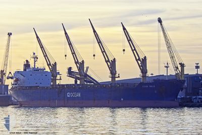
The vessel STAR MAIA (IMO: 9189940, MMSI: 235088041) is a General Cargo that was built in 1998 ( 27 År gammal ). It's sailing under the flag of [GB] United Kingdom.
In this page you can find informations about the vessels current position, last detected port calls, and current voyage information. If the vessels is not in coverage by AIS you will find the latest position.
The current position of STAR MAIA is detected by our AIS receivers and we are not responsible for the reliability of the data. The last position was recorded while the vessel was in Coverage by the Ais receivers of our vessel tracking app.
The current draught of STAR MAIA as reported by AIS is 11.3 meters
Weather
| Temperature | 18.5°C / 65.3°F |
|---|---|
| Wind Speed | 8 knots |
| Direction | 213° SSW |
| Pressure | 1014.9 hPa |
| Humidity | 80.3 % |
| Cloud Coverage | 100 % |
Featured Company
Most Visited Ports (Last year)
| Port | Arrivals | |
|---|---|---|
| 3 | ||
| 2 | ||
| 2 | ||
| 2 | ||
| 2 | ||
| 1 |
Events
| Tid | Event | Detaljer | Position / Dest | Information |
|---|---|---|---|---|
| 2025-03-18 00:43 | Status ändrad | Default At anchor |
-23.67326 / -70.43124
CA QDG
|
Fart: Kurs: 210° |
| 2025-03-18 00:34 | Status ändrad | At anchor Default |
-23.67314 / -70.43119
CA QDG
|
Fart: Kurs: 211° |
| 2025-03-18 00:22 | Status ändrad | Default At anchor |
-23.67304 / -70.43114
CA QDG
|
Fart: Kurs: 211° |
| 2025-03-18 00:22 | Status ändrad | At anchor Default |
-23.67304 / -70.43114
CA QDG
|
Fart: 0.1 kn Kurs: 212° |
| 2025-03-18 00:10 | I täckningsområde |
-23.67304 / -70.43114
South Pacific Ocean
|
Fart: Kurs: 297.7° |
|
| 2025-03-17 22:17 | Status ändrad | Default At anchor |
-23.67495 / -70.43010
CA QDG
|
Fart: 0.1 kn Kurs: 297° |
| 2025-03-17 21:55 | UTANFÖR täckningsområde |
-23.67568 / -70.43118
South Pacific Ocean
|
Fart: 0.1 kn Kurs: 36.3° |
|
| 2025-03-17 21:55 | Status ändrad | At anchor Under way using engine |
-23.67569 / -70.43119
CA QDG
|
Fart: 0.2 kn Kurs: 298° |
| 2025-03-17 21:52 | Status ändrad | Under way using engine Default |
-23.67579 / -70.43126
CA QDG
|
Fart: 1.4 kn Kurs: 211° |
| 2025-03-17 21:52 | STOPPAR förflyttning | 2.06 nm, South West of ANTOFAGASTA |
-23.67579 / -70.43126
CA QDG
|
Fart: 0.1 kn Kurs: 300° |