
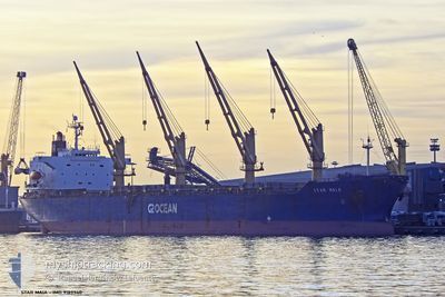
STAR MAIA
General Cargo
Current Trip
| Time Travelled | 4 days |
|---|---|
| Remaining Time | --- |
| Distance Travelled | 991.84 nm |
| Remaining Distance | --- |
| AVG Speed | 10.7 Knopen |
| MAX Speed | 15 Knopen |
| AVG Wind | 17.3 knots |
| MAX Wind | 31 knots |
| MIN Temp | -2.7°C / 27.14°F |
| MAX Temp | 18.9°C / 66.02°F |
| Diepgang | 7 M |
| Positie ontvangen | 1 h, 37 m geleden |
Current Position
| Lengtegraad | --- |
|---|---|
| Breedtegraat | --- |
| Status | At anchor |
| Snelheid | 0.5 Knopen |
| Koers | 250° |
| Gebied | Black Sea |
| Station | T-AIS |
| Positie ontvangen | 1 h, 37 m geleden |
Info
Information
The current position of STAR MAIA is in Black Sea with coordinates 44.16586° / 28.79646° as reported on 2026-01-03 17:13 by AIS to our vessel tracker app. The vessel's current speed is 0.5 Knopen
The vessel STAR MAIA (IMO: 9189940, MMSI: 235088041) is a General Cargo that was built in 1998 ( 28 Jaar oud ). It's sailing under the flag of [GB] United Kingdom.
In this page you can find informations about the vessels current position, last detected port calls, and current voyage information. If the vessels is not in coverage by AIS you will find the latest position.
The current position of STAR MAIA is detected by our AIS receivers and we are not responsible for the reliability of the data. The last position was recorded while the vessel was in Coverage by the Ais receivers of our vessel tracking app.
The current draught of STAR MAIA as reported by AIS is 7 meters
Weather
| Temperature | 8.7°C / 47.66°F |
|---|---|
| Wind Speed | 18 knots |
| Direction | 293° WNW |
| Pressure | 1010 hPa |
| Humidity | 82 % |
| Cloud Coverage | 90 % |
Featured Company
Last Port Calls
| Port | Arrival | Departure | Time In Port |
|---|---|---|---|
| 2025-12-22 03:54 | 2025-12-30 07:27 | 8 d | |
| 2025-11-23 11:45 | 2025-12-02 14:16 | 9 d | |
| 2025-11-11 15:24 | 2025-11-20 08:31 | 8 d | |
| 2025-11-02 10:55 |
Most Visited Ports (Last year)
| Port | Arrivals | |
|---|---|---|
| 3 | ||
| 2 | ||
| 1 | ||
| 1 | ||
| 1 | ||
| 1 |
Last Trips
| Origin | Departure | Destination | Arrival | Distance | |
|---|---|---|---|---|---|
| 2025-12-02 14:16 | 2025-12-22 03:54 | 5073.80 nm | |||
| 2025-11-20 08:31 | 2025-11-23 11:45 | 146.48 nm | |||
| 2025-11-02 10:55 | 2025-11-11 15:24 | 1652.83 nm |
Events
| Tijd | Evenement | Details | Positie / Bestemming | Info |
|---|---|---|---|---|
| 2026-01-03 17:19 | Status Changed | Default At anchor |
44.16538 / 28.79649
CONSTANTA
|
Snelheid: 0.5 kn Koers: 250° |
| 2026-01-03 17:13 | Status Changed | At anchor Default |
44.16586 / 28.79646
CONSTANTA
|
Snelheid: 0.2 kn Koers: 243° |
| 2026-01-03 17:13 | Buitenbereik |
44.16586 / 28.79646
Black Sea
CONSTANTA
|
Snelheid: 0.5 kn Koers: 157.6° |
|
| 2026-01-03 17:07 | Binnenbereik |
44.16586 / 28.79646
Black Sea
CONSTANTA
|
Snelheid: 0.5 kn Koers: 157.6° |
|
| 2026-01-03 13:13 | Stop beweging | 5.94 nm, North East of CONSTANTA |
44.16767 / 28.79408
CONSTANTA
|
Snelheid: 0.3 kn Koers: 194° |
| 2026-01-03 13:05 | Status Changed | Default Under way using engine |
44.16698 / 28.79289
CONSTANTA
|
Snelheid: 0.9 kn Koers: 165° |
| 2026-01-03 12:58 | Status Changed | Under way using engine Default |
44.16577 / 28.79273
CONSTANTA
|
Snelheid: 1 kn Koers: 173° |
| 2026-01-03 12:58 | Buitenbereik |
44.16577 / 28.79273
Black Sea
CONSTANTA
|
Snelheid: 0.9 kn Koers: 193.7° |
|
| 2026-01-03 12:41 | Binnenbereik |
44.16577 / 28.79273
Black Sea
CONSTANTA
|
Snelheid: 0.9 kn Koers: 193.7° |
|
| 2026-01-03 11:35 | Buitenbereik |
44.03589 / 28.84789
Black Sea
CONSTANTA
|
Snelheid: 14.1 kn Koers: 358.9° |