

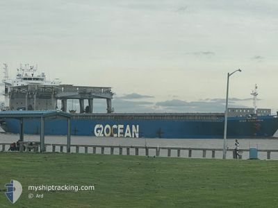
STAR HARMONIA
General Cargo

Current Trip
| Time Travelled | 1 day |
|---|---|
| Remaining Time | --- |
| Distance Travelled | 387.78 nm |
| Remaining Distance | --- |
| AVG Speed | 10.8 Knop |
| MAX Speed | 12.6 Knop |
| AVG Wind | 24.4 knots |
| MAX Wind | 31.3 knots |
| MIN Temp | 10.5°C / 50.9°F |
| MAX Temp | 14.7°C / 58.46°F |
| Djupgående | 10.4 m |
| Position mottagen | 1 d sen |
Current Position
| Longitud | --- |
|---|---|
| Latitude | --- |
| Status | Under way using engine |
| Fart | 12 Knop |
| Kurs | 269.7° |
| Område | North Atlantic Ocean |
| Station | T-AIS |
| Position mottagen | 1 d sen |
Information
The current position of STAR HARMONIA is in North Atlantic Ocean with coordinates 43.46229° / -9.08126° as reported on 2025-02-28 22:51 by AIS to our vessel tracker app. The vessel's current speed is 12 Knop and is heading at the port of CORPUS CHRISTI. The estimated time of arrival as calculated by MyShipTracking vessel tracking app is 2025-03-16 12:30 LT
The vessel STAR HARMONIA (IMO: 9103130, MMSI: 259885000) is a General Cargo that was built in 1998 ( 27 År gammal ). It's sailing under the flag of [NO] Norway.
In this page you can find informations about the vessels current position, last detected port calls, and current voyage information. If the vessels is not in coverage by AIS you will find the latest position.
The current position of STAR HARMONIA is detected by our AIS receivers and we are not responsible for the reliability of the data. The last position was recorded while the vessel was in Coverage by the Ais receivers of our vessel tracking app.
The current draught of STAR HARMONIA as reported by AIS is 10.4 meters
Weather
| Temperature | 13.8°C / 56.84°F |
|---|---|
| Wind Speed | 17 knots |
| Direction | 56° NE |
| Pressure | 1014.9 hPa |
| Humidity | 72 % |
| Cloud Coverage | --- |


Featured Company
Last Port Calls
| Port | Arrival | Departure | Time In Port |
|---|---|---|---|
| 2025-02-25 13:11 | 2025-02-28 19:47 | 3 d | |
| 2025-02-15 23:09 | 2025-02-21 04:36 | 5 d | |
| 2025-02-10 22:44 | 2025-02-14 14:59 | 3 d | |
| 2025-02-02 15:01 | 2025-02-08 11:38 | 5 d | |
| 2025-01-23 06:10 | 2025-01-25 20:51 | 2 d | |
| 2025-01-14 03:14 | 2025-01-15 23:22 | 1 d | |
| 2025-01-12 11:09 | 2025-01-13 19:03 | 1 d |
Last Trips
| Origin | Departure | Destination | Arrival | Distance | |
|---|---|---|---|---|---|
| 2025-02-21 05:36 | 2025-02-25 14:11 | 1043.24 nm | |||
| 2025-02-14 15:59 | 2025-02-16 00:09 | 358.09 nm | |||
| 2025-02-08 12:38 | 2025-02-10 23:44 | 798.95 nm | |||
| 2025-01-25 21:51 | 2025-02-02 16:01 | 1014.73 nm | |||
| 2025-01-16 00:22 | 2025-01-23 07:10 | 1256.82 nm | |||
| 2025-01-13 20:03 | 2025-01-14 04:14 | 95.50 nm | |||
| 2024-12-29 16:53 | 2025-01-12 12:09 | 3987.87 nm |
Events
| Tid | Event | Detaljer | Position / Dest | Information |
|---|---|---|---|---|
| 2025-02-28 22:53 | Status ändrad | Default Under way using engine |
43.46249 / -9.09128
US CRP
|
Fart: 12 kn Kurs: 269.7° |
| 2025-02-28 22:51 | UTANFÖR täckningsområde |
43.46229 / -9.08126
North Atlantic Ocean
US CRP
|
Fart: 12 kn Kurs: 269.7° |
|
| 2025-02-28 19:58 | Djupgående ändrat | 10.4 10.2 |
43.45952 / -8.30895
US CRP
|
Fart: 7.4 kn Kurs: 274° |
| 2025-02-28 19:58 | Destination ändrad | US CRP ES FRO |
43.45952 / -8.30895
US CRP
|
Fart: 7.4 kn Kurs: 274° |
| 2025-02-28 19:58 | ETA ändrat | 2025/03/16 12:30 2025/02/25 12:30 |
43.45952 / -8.30895
US CRP
|
Fart: 7.4 kn Kurs: 274° |
| 2025-02-28 19:55 | Status ändrad | Under way using engine Default |
43.45891 / -8.30219
ES FRO
|
Fart: 9.5 kn Kurs: 252° |
| 2025-02-28 19:47 | AVGÅTT HAMN |
|
43.46396 / -8.27660
ES FRO
|
Fart: 8.3 kn Kurs: 233° |
| 2025-02-28 19:35 | STARTAR förflyttning |
43.47904 / -8.25109
[ES] EL FERROL
|
Fart: 4.4 kn Kurs: 190° |
|
| 2025-02-28 19:35 | I täckningsområde |
43.45891 / -8.30219
North Atlantic Ocean
|
Fart: 7.9 kn Kurs: 276.5° |
|
| 2025-02-25 12:49 | UTANFÖR täckningsområde |
43.45857 / -8.31272
North Atlantic Ocean
[ES] EL FERROL
|
Fart: 6.8 kn Kurs: 93.5° |