

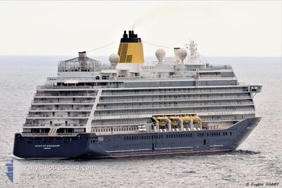
SPIRIT OF DISCOVERY
Passenger

Current Trip
US MIA>BM KWF
| Time Travelled | 6 days |
|---|---|
| Remaining Time | --- |
| Distance Travelled | 2326.88 nm |
| Remaining Distance | --- |
| AVG Speed | 16.4 Knop |
| MAX Speed | 20.2 Knop |
| AVG Wind | 10.1 knots |
| MAX Wind | 23.2 knots |
| MIN Temp | 15.3°C / 59.54°F |
| MAX Temp | 24.1°C / 75.38°F |
| Djupgående | 7.3 m |
| Position mottagen | 6 d sen |
Current Position
| Longitud | --- |
|---|---|
| Latitude | --- |
| Status | Under way using engine |
| Fart | 19.2 Knop |
| Kurs | 24.6° |
| Område | North Atlantic Ocean |
| Station | T-AIS |
| Position mottagen | 6 d sen |
Information
The current position of SPIRIT OF DISCOVERY is in North Atlantic Ocean with coordinates 25.95031° / -79.96969° as reported on 2025-02-11 23:36 by AIS to our vessel tracker app. The vessel's current speed is 19.2 Knop
The vessel SPIRIT OF DISCOVERY (IMO: 9802683, MMSI: 232021171) is a Passenger It's sailing under the flag of [GB] United Kingdom.
In this page you can find informations about the vessels current position, last detected port calls, and current voyage information. If the vessels is not in coverage by AIS you will find the latest position.
The current position of SPIRIT OF DISCOVERY is detected by our AIS receivers and we are not responsible for the reliability of the data. The last position was recorded while the vessel was in Coverage by the Ais receivers of our vessel tracking app.
The current draught of SPIRIT OF DISCOVERY as reported by AIS is 7.3 meters
Weather
| Temperature | 19.4°C / 66.92°F |
|---|---|
| Wind Speed | 16 knots |
| Direction | 243° WSW |
| Pressure | 1019.6 hPa |
| Humidity | 80.3 % |
| Cloud Coverage | 100 % |


Featured Company
Last Port Calls
| Port | Arrival | Departure | Time In Port |
|---|---|---|---|
| 2025-02-11 11:01 | 2025-02-11 22:38 | 11 h | |
| 2025-02-07 10:35 | 2025-02-09 00:35 | 1 d | |
| 2025-02-04 13:44 | 2025-02-06 02:15 | 1 d | |
| 2025-02-02 13:46 | 2025-02-03 01:08 | 11 h | |
| 2025-01-31 14:01 | 2025-01-31 23:47 | 9 h | |
| 2025-01-30 14:40 | 2025-01-31 02:03 | 11 h | |
| 2025-01-28 13:24 | 2025-01-28 22:44 | 9 h | |
| 2025-01-26 17:34 | 2025-01-27 22:12 | 1 d | |
| 2025-01-25 12:13 | 2025-01-25 22:25 | 10 h | |
| 2025-01-22 11:08 | 2025-01-23 00:55 | 13 h |
Most Visited Ports (Last year)
| Port | Arrivals | |
|---|---|---|
| 16 | ||
| 13 | ||
| 10 | ||
| 8 | ||
| 6 | ||
| 6 |
Last Trips
| Origin | Departure | Destination | Arrival | Distance | |
|---|---|---|---|---|---|
| 2025-02-08 18:35 | 2025-02-11 06:01 | 759.54 nm | |||
| 2025-02-05 20:15 | 2025-02-07 04:35 | 418.38 nm | |||
| 2025-02-02 19:08 | 2025-02-04 07:44 | 570.11 nm | |||
| 2025-01-31 17:47 | 2025-02-02 07:46 | 617.97 nm | |||
| 2025-01-30 20:03 | 2025-01-31 08:01 | 127.48 nm | |||
| 2025-01-28 16:44 | 2025-01-30 08:40 | 677.08 nm | |||
| 2025-01-27 17:12 | 2025-01-28 07:24 | 196.98 nm | |||
| 2025-01-25 17:25 | 2025-01-26 12:34 | 281.85 nm | |||
| 2025-01-22 20:55 | 2025-01-25 07:13 | 516.50 nm | |||
| 2025-01-20 23:02 | 2025-01-22 07:08 | 432.75 nm |
Events
| Tid | Event | Detaljer | Position / Dest | Information |
|---|---|---|---|---|
| 2025-02-15 11:06 | STARTAR förflyttning |
32.32863 / -64.82780
US MIA>BM KWF
|
Fart: 5.4 kn Kurs: 18° |
|
| 2025-02-11 23:46 | Status ändrad | Default Under way using engine |
25.98669 / -79.93570
US MIA>BM KWF
|
Fart: 19.2 kn Kurs: 24.6° |
| 2025-02-11 23:36 | UTANFÖR täckningsområde |
25.95031 / -79.96969
North Atlantic Ocean
US MIA>BM KWF
|
Fart: 19.2 kn Kurs: 24.6° |
|
| 2025-02-11 22:38 | AVGÅTT HAMN |
|
25.76162 / -80.12829
US MIA>BM KWF
|
Fart: 10.2 kn Kurs: 115° |
| 2025-02-11 22:18 | STARTAR förflyttning |
25.77772 / -80.16972
[US] MIAMI
|
Fart: 4.6 kn Kurs: 106° |
|
| 2025-02-11 22:11 | Status ändrad | Under way using engine Moored |
25.77772 / -80.17164
[US] MIAMI
|
Fart: Kurs: 116° |
| 2025-02-11 21:45 | Status ändrad | Moored Default |
25.77772 / -80.17164
[US] MIAMI
|
Fart: Kurs: 116° |
| 2025-02-11 21:33 | Status ändrad | Default Moored |
25.77772 / -80.17164
[US] MIAMI
|
Fart: Kurs: 116° |
| 2025-02-11 21:31 | Destination ändrad | US MIA>BM KWF US MSY>US MIA |
25.77772 / -80.17164
[US] MIAMI
|
Fart: Kurs: 116° |
| 2025-02-11 21:31 | ETA ändrat | 2025/02/14 10:40 2025/02/11 10:30 |
25.77772 / -80.17164
[US] MIAMI
|
Fart: Kurs: 116° |