
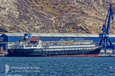
SPIRIDON II
General Cargo
Current Trip
| Time Travelled | 5 days |
|---|---|
| Remaining Time | --- |
| Distance Travelled | 1201.92 nm |
| Remaining Distance | --- |
| AVG Speed | 11.2 Knop |
| MAX Speed | 12.5 Knop |
| AVG Wind | 11.4 knots |
| MAX Wind | 22.8 knots |
| MIN Temp | 15.8°C / 60.44°F |
| MAX Temp | 21.4°C / 70.52°F |
| Djupgående | 7.1 m |
| Position mottagen | 16 h, 11 m sen |
Current Position
| Longitud | 12.85085° |
|---|---|
| Latitude | 36.74406° |
| Status | Under way using engine |
| Fart | 11.9 Knop |
| Kurs | 291.2° |
| Område | Mediterranean Sea - Eastern Basin |
| Station | T-AIS |
| Position mottagen | 16 h, 11 m sen |
Info
Information
The current position of SPIRIDON II is in Mediterranean Sea - Eastern Basin with coordinates 36.74406° / 12.85085° as reported on 2024-04-27 17:08 by AIS to our vessel tracker app. The vessel's current speed is 11.9 Knop and is heading at the port of VILA DO CONDE. The estimated time of arrival as calculated by MyShipTracking vessel tracking app is 2024-05-13 13:00 LT
The vessel SPIRIDON II (IMO: 7311329, MMSI: 671114100) is a General Cargo that was built in 1973 ( 51 År gammal ). It's sailing under the flag of [TG] Togo.
In this page you can find informations about the vessels current position, last detected port calls, and current voyage information. If the vessels is not in coverage by AIS you will find the latest position.
The current position of SPIRIDON II is detected by our AIS receivers and we are not responsible for the reliability of the data. The last position was recorded while the vessel was in Coverage by the Ais receivers of our vessel tracking app.
The current draught of SPIRIDON II as reported by AIS is 7.1 meters
Weather
| Temperature | 17.7°C / 63.86°F |
|---|---|
| Wind Speed | 15 knots |
| Direction | 117° ESE |
| Pressure | 1014.4 hPa |
| Humidity | 71.3 % |
| Cloud Coverage | 1 % |
Featured Company
Most Visited Ports (Last year)
| Port | Arrivals | |
|---|---|---|
| 5 | ||
| 4 | ||
| 2 | ||
| 2 | ||
| 2 | ||
| 2 |
Last Trips
| Origin | Departure | Destination | Arrival | Distance | |
|---|---|---|---|---|---|
| 2024-03-29 10:38 | 2024-04-21 09:58 | 5407.53 nm | |||
| 2024-02-22 18:20 | 2024-03-26 11:35 | 5703.28 nm | |||
| 2024-02-16 21:24 | 2024-02-17 10:13 | 109.92 nm |
Events
| Tid | Event | Detaljer | Position / Dest | Information |
|---|---|---|---|---|
| 2024-04-27 17:18 | Status ändrad | Default Under way using engine |
36.75594 / 12.81299
BRVDC
|
Fart: 11.9 kn Kurs: 291.2° |
| 2024-04-27 17:08 | UTANFÖR täckningsområde |
36.74406 / 12.85085
Mediterranean Sea - Eastern Basin
BRVDC
|
Fart: 11.9 kn Kurs: 291.2° |
|
| 2024-04-27 17:07 | Status ändrad | Under way using engine Default |
36.74209 / 12.85728
BRVDC
|
Fart: 11.5 kn Kurs: 292° |
| 2024-04-27 16:46 | Status ändrad | Default Under way using engine |
36.71684 / 12.93505
BRVDC
|
Fart: 11.7 kn Kurs: 292.2° |
| 2024-04-27 16:41 | Status ändrad | Under way using engine Default |
36.71102 / 12.95252
BRVDC
|
Fart: 11.8 kn Kurs: 291° |
| 2024-04-27 16:18 | Status ändrad | Default Under way using engine |
36.68338 / 13.04215
BRVDC
|
Fart: 11.7 kn Kurs: 288.9° |
| 2024-04-27 16:14 | Status ändrad | Under way using engine Default |
36.67958 / 13.05553
BRVDC
|
Fart: 11.8 kn Kurs: 288° |
| 2024-04-27 16:08 | Status ändrad | Default Under way using engine |
36.67318 / 13.07945
BRVDC
|
Fart: 11.7 kn Kurs: 287.2° |
| 2024-04-27 15:38 | Upptäckt i hav | Italian part of the Mediterranean Sea - Eastern Basin |
36.64196 / 13.19540
Mediterranean Sea - Eastern Basin
BRVDC
|
Fart: 11.4 kn Kurs: 288° |
| 2024-04-27 15:37 | Status ändrad | Under way using engine Default |
36.64057 / 13.20034
BRVDC
|
Fart: 11.2 kn Kurs: 291° |