
SPECTRE
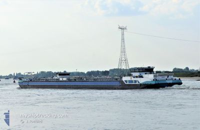
Tanker
Current Trip
| Trip Time | 1 day |
|---|---|
| Trip Distance | 50.88 nm |
| AVG Speed | 4.5 Knop |
| MAX Speed | 6.9 Knop |
| Djupgående | 1.5 m |
| AVG Wind | 7.1 knots |
| MAX Wind | 9.7 knots |
| MIN Temp | -2.5°C / 27.5°F |
| MAX Temp | 2.4°C / 36.32°F |
| Position mottagen | 1 m sen |
Current Position
| Longitud | --- |
|---|---|
| Latitude | --- |
| Status | Under way using engine |
| Fart | 1.8 Knop |
| Kurs | 67° |
| Område | North Sea |
| Station | T-AIS |
| Position mottagen | 1 m sen |
Info
Information
The current position of SPECTRE is in North Sea with coordinates 51.08842° / 3.66324° as reported on 2026-01-06 20:40 by AIS to our vessel tracker app. The vessel's current speed is 1.8 Knop and is currently inside the port of GENT.
The vessel SPECTRE (MMSI: 244690229) is a Tanker It's sailing under the flag of [NL] Netherlands.
In this page you can find informations about the vessels current position, last detected port calls, and current voyage information. If the vessels is not in coverage by AIS you will find the latest position.
The current position of SPECTRE is detected by our AIS receivers and we are not responsible for the reliability of the data. The last position was recorded while the vessel was in Coverage by the Ais receivers of our vessel tracking app.
The current draught of SPECTRE as reported by AIS is 1.5 meters
Weather
| Temperature | -1.3°C / 29.66°F |
|---|---|
| Wind Speed | 8 knots |
| Direction | 197° SSW |
| Pressure | 1015.4 hPa |
| Humidity | 84.1 % |
| Cloud Coverage | 73 % |
Featured Company
Last Port Calls
| Port | Arrival | Departure | Time In Port |
|---|---|---|---|
| 2026-01-06 21:29 | |||
| 2026-01-05 12:07 | 2026-01-05 14:10 | 2 h | |
| 2026-01-05 10:47 | 2026-01-05 11:52 | 1 h | |
| 2026-01-03 21:56 | 2026-01-05 06:28 | 1 d | |
| 2026-01-03 14:53 | 2026-01-03 17:11 | 2 h | |
| 2026-01-02 07:52 | 2026-01-02 11:24 | 3 h | |
| 2026-01-01 21:14 | 2026-01-02 07:00 | 9 h | |
| 2025-12-30 20:00 | 2026-01-01 18:04 | 1 d | |
| 2025-12-30 10:10 | 2025-12-30 10:50 | 39 m | |
| 2025-12-29 19:17 | 2025-12-29 19:27 | 10 m |
Last Trips
| Origin | Departure | Destination | Arrival | Distance | |
|---|---|---|---|---|---|
| 2026-01-05 14:10 | 2026-01-06 21:29 | 50.88 nm | |||
| 2026-01-05 11:52 | 2026-01-05 12:07 | 2.16 nm | |||
| 2026-01-05 06:28 | 2026-01-05 10:47 | 30.18 nm | |||
| 2026-01-03 17:11 | 2026-01-03 21:56 | 32.15 nm | |||
| 2026-01-02 11:24 | 2026-01-03 14:53 | 49.75 nm | |||
| 2026-01-02 07:00 | 2026-01-02 07:52 | 7.12 nm | |||
| 2026-01-01 18:04 | 2026-01-01 21:14 | 24.18 nm | |||
| 2025-12-30 10:50 | 2025-12-30 20:00 | 66.26 nm | |||
| 2025-12-29 19:27 | 2025-12-30 10:10 | 63.61 nm | |||
| 2025-12-28 21:56 | 2025-12-29 19:17 | 63.66 nm |
Events
| Tid | Event | Detaljer | Position / Dest | Information |
|---|---|---|---|---|
| 2026-01-06 20:29 | Destination ändrad | SLUIS EVERGEM ROESELARE |
51.09113 / 3.64847
[BE] GENT
|
Fart: 6.8 kn Kurs: 117.5° |
| 2026-01-06 20:29 | ETA ändrat | 2026/01/07 07:24 2026/01/05 15:05 |
51.09113 / 3.64847
[BE] GENT
|
Fart: 6.8 kn Kurs: 117.5° |
| 2026-01-06 20:29 | ANLÄNDER HAMN |
|
51.09113 / 3.64847
[BE] GENT
|
Fart: 6.9 kn Kurs: 86.2° |
| 2026-01-06 19:53 | I täckningsområde |
51.09492 / 3.56851
North Sea
|
Fart: 3.4 kn Kurs: 89.9° |
|
| 2026-01-06 17:19 | STOPPAR förflyttning | 6.4 nm, South West of DEINZE |
50.91000 / 3.40667
ROESELARE
|
Fart: Kurs: -1° |
| 2026-01-06 16:49 | STARTAR förflyttning | 5.11 nm, North East of KORTRIJK |
50.89667 / 3.35167
ROESELARE
|
Fart: 6 kn Kurs: 54° |
| 2026-01-05 21:08 | STOPPAR förflyttning | 0.95 nm, East of ROESELARE |
50.93833 / 3.16667
ROESELARE
|
Fart: Kurs: -1° |
| 2026-01-05 17:19 | STOPPAR förflyttning | 6.12 nm, South West of DEINZE |
50.91333 / 3.41167
ROESELARE
|
Fart: Kurs: -1° |
| 2026-01-05 13:53 | Status ändrad | Default Under way using engine |
51.08874 / 3.56295
ROESELARE
|
Fart: 2.9 kn Kurs: 194° |
| 2026-01-05 13:47 | UTANFÖR täckningsområde |
51.09422 / 3.56505
North Sea
ROESELARE
|
Fart: 2.9 kn Kurs: 209.3° |