
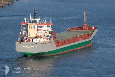
SPANACO RELIABILITY
General Cargo
Current Trip
| Time Travelled | 1 day |
|---|---|
| Remaining Time | 2 days |
| Distance Travelled | 414.48 nm |
| Remaining Distance | 665.85 nm |
| AVG Speed | 10.4 Knop |
| MAX Speed | 13.6 Knop |
| AVG Wind | 17.5 knots |
| MAX Wind | 48.2 knots |
| MIN Temp | 6.3°C / 43.34°F |
| MAX Temp | 11.8°C / 53.24°F |
| Djupgående | 5.6 m |
| Position mottagen | 6 m sen |
Current Position
| Longitud | --- |
|---|---|
| Latitude | --- |
| Status | Under way using engine |
| Fart | 10.7 Knop |
| Kurs | 230° |
| Område | English Channel |
| Station | T-AIS |
| Position mottagen | 6 m sen |
Info
Information
The current position of SPANACO RELIABILITY is in English Channel with coordinates 50.92365° / 1.16148° as reported on 2024-11-28 07:44 by AIS to our vessel tracker app. The vessel's current speed is 10.7 Knop and is heading at the port of LONDONDERRY. The estimated time of arrival as calculated by MyShipTracking vessel tracking app is 2024-11-30 13:00 LT
The vessel SPANACO RELIABILITY (IMO: 9373515, MMSI: 304045000) is a General Cargo that was built in 2007 ( 17 År gammal ). It's sailing under the flag of [AG] Antigua Barbuda.
In this page you can find informations about the vessels current position, last detected port calls, and current voyage information. If the vessels is not in coverage by AIS you will find the latest position.
The current position of SPANACO RELIABILITY is detected by our AIS receivers and we are not responsible for the reliability of the data. The last position was recorded while the vessel was in Coverage by the Ais receivers of our vessel tracking app.
The current draught of SPANACO RELIABILITY as reported by AIS is 5.6 meters
Weather
| Temperature | 6.3°C / 43.34°F |
|---|---|
| Wind Speed | 8 knots |
| Direction | 347° NNW |
| Pressure | 1026.4 hPa |
| Humidity | 78.8 % |
| Cloud Coverage | 19 % |
Featured Company
Last Port Calls
| Port | Arrival | Departure | Time In Port |
|---|---|---|---|
| 2024-11-22 18:38 | 2024-11-26 12:28 | 3 d | |
| 2024-11-17 08:30 | 2024-11-17 10:40 | 2 h | |
| 2024-11-12 10:49 | 2024-11-14 12:31 | 2 d | |
| 2024-10-31 15:33 | 2024-11-05 18:06 | 5 d | |
| 2024-10-04 07:59 | 2024-10-08 19:58 | 4 d | |
| 2024-09-16 17:11 | 2024-09-19 19:34 | 3 d | |
| 2024-09-03 21:03 | 2024-09-11 10:54 | 7 d | |
| 2024-09-01 19:40 | 2024-09-01 20:34 | 53 m |
Most Visited Ports (Last year)
| Port | Arrivals | |
|---|---|---|
| 4 | ||
| 4 | ||
| 3 | ||
| 3 | ||
| 2 | ||
| 2 |
Last Trips
| Origin | Departure | Destination | Arrival | Distance | |
|---|---|---|---|---|---|
| 2024-11-17 11:40 | 2024-11-22 19:38 | 402.14 nm | |||
| 2024-11-14 13:31 | 2024-11-17 09:30 | 695.33 nm | |||
| 2024-11-05 18:06 | 2024-11-12 11:49 | 589.05 nm | |||
| 2024-10-08 20:58 | 2024-10-31 15:33 | 2942.28 nm | |||
| 2024-09-19 20:34 | 2024-10-04 08:59 | 2183.98 nm | |||
| 2024-09-11 11:54 | 2024-09-16 18:11 | 470.00 nm | |||
| 2024-09-01 22:34 | 2024-09-03 22:03 | 424.24 nm | |||
| 2024-08-18 08:57 | 2024-09-01 21:40 | 1575.44 nm |
Events
| Tid | Event | Detaljer | Position / Dest | Information |
|---|---|---|---|---|
| 2024-11-28 06:35 | Byter havsområde | United Kingdom part of the English Channel United Kingdom part of the North Sea |
51.07121 / 1.43315
English Channel
GB LDY
|
Fart: 13.1 kn Kurs: 228.7° |
| 2024-11-28 00:28 | Byter havsområde | United Kingdom part of the North Sea Dutch part of the North Sea |
51.90648 / 2.56017
North Sea
GB LDY
|
Fart: 8.8 kn Kurs: 220.5° |
| 2024-11-28 00:00 | ETA ändrat | 2024/12/01 01:00 2024/11/30 22:30 |
51.95395 / 2.63286
GB LDY
|
Fart: 8.4 kn Kurs: 225.6° |
| 2024-11-27 22:54 | Status ändrad | Under way using engine Default |
52.06644 / 2.80297
GB LDY
|
Fart: 8.6 kn Kurs: 225° |
| 2024-11-27 22:38 | Status ändrad | Default Under way using engine |
52.09566 / 2.84620
GB LDY
|
Fart: 8.7 kn Kurs: 226.9° |
| 2024-11-27 22:30 | Status ändrad | Under way using engine Default |
52.10983 / 2.86725
GB LDY
|
Fart: 8.7 kn Kurs: 218° |
| 2024-11-27 22:30 | I täckningsområde |
52.10983 / 2.86725
North Sea
GB LDY
|
Fart: 8.9 kn Kurs: 223.6° |
|
| 2024-11-27 11:13 | Status ändrad | Default Under way using engine |
53.05168 / 4.13728
GB LDY
|
Fart: 9.8 kn Kurs: 229.1° |
| 2024-11-27 11:06 | UTANFÖR täckningsområde |
53.06343 / 4.16022
North Sea
GB LDY
|
Fart: 9.8 kn Kurs: 229.1° |
|
| 2024-11-27 10:32 | Status ändrad | Under way using engine Default |
53.12728 / 4.28557
GB LDY
|
Fart: 11.1 kn Kurs: 231° |