
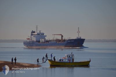
SOLWAY FISHER
Oil Products Tanker
Current Trip
| Time Travelled | 10 h, 6 mins |
|---|---|
| Remaining Time | 16 h, 58 mins |
| Distance Travelled | 94.60 nm |
| Remaining Distance | 176.28 nm |
| AVG Speed | 8.5 Knop |
| MAX Speed | 11.5 Knop |
| AVG Wind | 15.4 knots |
| MAX Wind | 26.8 knots |
| MIN Temp | 6.7°C / 44.06°F |
| MAX Temp | 9.2°C / 48.56°F |
| Djupgående | 5 m |
| Position mottagen | Nu |
Current Position
| Longitud | --- |
|---|---|
| Latitude | --- |
| Status | Under way using engine |
| Fart | 10.1 Knop |
| Kurs | 126.8° |
| Område | North Sea |
| Station | T-AIS |
| Position mottagen | Nu |
Info
Information
The current position of SOLWAY FISHER is in North Sea with coordinates 55.85764° / -1.79234° as reported on 2025-12-05 15:09 by AIS to our vessel tracker app. The vessel's current speed is 10.1 Knop and is heading at the port of IMMINGHAM. The estimated time of arrival as calculated by MyShipTracking vessel tracking app is 2025-12-06 08:07 LT
The vessel SOLWAY FISHER (IMO: 9320491, MMSI: 308665000) is a Oil Products Tanker that was built in 2006 ( 19 År gammal ). It's sailing under the flag of [BS] Bahamas.
In this page you can find informations about the vessels current position, last detected port calls, and current voyage information. If the vessels is not in coverage by AIS you will find the latest position.
The current position of SOLWAY FISHER is detected by our AIS receivers and we are not responsible for the reliability of the data. The last position was recorded while the vessel was in Coverage by the Ais receivers of our vessel tracking app.
The current draught of SOLWAY FISHER as reported by AIS is 5 meters
Weather
| Temperature | 7.8°C / 46.04°F |
|---|---|
| Wind Speed | 25 knots |
| Direction | 155° SSE |
| Pressure | 996.5 hPa |
| Humidity | 80.2 % |
| Cloud Coverage | 100 % |
Featured Company
Last Port Calls
| Port | Arrival | Departure | Time In Port |
|---|---|---|---|
| 2025-12-04 01:26 | 2025-12-05 05:03 | 1 d | |
| 2025-12-01 22:45 | 2025-12-02 23:21 | 1 d | |
| 2025-11-27 19:22 | 2025-11-29 01:23 | 1 d | |
| 2025-11-23 12:45 | 2025-11-25 01:25 | 1 d | |
| 2025-11-20 12:52 | 2025-11-21 10:06 | 21 h | |
| 2025-11-12 10:09 | 2025-11-13 14:34 | 1 d | |
| 2025-11-10 16:58 | 2025-11-11 07:18 | 14 h | |
| 2025-11-09 03:58 | 2025-11-09 16:04 | 12 h | |
| 2025-11-08 00:53 | 2025-11-08 17:07 | 16 h | |
| 2025-11-05 13:20 | 2025-11-06 17:18 | 1 d |
Last Trips
| Origin | Departure | Destination | Arrival | Distance | |
|---|---|---|---|---|---|
| 2025-12-02 23:21 | 2025-12-04 01:26 | 253.19 nm | |||
| 2025-11-29 01:23 | 2025-12-01 22:45 | 322.48 nm | |||
| 2025-11-25 01:25 | 2025-11-27 19:22 | 537.82 nm | |||
| 2025-11-21 10:06 | 2025-11-23 12:45 | 526.77 nm | |||
| 2025-11-13 14:34 | 2025-11-20 12:52 | 485.02 nm | |||
| 2025-11-11 07:18 | 2025-11-12 10:09 | 256.01 nm | |||
| 2025-11-09 16:04 | 2025-11-10 16:58 | 231.08 nm | |||
| 2025-11-08 17:07 | 2025-11-09 03:58 | 57.53 nm | |||
| 2025-11-06 17:18 | 2025-11-08 00:53 | 285.25 nm | |||
| 2025-11-02 17:35 | 2025-11-05 13:20 | 268.19 nm |
Events
| Tid | Event | Detaljer | Position / Dest | Information |
|---|---|---|---|---|
| 2025-12-05 13:36 | Status ändrad | Under way using engine Default |
56.01404 / -2.17082
GB IMM
|
Fart: 10.4 kn Kurs: 111° |
| 2025-12-05 13:36 | I täckningsområde |
56.01404 / -2.17082
North Sea
GB IMM
|
Fart: 9.9 kn Kurs: 113.4° |
|
| 2025-12-05 12:00 | Status ändrad | Default Under way using engine |
56.19913 / -2.41245
GB IMM
|
Fart: 10.1 kn Kurs: 175.7° |
| 2025-12-05 11:52 | Status ändrad | Under way using engine Default |
56.22283 / -2.41195
GB IMM
|
Fart: 10.2 kn Kurs: 167° |
| 2025-12-05 11:52 | UTANFÖR täckningsområde |
56.22283 / -2.41195
North Sea
GB IMM
|
Fart: 10.1 kn Kurs: 175.7° |
|
| 2025-12-05 11:30 | Status ändrad | Default Under way using engine |
56.28249 / -2.43198
GB IMM
|
Fart: 9.9 kn Kurs: 161.4° |
| 2025-12-05 10:36 | Status ändrad | Under way using engine Default |
56.43690 / -2.42692
GB IMM
|
Fart: 9.9 kn Kurs: 205° |
| 2025-12-05 10:34 | Status ändrad | Default Under way using engine |
56.44034 / -2.42422
GB IMM
|
Fart: 9.9 kn Kurs: 204.6° |
| 2025-12-05 10:02 | Status ändrad | Under way using engine Default |
56.52424 / -2.36383
GB IMM
|
Fart: 10.6 kn Kurs: 199° |
| 2025-12-05 10:02 | I täckningsområde |
56.52424 / -2.36383
North Sea
GB IMM
|
Fart: 10.2 kn Kurs: 201.3° |