

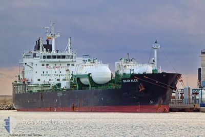
SOLAR ALICE
Tanker

Current Trip
| Trip Time | 12 days |
|---|---|
| Trip Distance | 1299.09 nm |
| AVG Speed | 4.6 Knop |
| MAX Speed | 4.6 Knop |
| Djupgående | 7.8 m |
| AVG Wind | 22.5 knots |
| MAX Wind | 43 knots |
| MIN Temp | 3°C / 37.4°F |
| MAX Temp | 19.5°C / 67.1°F |
| Position mottagen | 3 m sen |
Current Position
| Longitud | --- |
|---|---|
| Latitude | --- |
| Status | Moored |
| Fart | |
| Kurs | 178° |
| Område | North Atlantic Ocean |
| Station | T-AIS |
| Position mottagen | 3 m sen |
Information
The current position of SOLAR ALICE is in North Atlantic Ocean with coordinates 37.94942° / -8.88817° as reported on 2025-03-29 07:46 by AIS to our vessel tracker app. The vessel's current speed is 0 Knop and is currently inside the port of SINES.
The vessel SOLAR ALICE (IMO: 9887384, MMSI: 636020365) is a Tanker It's sailing under the flag of [LR] Liberia.
In this page you can find informations about the vessels current position, last detected port calls, and current voyage information. If the vessels is not in coverage by AIS you will find the latest position.
The current position of SOLAR ALICE is detected by our AIS receivers and we are not responsible for the reliability of the data. The last position was recorded while the vessel was in Coverage by the Ais receivers of our vessel tracking app.
The current draught of SOLAR ALICE as reported by AIS is 7.8 meters
Weather
| Temperature | 13°C / 55.4°F |
|---|---|
| Wind Speed | 8 knots |
| Direction | 25° NNE |
| Pressure | 1021.1 hPa |
| Humidity | 81.5 % |
| Cloud Coverage | --- |


Featured Company
Last Port Calls
| Port | Arrival | Departure | Time In Port |
|---|---|---|---|
| 2025-03-28 17:30 | |||
| 2025-03-15 06:57 | 2025-03-16 09:45 | 1 d | |
| 2025-03-13 16:13 | 2025-03-14 07:23 | 15 h | |
| 2025-03-11 13:00 | 2025-03-11 13:53 | 53 m | |
| 2025-03-09 07:40 | 2025-03-11 12:07 | 2 d | |
| 2025-03-04 15:20 | 2025-03-06 02:15 | 1 d | |
| 2025-02-28 11:50 | 2025-03-01 15:07 | 1 d | |
| 2025-02-24 20:19 | 2025-02-27 10:05 | 2 d | |
| 2025-02-22 08:06 | 2025-02-23 21:27 | 1 d | |
| 2025-02-19 03:43 | 2025-02-20 14:53 | 1 d |
Most Visited Ports (Last year)
| Port | Arrivals | |
|---|---|---|
| 8 | ||
| 8 | ||
| 6 | ||
| 6 | ||
| 5 | ||
| 5 |
Last Trips
| Origin | Departure | Destination | Arrival | Distance | |
|---|---|---|---|---|---|
| 2025-03-16 10:45 | 2025-03-28 17:30 | 1299.09 nm | |||
| 2025-03-14 08:23 | 2025-03-15 07:57 | 252.48 nm | |||
| 2025-03-11 14:53 | 2025-03-13 17:13 | 569.13 nm | |||
| 2025-03-11 13:07 | 2025-03-11 14:00 | 4.20 nm | |||
| 2025-03-06 02:15 | 2025-03-09 08:40 | 207.35 nm | |||
| 2025-03-01 15:07 | 2025-03-04 15:20 | 58.94 nm | |||
| 2025-02-27 11:05 | 2025-02-28 11:50 | 200.17 nm | |||
| 2025-02-23 22:27 | 2025-02-24 21:19 | 183.41 nm | |||
| 2025-02-20 15:53 | 2025-02-22 09:06 | 159.96 nm | |||
| 2025-02-19 04:09 | 2025-02-19 04:43 | 2.67 nm |
Events
| Tid | Event | Detaljer | Position / Dest | Information |
|---|---|---|---|---|
| 2025-03-29 07:10 | Status ändrad | Moored Default |
37.94943 / -8.88816
[PT] SINES
|
Fart: Kurs: 178° |
| 2025-03-29 07:07 | Status ändrad | Default Moored |
37.94942 / -8.88815
[PT] SINES
|
Fart: Kurs: 178° |
| 2025-03-28 18:10 | Status ändrad | Moored Under way using engine |
37.94947 / -8.88817
[PT] SINES
|
Fart: Kurs: 178° |
| 2025-03-28 17:52 | STOPPAR förflyttning |
37.94959 / -8.88801
[PT] SINES
|
Fart: 0.3 kn Kurs: 171° |
|
| 2025-03-28 17:30 | ANLÄNDER HAMN |
|
37.93599 / -8.88403
[PT] SINES
|
Fart: 5 kn Kurs: 347.4° |
| 2025-03-28 17:06 | Status ändrad | Under way using engine At anchor |
37.90608 / -8.88359
SINES
|
Fart: 5.1 kn Kurs: 353.5° |
| 2025-03-28 17:03 | STARTAR förflyttning | 2.53 nm, South of SINES |
37.90312 / -8.88045
SINES
|
Fart: 3.1 kn Kurs: 299° |
| 2025-03-27 15:53 | Status ändrad | At anchor Under way using engine |
37.89984 / -8.87254
SINES
|
Fart: 0.2 kn Kurs: 333° |
| 2025-03-27 15:51 | STOPPAR förflyttning | 2.66 nm, South of SINES |
37.89976 / -8.87256
SINES
|
Fart: 0.3 kn Kurs: 329° |
| 2025-03-27 14:42 | STARTAR förflyttning | 9.04 nm, South West of SINES |
37.82252 / -8.97926
SINES
|
Fart: 3.3 kn Kurs: 31° |