
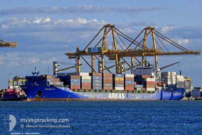
SM KAVERI
Container Ship
Current Trip
| Trip Time | 2 days |
|---|---|
| Trip Distance | 399.41 nm |
| AVG Speed | 11.5 Knop |
| MAX Speed | 15.2 Knop |
| Djupgående | 9.6 m |
| AVG Wind | 9.9 knots |
| MAX Wind | 18 knots |
| MIN Temp | 5.8°C / 42.44°F |
| MAX Temp | 19°C / 66.2°F |
| Position mottagen | 3 d sen |
Current Position
| Longitud | --- |
|---|---|
| Latitude | --- |
| Status | Under way using engine |
| Fart | 14.9 Knop |
| Kurs | 144.2° |
| Område | Mediterranean Sea - Eastern Basin |
| Station | T-AIS |
| Position mottagen | 3 d sen |
Info
Information
The current position of SM KAVERI is in Mediterranean Sea - Eastern Basin with coordinates 36.41545° / 34.88479° as reported on 2026-01-03 00:11 by AIS to our vessel tracker app. The vessel's current speed is 14.9 Knop and is currently inside the port of DAMIETTA.
The vessel SM KAVERI (IMO: 9236042, MMSI: 419001574) is a Container Ship that was built in 2002 ( 24 År gammal ). It's sailing under the flag of [IN] India.
In this page you can find informations about the vessels current position, last detected port calls, and current voyage information. If the vessels is not in coverage by AIS you will find the latest position.
The current position of SM KAVERI is detected by our AIS receivers and we are not responsible for the reliability of the data. The last position was recorded while the vessel was in Coverage by the Ais receivers of our vessel tracking app.
The current draught of SM KAVERI as reported by AIS is 9.6 meters
Weather
| Temperature | 16.8°C / 62.24°F |
|---|---|
| Wind Speed | 3 knots |
| Direction | 231° SW |
| Pressure | 1019.3 hPa |
| Humidity | 68.7 % |
| Cloud Coverage | 100 % |
Featured Company
Last Port Calls
| Port | Arrival | Departure | Time In Port |
|---|---|---|---|
| 2026-01-05 07:21 | |||
| 2026-01-02 06:09 | 2026-01-03 01:27 | 19 h | |
| 2025-12-28 23:42 | 2025-12-29 13:54 | 14 h | |
| 2025-12-27 05:20 | 2025-12-27 20:05 | 14 h | |
| 2025-12-24 22:42 | 2025-12-25 10:50 | 12 h | |
| 2025-12-23 08:01 | 2025-12-23 17:26 | 9 h | |
| 2025-12-20 05:01 | 2025-12-20 16:50 | 11 h | |
| 2025-12-12 18:07 | 2025-12-13 13:59 | 19 h | |
| 2025-12-10 05:39 | 2025-12-10 17:51 | 12 h | |
| 2025-12-02 12:21 | 2025-12-02 22:07 | 9 h |
Most Visited Ports (Last year)
| Port | Arrivals | |
|---|---|---|
| 9 | ||
| 9 | ||
| 8 | ||
| 7 | ||
| 7 | ||
| 6 |
Last Trips
| Origin | Departure | Destination | Arrival | Distance | |
|---|---|---|---|---|---|
| 2026-01-03 01:27 | 2026-01-05 07:21 | 399.41 nm | |||
| 2025-12-29 13:54 | 2026-01-02 06:09 | 913.30 nm | |||
| 2025-12-27 20:05 | 2025-12-28 23:42 | 278.87 nm | |||
| 2025-12-25 10:50 | 2025-12-27 05:20 | 562.42 nm | |||
| 2025-12-20 16:50 | 2025-12-24 22:42 | 895.41 nm | |||
| 2025-12-20 16:50 | 2025-12-23 08:01 | 636.69 nm | |||
| 2025-12-13 13:59 | 2025-12-20 05:01 | 2297.01 nm | |||
| 2025-12-10 17:51 | 2025-12-12 18:07 | 434.44 nm | |||
| 2025-12-02 22:07 | 2025-12-10 05:39 | 2412.01 nm | |||
| 2025-11-29 13:30 | 2025-12-02 12:21 | 778.36 nm |
Events
| Tid | Event | Detaljer | Position / Dest | Information |
|---|---|---|---|---|
| 2026-01-05 05:59 | STOPPAR förflyttning |
31.45457 / 31.76572
[EG] DAMIETTA
|
Fart: Kurs: 136° |
|
| 2026-01-05 05:21 | ANLÄNDER HAMN |
|
31.48987 / 31.75879
[EG] DAMIETTA
|
Fart: 7.5 kn Kurs: 191° |
| 2026-01-05 04:33 | STARTAR förflyttning | 7.99 nm, North of DAMIETTA |
31.60084 / 31.75774
TRMER
|
Fart: 3.7 kn Kurs: 113° |
| 2026-01-05 04:17 | STOPPAR förflyttning | 8.17 nm, North of DAMIETTA |
31.60382 / 31.75690
TRMER
|
Fart: 0.1 kn Kurs: 111° |
| 2026-01-05 03:28 | STARTAR förflyttning | 10.75 nm, North West of DAMIETTA |
31.63158 / 31.67348
TRMER
|
Fart: 5 kn Kurs: 117° |
| 2026-01-04 07:43 | STOPPAR förflyttning | 10.86 nm, North West of DAMIETTA |
31.63143 / 31.66799
TRMER
|
Fart: 0.3 kn Kurs: 60° |
| 2026-01-03 00:19 | Status ändrad | Default Under way using engine |
36.38896 / 34.90828
TRMER
|
Fart: 14.9 kn Kurs: 144.2° |
| 2026-01-03 00:11 | UTANFÖR täckningsområde |
36.41545 / 34.88479
Mediterranean Sea - Eastern Basin
|
Fart: 14.9 kn Kurs: 144.2° |
|
| 2026-01-03 00:08 | Status ändrad | Under way using engine Default |
36.42777 / 34.87424
TRMER
|
Fart: 15 kn Kurs: 146° |
| 2026-01-03 00:04 | Status ändrad | Default Under way using engine |
36.43893 / 34.86500
TRMER
|
Fart: 15 kn Kurs: 146.8° |