
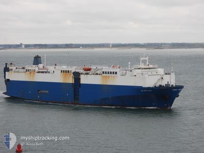
SILVER SUN
Vehicles Carrier
Current Trip
| Time Travelled | 17 days |
|---|---|
| Remaining Time | 2 days |
| Distance Travelled | 5952.82 nm |
| Remaining Distance | 926.71 nm |
| AVG Speed | 14.5 Knop |
| MAX Speed | 16.5 Knop |
| AVG Wind | 12.3 knots |
| MAX Wind | 27.7 knots |
| MIN Temp | 11.6°C / 52.88°F |
| MAX Temp | 28.1°C / 82.58°F |
| Djupgående | 8.2 m |
| Position mottagen | 38 m sen |
Current Position
| Longitud | --- |
|---|---|
| Latitude | --- |
| Status | Under way using engine |
| Fart | 13.7 Knop |
| Kurs | 32° |
| Område | North Atlantic Ocean |
| Station | T-AIS |
| Position mottagen | 38 m sen |
Info
Information
The current position of SILVER SUN is in North Atlantic Ocean with coordinates 43.64897° / -9.39518° as reported on 2025-03-17 23:22 by AIS to our vessel tracker app. The vessel's current speed is 13.7 Knop and is heading at the port of ZEEBRUGGE. The estimated time of arrival as calculated by MyShipTracking vessel tracking app is 2025-03-20 01:09 LT
The vessel SILVER SUN (IMO: 8519710, MMSI: 373207000) is a Vehicles Carrier that was built in 1988 ( 37 År gammal ). It's sailing under the flag of [PA] Panama.
In this page you can find informations about the vessels current position, last detected port calls, and current voyage information. If the vessels is not in coverage by AIS you will find the latest position.
The current position of SILVER SUN is detected by our AIS receivers and we are not responsible for the reliability of the data. The last position was recorded while the vessel was in Coverage by the Ais receivers of our vessel tracking app.
The current draught of SILVER SUN as reported by AIS is 8.2 meters
Weather
| Temperature | 12.8°C / 55.04°F |
|---|---|
| Wind Speed | 9 knots |
| Direction | 144° SE |
| Pressure | 1008.4 hPa |
| Humidity | 77.9 % |
| Cloud Coverage | 99 % |
Featured Company
Last Port Calls
| Port | Arrival | Departure | Time In Port |
|---|---|---|---|
| 2025-02-28 11:15 | 2025-02-28 23:39 | 12 h | |
| 2025-02-25 04:04 | 2025-02-27 01:21 | 1 d | |
| 2025-02-16 10:36 | 2025-02-17 07:24 | 20 h | |
| 2025-02-09 09:54 | 2025-02-11 07:44 | 1 d | |
| 2025-02-06 19:35 | 2025-02-07 22:39 | 1 d | |
| 2025-01-14 22:01 | 2025-01-30 03:49 | 15 d |
Most Visited Ports (Last year)
| Port | Arrivals | |
|---|---|---|
| 5 | ||
| 4 | ||
| 4 | ||
| 4 | ||
| 4 | ||
| 3 |
Last Trips
| Origin | Departure | Destination | Arrival | Distance | |
|---|---|---|---|---|---|
| 2025-02-27 01:21 | 2025-02-28 11:15 | 297.94 nm | |||
| 2025-02-17 07:24 | 2025-02-25 04:04 | 2685.90 nm | |||
| 2025-02-11 07:44 | 2025-02-16 10:36 | 1828.14 nm | |||
| 2025-02-07 22:39 | 2025-02-09 09:54 | 502.46 nm | |||
| 2025-01-30 03:49 | 2025-02-06 19:35 | 2633.77 nm | |||
| 2024-12-30 22:20 | 2025-01-14 22:01 | 4856.82 nm |
Events
| Tid | Event | Detaljer | Position / Dest | Information |
|---|---|---|---|---|
| 2025-03-17 23:28 | Status ändrad | Default Under way using engine |
43.66774 / -9.37860
ZA ELS>BE ZEE
|
Fart: 13.7 kn Kurs: 32° |
| 2025-03-17 23:22 | Status ändrad | Under way using engine Default |
43.64897 / -9.39518
ZA ELS>BE ZEE
|
Fart: 13.1 kn Kurs: 30° |
| 2025-03-17 23:13 | Status ändrad | Default Under way using engine |
43.61816 / -9.42161
ZA ELS>BE ZEE
|
Fart: 14 kn Kurs: 33° |
| 2025-03-17 22:57 | Byter havsområde | Spanish part of the North Atlantic Ocean Portuguese part of the North Atlantic Ocean |
43.56630 / -9.46528
North Atlantic Ocean
ZA ELS>BE ZEE
|
Fart: 14.1 kn Kurs: 33.2° |
| 2025-03-17 22:57 | Status ändrad | Under way using engine Default |
43.56436 / -9.46703
ZA ELS>BE ZEE
|
Fart: 14.6 kn Kurs: 26° |
| 2025-03-17 22:57 | I täckningsområde |
43.56630 / -9.46528
North Atlantic Ocean
ZA ELS>BE ZEE
|
Fart: 14.1 kn Kurs: 33.2° |
|
| 2025-03-17 04:12 | Status ändrad | Default Under way using engine |
39.00262 / -10.36764
ZA ELS>BE ZEE
|
Fart: 15.1 kn Kurs: 8.3° |
| 2025-03-17 04:05 | UTANFÖR täckningsområde |
38.97539 / -10.37241
North Atlantic Ocean
ZA ELS>BE ZEE
|
Fart: 15.1 kn Kurs: 8.3° |
|
| 2025-03-17 03:39 | Status ändrad | Under way using engine Default |
38.86600 / -10.39051
ZA ELS>BE ZEE
|
Fart: 15.2 kn Kurs: 5° |
| 2025-03-17 03:36 | Status ändrad | Default Under way using engine |
38.85211 / -10.39241
ZA ELS>BE ZEE
|
Fart: 15.1 kn Kurs: 5.3° |