
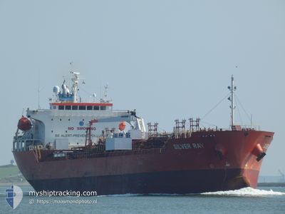
SILVER RAY
Oil/Chemical Tanker
Current Trip
| Time Travelled | 6 days |
|---|---|
| Remaining Time | 18 h, 49 mins |
| Distance Travelled | 1490.86 nm |
| Remaining Distance | 132.18 nm |
| AVG Speed | 10 Knop |
| MAX Speed | 14.1 Knop |
| AVG Wind | 15.3 knots |
| MAX Wind | 31 knots |
| MIN Temp | 11.8°C / 53.24°F |
| MAX Temp | 19.1°C / 66.38°F |
| Djupgående | 5.4 m |
| Position mottagen | Nu |
Current Position
| Longitud | 30.38506° |
|---|---|
| Latitude | 32.51020° |
| Status | Under way using engine |
| Fart | 6.8 Knop |
| Kurs | 96.4° |
| Område | Mediterranean Sea - Eastern Basin |
| Station | T-AIS |
| Position mottagen | Nu |
Info
Information
The current position of SILVER RAY is in Mediterranean Sea - Eastern Basin with coordinates 32.51020° / 30.38506° as reported on 2024-04-28 04:28 by AIS to our vessel tracker app. The vessel's current speed is 6.8 Knop and is heading at the port of PORT SAID. The estimated time of arrival as calculated by MyShipTracking vessel tracking app is 2024-04-28 23:18 LT
The vessel SILVER RAY (IMO: 9493133, MMSI: 636015953) is a Oil/Chemical Tanker that was built in 2013 ( 11 År gammal ). It's sailing under the flag of [LR] Liberia.
In this page you can find informations about the vessels current position, last detected port calls, and current voyage information. If the vessels is not in coverage by AIS you will find the latest position.
The current position of SILVER RAY is detected by our AIS receivers and we are not responsible for the reliability of the data. The last position was recorded while the vessel was in Coverage by the Ais receivers of our vessel tracking app.
The current draught of SILVER RAY as reported by AIS is 5.4 meters
Weather
| Temperature | 18.7°C / 65.66°F |
|---|---|
| Wind Speed | 16 knots |
| Direction | 323° NW |
| Pressure | 1013.1 hPa |
| Humidity | 75.4 % |
| Cloud Coverage | --- |
Featured Company
Last Port Calls
| Port | Arrival | Departure | Time In Port |
|---|---|---|---|
| 2024-04-20 04:57 | 2024-04-21 15:17 | 1 d | |
| 2024-04-06 14:00 | 2024-04-06 14:25 | 24 m | |
| 2024-04-01 07:29 | 2024-04-04 04:29 | 2 d | |
| 2024-03-26 15:22 | 2024-03-28 12:13 | 1 d | |
| 2024-03-22 17:28 | 2024-03-24 11:10 | 1 d | |
| 2024-02-25 20:11 | 2024-02-27 05:02 | 1 d | |
| 2024-02-15 21:22 | 2024-02-16 23:50 | 1 d | |
| 2024-02-08 08:18 | 2024-02-10 13:11 | 2 d | |
| 2024-02-07 03:06 | 2024-02-07 19:55 | 16 h | |
| 2024-02-04 06:33 |
Most Visited Ports (Last year)
| Port | Arrivals | |
|---|---|---|
| 3 | ||
| 3 | ||
| 2 | ||
| 2 | ||
| 2 | ||
| 2 |
Last Trips
| Origin | Departure | Destination | Arrival | Distance | |
|---|---|---|---|---|---|
| 2024-04-06 16:25 | 2024-04-20 06:57 | 1432.67 nm | |||
| 2024-04-04 04:29 | 2024-04-06 16:00 | 485.74 nm | |||
| 2024-03-28 13:13 | 2024-04-01 07:29 | 415.52 nm | |||
| 2024-03-24 11:10 | 2024-03-26 16:22 | 336.01 nm | |||
| 2024-02-27 07:02 | 2024-03-22 17:28 | 2769.61 nm | |||
| 2024-02-17 00:50 | 2024-02-25 22:11 | 2251.45 nm | |||
| 2024-02-10 14:11 | 2024-02-15 22:22 | 1374.04 nm | |||
| 2024-02-07 20:55 | 2024-02-08 09:18 | 94.93 nm | |||
| 2024-02-04 07:33 | 2024-02-07 04:06 | 386.27 nm |
Events
| Tid | Event | Detaljer | Position / Dest | Information |
|---|---|---|---|---|
| 2024-04-28 03:48 | Status ändrad | Under way using engine Default |
32.51745 / 30.29899
PORT SAID
|
Fart: 6.6 kn Kurs: 95° |
| 2024-04-28 03:34 | I täckningsområde |
32.51727 / 30.30114
Mediterranean Sea - Eastern Basin
PORT SAID
|
Fart: 6.6 kn Kurs: 96.5° |
|
| 2024-04-28 02:28 | Status ändrad | Default Under way using engine |
32.53850 / 30.12574
PORT SAID
|
Fart: 6.9 kn Kurs: 105.8° |
| 2024-04-28 02:23 | UTANFÖR täckningsområde |
32.54075 / 30.11511
Mediterranean Sea - Eastern Basin
PORT SAID
|
Fart: 6.9 kn Kurs: 105.8° |
|
| 2024-04-28 02:23 | Status ändrad | Under way using engine Default |
32.54103 / 30.11398
PORT SAID
|
Fart: 6.9 kn Kurs: 105° |
| 2024-04-28 01:47 | Status ändrad | Default Under way using engine |
32.56086 / 30.03707
PORT SAID
|
Fart: 6.9 kn Kurs: 107.2° |
| 2024-04-28 01:40 | Status ändrad | Under way using engine Default |
32.56506 / 30.02145
PORT SAID
|
Fart: 6.9 kn Kurs: 107° |
| 2024-04-28 00:52 | Status ändrad | Default Under way using engine |
32.59878 / 29.91680
PORT SAID
|
Fart: 7.4 kn Kurs: 114.6° |
| 2024-04-28 00:36 | Status ändrad | Under way using engine Default |
32.61182 / 29.88143
PORT SAID
|
Fart: 7 kn Kurs: 104° |
| 2024-04-28 00:15 | Status ändrad | Default Under way using engine |
32.62062 / 29.83525
PORT SAID
|
Fart: 7 kn Kurs: 102.5° |