
SHI LONG LING
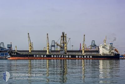
Bulk Carrier
Current Trip
| Trip Time | 15 days |
|---|---|
| Trip Distance | 2418.39 nm |
| AVG Speed | 9.2 Knop |
| MAX Speed | 13.1 Knop |
| Djupgående | 6.9 m |
| AVG Wind | 11.4 knots |
| MAX Wind | 31.6 knots |
| MIN Temp | 4°C / 39.2°F |
| MAX Temp | 29.9°C / 85.82°F |
| Position mottagen | 2 d sen |
Current Position
| Longitud | -59.75010° |
|---|---|
| Latitude | -33.62699° |
| Status | Under way using engine |
| Fart | 9.7 Knop |
| Kurs | 280.4° |
| Område | Rio de La Plata |
| Station | T-AIS |
| Position mottagen | 2 d sen |
Info
Information
The current position of SHI LONG LING is in Rio de La Plata with coordinates -33.62699° / -59.75010° as reported on 2024-06-03 07:37 by AIS to our vessel tracker app. The vessel's current speed is 9.7 Knop and is currently inside the port of ROSARIO.
The vessel SHI LONG LING (IMO: 9712060, MMSI: 414772000) is a Bulk Carrier that was built in 2013 ( 11 År gammal ). It's sailing under the flag of [CN] China.
In this page you can find informations about the vessels current position, last detected port calls, and current voyage information. If the vessels is not in coverage by AIS you will find the latest position.
The current position of SHI LONG LING is detected by our AIS receivers and we are not responsible for the reliability of the data. The last position was recorded while the vessel was in Coverage by the Ais receivers of our vessel tracking app.
The current draught of SHI LONG LING as reported by AIS is 6.9 meters
Weather
| Temperature | 18.9°C / 66.02°F |
|---|---|
| Wind Speed | 3 knots |
| Direction | 46° NE |
| Pressure | 1014.5 hPa |
| Humidity | 59 % |
| Cloud Coverage | 89 % |
Featured Company
Last Port Calls
| Port | Arrival | Departure | Time In Port |
|---|---|---|---|
| 2024-06-03 12:49 | |||
| 2024-05-17 09:22 | 2024-05-18 15:28 | 1 d | |
| 2024-05-12 01:56 | 2024-05-14 11:09 | 2 d | |
| 2024-05-09 02:30 | 2024-05-11 15:13 | 2 d |
Last Trips
| Origin | Departure | Destination | Arrival | Distance | |
|---|---|---|---|---|---|
| 2024-05-18 12:28 | 2024-06-03 09:49 | 2418.39 nm | |||
| 2024-05-14 08:09 | 2024-05-17 06:22 | 824.57 nm | |||
| 2024-05-11 12:13 | 2024-05-11 22:56 | 12.75 nm | |||
| 2024-03-25 20:25 | 2024-05-08 23:30 | 9714.50 nm |
Events
| Tid | Event | Detaljer | Position / Dest | Information |
|---|---|---|---|---|
| 2024-06-03 14:43 | STOPPAR förflyttning |
-33.05086 / -60.57027
[AR] ROSARIO
|
Fart: Kurs: 352° |
|
| 2024-06-03 12:49 | ANLÄNDER HAMN |
|
-33.18500 / -60.36500
[AR] ROSARIO
|
Fart: 9 kn Kurs: 261° |
| 2024-06-03 10:35 | STARTAR förflyttning | 4.22 nm, East of SAN NICOLAS |
-33.37667 / -60.09333
ROSARIO
|
Fart: 8 kn Kurs: 308° |
| 2024-06-03 10:23 | STOPPAR förflyttning | 4.84 nm, South East of SAN NICOLAS |
-33.38667 / -60.08500
ROSARIO
|
Fart: Kurs: -1° |
| 2024-06-03 07:41 | Status ändrad | Default Under way using engine |
-33.62137 / -59.76186
ROSARIO
|
Fart: 9.7 kn Kurs: 280.4° |
| 2024-06-03 07:37 | UTANFÖR täckningsområde |
-33.62699 / -59.75010
Rio de La Plata
ROSARIO
|
Fart: 9.7 kn Kurs: 280.4° |
|
| 2024-06-03 07:22 | Status ändrad | Under way using engine Default |
-33.63141 / -59.70197
ROSARIO
|
Fart: 9.7 kn Kurs: 268° |
| 2024-06-03 07:11 | Status ändrad | Default Under way using engine |
-33.62970 / -59.66778
ROSARIO
|
Fart: 9.4 kn Kurs: 296.4° |
| 2024-06-03 06:25 | Status ändrad | Under way using engine Default |
-33.68278 / -59.58126
ROSARIO
|
Fart: 9 kn Kurs: 215° |
| 2024-06-03 06:17 | I täckningsområde |
-33.69075 / -59.58940
Rio de La Plata
ROSARIO
|
Fart: 9.9 kn Kurs: 225° |