

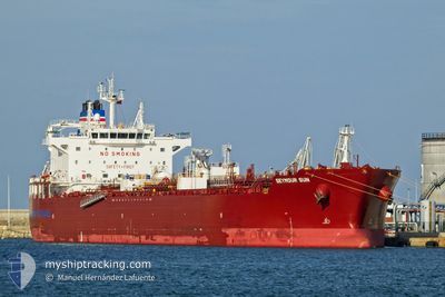
SEYMOUR SUN
Tanker

Current Trip
CNZOS
| Time Travelled | 15 h, 43 mins |
|---|---|
| Remaining Time | --- |
| Distance Travelled | 113.40 nm |
| Remaining Distance | --- |
| AVG Speed | 10.3 Knop |
| MAX Speed | 12.5 Knop |
| AVG Wind | 18.6 knots |
| MAX Wind | 25.8 knots |
| MIN Temp | 1.8°C / 35.24°F |
| MAX Temp | 7.1°C / 44.78°F |
| Djupgående | 8 m |
| Position mottagen | 12 h, 3 m sen |
Current Position
| Longitud | --- |
|---|---|
| Latitude | --- |
| Status | Under way using engine |
| Fart | 11.6 Knop |
| Kurs | 241° |
| Område | Japan Sea |
| Station | T-AIS |
| Position mottagen | 12 h, 3 m sen |
Information
The current position of SEYMOUR SUN is in Japan Sea with coordinates 34.85931° / 129.18162° as reported on 2025-02-17 07:42 by AIS to our vessel tracker app. The vessel's current speed is 11.6 Knop
The vessel SEYMOUR SUN (IMO: 9911501, MMSI: 563145200) is a Tanker It's sailing under the flag of [SG] Singapore.
In this page you can find informations about the vessels current position, last detected port calls, and current voyage information. If the vessels is not in coverage by AIS you will find the latest position.
The current position of SEYMOUR SUN is detected by our AIS receivers and we are not responsible for the reliability of the data. The last position was recorded while the vessel was in Coverage by the Ais receivers of our vessel tracking app.
The current draught of SEYMOUR SUN as reported by AIS is 8 meters
Weather
| Temperature | 1.8°C / 35.24°F |
|---|---|
| Wind Speed | 21 knots |
| Direction | 317° NW |
| Pressure | 1024.3 hPa |
| Humidity | 56.4 % |
| Cloud Coverage | 100 % |


Featured Company
Last Port Calls
| Port | Arrival | Departure | Time In Port |
|---|---|---|---|
| 2025-02-15 22:33 | 2025-02-17 04:03 | 1 d | |
| 2025-02-12 01:12 | 2025-02-13 06:47 | 1 d | |
| 2025-02-11 02:27 | 2025-02-12 00:25 | 21 h | |
| 2025-01-27 09:53 | 2025-02-01 06:23 | 4 d | |
| 2025-01-18 04:47 | 2025-01-19 07:40 | 1 d | |
| 2025-01-15 23:35 | 2025-01-16 23:42 | 1 d | |
| 2025-01-14 05:45 | 2025-01-15 00:12 | 18 h | |
| 2024-12-03 19:53 | 2024-12-05 15:25 | 1 d |
Most Visited Ports (Last year)
| Port | Arrivals | |
|---|---|---|
| 4 | ||
| 4 | ||
| 3 | ||
| 3 | ||
| 2 | ||
| 2 |
Last Trips
| Origin | Departure | Destination | Arrival | Distance | |
|---|---|---|---|---|---|
| 2025-02-13 15:47 | 2025-02-16 07:33 | 15.75 nm | |||
| 2025-02-12 09:25 | 2025-02-12 10:12 | 2.33 nm | |||
| 2025-02-01 14:23 | 2025-02-11 11:27 | 1012.71 nm | |||
| 2025-01-19 16:40 | 2025-01-27 17:53 | 1179.23 nm | |||
| 2025-01-17 08:42 | 2025-01-18 13:47 | 366.28 nm | |||
| 2025-01-15 09:12 | 2025-01-16 08:35 | 13.47 nm | |||
| 2024-12-05 09:25 | 2025-01-14 14:45 | 10023.30 nm | |||
| 2024-11-10 21:47 | 2024-12-03 13:53 | 5136.85 nm |
Events
| Tid | Event | Detaljer | Position / Dest | Information |
|---|---|---|---|---|
| 2025-02-17 15:39 | STOPPAR förflyttning | 17.36 nm, South of SINSUAN-GIL |
34.62004 / 127.99473
CNZOS
|
Fart: 0.2 kn Kurs: 314° |
| 2025-02-17 07:49 | Status ändrad | Default Under way using engine |
34.84874 / 129.15861
CNZOS
|
Fart: 11.6 kn Kurs: 241° |
| 2025-02-17 07:42 | Status ändrad | Under way using engine Default |
34.85931 / 129.18162
CNZOS
|
Fart: 11.6 kn Kurs: 241° |
| 2025-02-17 07:42 | UTANFÖR täckningsområde |
34.85931 / 129.18162
Japan Sea
|
Fart: 11.6 kn Kurs: 241° |
|
| 2025-02-17 07:37 | Status ändrad | Default Under way using engine |
34.86718 / 129.19864
CNZOS
|
Fart: 11.3 kn Kurs: 239.7° |
| 2025-02-17 07:31 | Status ändrad | Under way using engine Default |
34.87793 / 129.22111
CNZOS
|
Fart: 11.3 kn Kurs: 240° |
| 2025-02-17 07:13 | I täckningsområde |
34.87793 / 129.22111
Japan Sea
|
Fart: 11.3 kn Kurs: 239.7° |
|
| 2025-02-17 06:10 | Status ändrad | Default Under way using engine |
35.05547 / 129.41103
CNZOS
|
Fart: 11 kn Kurs: 200.6° |
| 2025-02-17 06:02 | UTANFÖR täckningsområde |
35.07725 / 129.42097
Japan Sea
|
Fart: 11 kn Kurs: 200.6° |
|
| 2025-02-17 06:00 | Status ändrad | Under way using engine Default |
35.08203 / 129.42317
CNZOS
|
Fart: 11 kn Kurs: 201° |