
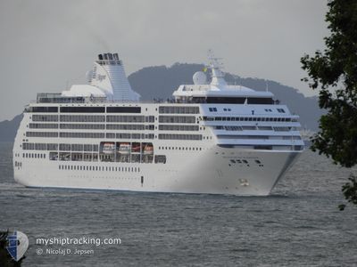
SEVEN SEAS MARINER
Passengers Ship
Current Trip
| Time Travelled | 1 day |
|---|---|
| Remaining Time | 2 h, 35 mins |
| Distance Travelled | 404.00 nm |
| Remaining Distance | 45.21 nm |
| AVG Speed | 13.5 Knop |
| MAX Speed | 16.5 Knop |
| AVG Wind | 18.9 knots |
| MAX Wind | 34.8 knots |
| MIN Temp | 16.7°C / 62.06°F |
| MAX Temp | 19.8°C / 67.64°F |
| Djupgående | 7 m |
| Position mottagen | Nu |
Current Position
| Longitud | 18.38614° |
|---|---|
| Latitude | -34.45786° |
| Status | Under way using engine |
| Fart | 15.9 Knop |
| Kurs | 298.8° |
| Område | South Atlantic Ocean |
| Station | T-AIS |
| Position mottagen | Nu |
Info
Information
The current position of SEVEN SEAS MARINER is in South Atlantic Ocean with coordinates -34.45786° / 18.38614° as reported on 2024-04-27 01:11 by AIS to our vessel tracker app. The vessel's current speed is 15.9 Knop and is heading at the port of CAPE TOWN. The estimated time of arrival as calculated by MyShipTracking vessel tracking app is 2024-04-27 03:47 LT
The vessel SEVEN SEAS MARINER (IMO: 9210139, MMSI: 311622000) is a Passengers Ship that was built in 2001 ( 23 År gammal ). It's sailing under the flag of [BS] Bahamas.
In this page you can find informations about the vessels current position, last detected port calls, and current voyage information. If the vessels is not in coverage by AIS you will find the latest position.
The current position of SEVEN SEAS MARINER is detected by our AIS receivers and we are not responsible for the reliability of the data. The last position was recorded while the vessel was in Coverage by the Ais receivers of our vessel tracking app.
The current draught of SEVEN SEAS MARINER as reported by AIS is 7 meters
Weather
| Temperature | 16.7°C / 62.06°F |
|---|---|
| Wind Speed | 34 knots |
| Direction | 105° ESE |
| Pressure | 1019.6 hPa |
| Humidity | 84.4 % |
| Cloud Coverage | --- |
Featured Company
Last Port Calls
| Port | Arrival | Departure | Time In Port |
|---|---|---|---|
| 2024-04-25 05:31 | 2024-04-25 18:39 | 13 h | |
| 2024-04-22 13:15 | 2024-04-23 18:27 | 1 d | |
| 2024-04-21 07:55 | 2024-04-21 14:59 | 7 h | |
| 2024-04-09 03:17 | 2024-04-09 14:09 | 10 h | |
| 2024-04-08 01:11 | 2024-04-08 15:09 | 13 h | |
| 2024-04-07 07:19 | 2024-04-07 19:11 | 11 h | |
| 2024-04-06 02:11 | 2024-04-06 11:49 | 9 h | |
| 2024-04-02 02:05 | 2024-04-03 14:45 | 1 d | |
| 2024-04-01 01:05 | 2024-04-01 11:33 | 10 h | |
| 2024-03-31 01:49 | 2024-03-31 12:29 | 10 h |
Most Visited Ports (Last year)
| Port | Arrivals | |
|---|---|---|
| 5 | ||
| 4 | ||
| 4 | ||
| 4 | ||
| 4 | ||
| 4 |
Last Trips
| Origin | Departure | Destination | Arrival | Distance | |
|---|---|---|---|---|---|
| 2024-04-23 20:27 | 2024-04-25 07:31 | 399.86 nm | |||
| 2024-04-21 16:59 | 2024-04-22 15:15 | 340.08 nm | |||
| 2024-04-09 18:09 | 2024-04-21 09:55 | 4161.91 nm | |||
| 2024-04-08 19:09 | 2024-04-09 07:17 | 102.29 nm | |||
| 2024-04-07 23:11 | 2024-04-08 05:11 | 87.24 nm | |||
| 2024-04-06 15:49 | 2024-04-07 11:19 | 333.93 nm | |||
| 2024-04-03 20:15 | 2024-04-06 06:11 | 859.40 nm | |||
| 2024-04-01 17:03 | 2024-04-02 07:35 | 243.02 nm | |||
| 2024-03-31 17:59 | 2024-04-01 06:35 | 171.53 nm | |||
| 2024-03-30 18:44 | 2024-03-31 07:19 | 210.69 nm |
Events
| Tid | Event | Detaljer | Position / Dest | Information |
|---|---|---|---|---|
| 2024-04-26 23:58 | Status ändrad | Under way using engine Default |
-34.58620 / 18.74013
CAPE TOWN - PBG
|
Fart: 15.8 kn Kurs: 301° |
| 2024-04-26 23:19 | Status ändrad | Default Under way using engine |
-34.66043 / 18.92471
CAPE TOWN - PBG
|
Fart: 15 kn Kurs: 294.6° |
| 2024-04-26 23:08 | Destination ändrad | CAPE TOWN - PBG DURBAN |
-34.68045 / 18.97640
CAPE TOWN - PBG
|
Fart: 15.1 kn Kurs: 294.1° |
| 2024-04-26 23:08 | ETA ändrat | 2024/04/27 04:00 2024/04/22 13:00 |
-34.68045 / 18.97640
CAPE TOWN - PBG
|
Fart: 15.1 kn Kurs: 294.1° |
| 2024-04-26 22:22 | Status ändrad | Under way using engine Default |
-34.75566 / 19.19326
DURBAN
|
Fart: 15.4 kn Kurs: 290° |
| 2024-04-26 22:14 | Status ändrad | Default Under way using engine |
-34.76833 / 19.23167
DURBAN
|
Fart: 15.6 kn Kurs: 293.2° |
| 2024-04-26 22:09 | Status ändrad | Under way using engine Default |
-34.77687 / 19.25539
DURBAN
|
Fart: 15.3 kn Kurs: 290° |
| 2024-04-26 21:43 | Status ändrad | Default Under way using engine |
-34.82057 / 19.38358
DURBAN
|
Fart: 15.9 kn Kurs: 294.1° |
| 2024-04-26 21:37 | Byter havsområde | South African part of the South Atlantic Ocean South African part of the Indian Ocean |
-34.83056 / 19.41294
South Atlantic Ocean
|
Fart: 15.9 kn Kurs: 294.1° |
| 2024-04-26 21:37 | Status ändrad | Under way using engine Default |
-34.83056 / 19.41294
DURBAN
|
Fart: 15.7 kn Kurs: 292° |