
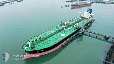
SEAWAYS EVEREST
Crude Oil Tanker
Current Trip
| Time Travelled | --- |
|---|---|
| Remaining Time | 19 h, 28 mins |
| Distance Travelled | 5188.18 nm |
| Remaining Distance | 289.82 nm |
| AVG Speed | 9.6 Knop |
| MAX Speed | 13.8 Knop |
| AVG Wind | 9 knots |
| MAX Wind | 25.2 knots |
| MIN Temp | 24.6°C / 76.28°F |
| MAX Temp | 30°C / 86°F |
| Djupgående | 11 m |
| Position mottagen | 18 h, 35 m sen |
Current Position
| Longitud | --- |
|---|---|
| Latitude | --- |
| Status | Under way using engine |
| Fart | 9.7 Knop |
| Kurs | 307.5° |
| Område | Malacca Strait |
| Station | T-AIS |
| Position mottagen | 18 h, 35 m sen |
Info
Information
The current position of SEAWAYS EVEREST is in Malacca Strait with coordinates 2.43954° / 101.66961° as reported on 2024-10-02 19:25 by AIS to our vessel tracker app. The vessel's current speed is 9.7 Knop and is heading at the port of SINGAPORE. The estimated time of arrival as calculated by MyShipTracking vessel tracking app is 2024-10-04 09:28 LT
The vessel SEAWAYS EVEREST (IMO: 9400679, MMSI: 538003712) is a Crude Oil Tanker that was built in 2010 ( 14 År gammal ). It's sailing under the flag of [MH] Marshall Is.
In this page you can find informations about the vessels current position, last detected port calls, and current voyage information. If the vessels is not in coverage by AIS you will find the latest position.
The current position of SEAWAYS EVEREST is detected by our AIS receivers and we are not responsible for the reliability of the data. The last position was recorded while the vessel was in Coverage by the Ais receivers of our vessel tracking app.
The current draught of SEAWAYS EVEREST as reported by AIS is 11 meters
Weather
| Temperature | 29.1°C / 84.38°F |
|---|---|
| Wind Speed | 10 knots |
| Direction | 303° WNW |
| Pressure | 1008.1 hPa |
| Humidity | 71.1 % |
| Cloud Coverage | 100 % |
Featured Company
Last Port Calls
Most Visited Ports (Last year)
| Port | Arrivals | |
|---|---|---|
| 1 | ||
| 1 | ||
| 1 | ||
| 1 |
Last Trips
| Origin | Departure | Destination | Arrival | Distance |
|---|
Events
| Tid | Event | Detaljer | Position / Dest | Information |
|---|---|---|---|---|
| 2024-10-02 19:29 | Status ändrad | Default Under way using engine |
2.44696 / 101.65988
SGSIN AESPA
|
Fart: 9.7 kn Kurs: 307.5° |
| 2024-10-02 19:25 | Status ändrad | Under way using engine Default |
2.43954 / 101.66961
SGSIN AESPA
|
Fart: 9.9 kn Kurs: 308° |
| 2024-10-02 19:25 | UTANFÖR täckningsområde |
2.43954 / 101.66961
Malacca Strait
|
Fart: 9.7 kn Kurs: 307.5° |
|
| 2024-10-02 19:15 | Status ändrad | Default Under way using engine |
2.42310 / 101.69043
SGSIN AESPA
|
Fart: 9.9 kn Kurs: 308.1° |
| 2024-10-02 18:59 | Status ändrad | Under way using engine Default |
2.39554 / 101.72459
SGSIN AESPA
|
Fart: 10.2 kn Kurs: 305° |
| 2024-10-02 18:46 | Status ändrad | Default Under way using engine |
2.37358 / 101.75388
SGSIN AESPA
|
Fart: 10.2 kn Kurs: 304.6° |
| 2024-10-02 17:37 | Upptäckt i hav | Malaysian part of the Malacca Strait |
2.25273 / 101.91318
Malacca Strait
|
Fart: 9.9 kn Kurs: 309.5° |
| 2024-10-02 17:36 | Status ändrad | Under way using engine Default |
2.25094 / 101.91535
SGSIN AESPA
|
Fart: 9.9 kn Kurs: 310° |
| 2024-10-02 17:25 | I täckningsområde |
2.25273 / 101.91318
Malacca Strait
|
Fart: 9.9 kn Kurs: 309.5° |
|
| 2024-10-02 06:36 | UTANFÖR täckningsområde |
1.18610 / 103.64290
Singapore Strait
|
Fart: 11.5 kn Kurs: 280.1° |