
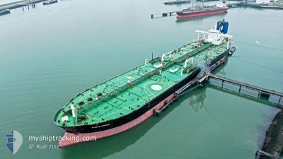
SEAWAYS EVEREST
Crude Oil Tanker
Current Trip
| Time Travelled | 3 days |
|---|---|
| Remaining Time | --- |
| Distance Travelled | 144.39 nm |
| Remaining Distance | --- |
| AVG Speed | 8.4 Noeuds |
| MAX Speed | 14 Noeuds |
| AVG Wind | 11.5 knots |
| MAX Wind | 22.9 knots |
| MIN Temp | 32.2°C / 89.96°F |
| MAX Temp | 34.8°C / 94.64°F |
| Tirant d eau | 16.7 m |
| Position reçue | 1 m depuis |
Current Position
| Longitude | 53.23112° |
|---|---|
| Latitude | 25.69510° |
| Etat | Under way using engine |
| Vitesse | 11.7 Noeuds |
| Parcours | 90.8° |
| Zone | Persian Gulf |
| Station | T-AIS |
| Position reçue | 1 m depuis |
Info
Information
The current position of SEAWAYS EVEREST is in Persian Gulf with coordinates 25.69510° / 53.23112° as reported on 2024-07-06 20:10 by AIS to our vessel tracker app. The vessel's current speed is 11.7 Noeuds and is heading at the port of RAYONG. The estimated time of arrival as calculated by MyShipTracking vessel tracking app is 2024-07-21 01:00 LT
The vessel SEAWAYS EVEREST (IMO: 9400679, MMSI: 538003712) is a Crude Oil Tanker that was built in 2010 ( 14 Age ). It's sailing under the flag of [MH] Marshall Is.
In this page you can find informations about the vessels current position, last detected port calls, and current voyage information. If the vessels is not in coverage by AIS you will find the latest position.
The current position of SEAWAYS EVEREST is detected by our AIS receivers and we are not responsible for the reliability of the data. The last position was recorded while the vessel was in Coverage by the Ais receivers of our vessel tracking app.
The current draught of SEAWAYS EVEREST as reported by AIS is 16.7 meters
Weather
| Temperature | 32.6°C / 90.68°F |
|---|---|
| Wind Speed | 1 knots |
| Direction | 8° N |
| Pressure | 993.8 hPa |
| Humidity | 68.5 % |
| Cloud Coverage | 5 % |
Featured Company
Most Visited Ports (Last year)
| Port | Arrivals | |
|---|---|---|
| 1 | ||
| 1 | ||
| 1 | ||
| 1 |
Last Trips
| Origin | Departure | Destination | Arrival | Distance |
|---|
Events
| Heure | Evenement | Détails | Position/ Destination | Info |
|---|---|---|---|---|
| 2024-07-06 19:57 | Etat Changé | Under way using engine Default |
25.69505 / 53.18280
QA HAL>TH RYG
|
Vitesse: 11.7 kn Parcours: 82° |
| 2024-07-06 19:50 | Etat Changé | Default Under way using engine |
25.69194 / 53.15652
QA HAL>TH RYG
|
Vitesse: 11.6 kn Parcours: 79.7° |
| 2024-07-06 18:52 | Changement de zone | Iranian part of the Persian Gulf Qatari part of the Persian Gulf |
25.68414 / 52.94809
Persian Gulf
QA HAL>TH RYG
|
Vitesse: 11.9 kn Parcours: 90.5° |
| 2024-07-06 18:46 | Tirant d'eau modifié | 16.7 11.8 |
25.68392 / 52.92607
QA HAL>TH RYG
|
Vitesse: 11.8 kn Parcours: 89.4° |
| 2024-07-06 18:46 | Changement de destination | QA HAL>TH RYG QA UMS>QA HAL |
25.68392 / 52.92607
QA HAL>TH RYG
|
Vitesse: 11.8 kn Parcours: 89.4° |
| 2024-07-06 18:46 | Changement d'ETA | 2024/07/21 01:00 2024/07/04 06:00 |
25.68392 / 52.92607
QA HAL>TH RYG
|
Vitesse: 11.8 kn Parcours: 89.4° |
| 2024-07-06 18:21 | Etat Changé | Under way using engine Default |
25.67185 / 52.83404
QA UMS>QA HAL
|
Vitesse: 11.7 kn Parcours: 70° |
| 2024-07-06 18:13 | Etat Changé | Default Under way using engine |
25.66313 / 52.80703
QA UMS>QA HAL
|
Vitesse: 11.6 kn Parcours: 70.8° |
| 2024-07-06 18:07 | Etat Changé | Under way using engine Default |
25.65636 / 52.78607
QA UMS>QA HAL
|
Vitesse: 11.3 kn Parcours: 71° |
| 2024-07-06 17:49 | Dans la zone couverte |
25.65636 / 52.78607
Persian Gulf
|
Vitesse: 11.6 kn Parcours: 70.8° |