
SEATRIBUTE
Tanker
Current Trip
| Trip Time | 10 days |
|---|---|
| Trip Distance | 1674.25 nm |
| AVG Speed | 9.5 Knop |
| MAX Speed | 13.7 Knop |
| Djupgående | 8.3 m |
| AVG Wind | 8.9 knots |
| MAX Wind | 26 knots |
| MIN Temp | 6.3°C / 43.34°F |
| MAX Temp | 17.9°C / 64.22°F |
| Position mottagen | 22 h, 12 m sen |
Current Position
| Longitud | --- |
|---|---|
| Latitude | --- |
| Status | Under way using engine |
| Fart | 10.2 Knop |
| Kurs | 46.6° |
| Område | Mediterranean Sea - Eastern Basin |
| Station | T-AIS |
| Position mottagen | 22 h, 12 m sen |
Info
Information
The current position of SEATRIBUTE is in Mediterranean Sea - Eastern Basin with coordinates 36.58136° / 35.76007° as reported on 2025-01-13 00:02 by AIS to our vessel tracker app. The vessel's current speed is 10.2 Knop and is currently inside the port of CEYHAN.
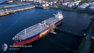
The vessel SEATRIBUTE (IMO: 9857468, MMSI: 215544000) is a Tanker It's sailing under the flag of [MT] Malta.
In this page you can find informations about the vessels current position, last detected port calls, and current voyage information. If the vessels is not in coverage by AIS you will find the latest position.
The current position of SEATRIBUTE is detected by our AIS receivers and we are not responsible for the reliability of the data. The last position was recorded while the vessel was in Coverage by the Ais receivers of our vessel tracking app.
The current draught of SEATRIBUTE as reported by AIS is 8.3 meters
Weather
| Temperature | 17.1°C / 62.78°F |
|---|---|
| Wind Speed | 7 knots |
| Direction | 106° ESE |
| Pressure | 1023.8 hPa |
| Humidity | 63.3 % |
| Cloud Coverage | 100 % |
Featured Company
Last Trips
| Origin | Departure | Destination | Arrival | Distance | |
|---|---|---|---|---|---|
| 2025-01-02 21:55 | 2025-01-13 12:25 | 1674.25 nm | |||
| 2024-12-03 16:13 | 2025-01-02 05:40 | 2948.26 nm | |||
| 2024-11-20 21:30 | 2024-12-03 14:36 | 1601.11 nm | |||
| 2024-11-03 19:48 | 2024-11-19 10:34 | 1391.60 nm | |||
| 2024-10-20 03:42 | 2024-11-03 00:28 | 3407.92 nm |
Events
| Tid | Event | Detaljer | Position / Dest | Information |
|---|---|---|---|---|
| 2025-01-13 09:51 | STOPPAR förflyttning |
36.85247 / 35.93201
[TR] CEYHAN
|
Fart: Kurs: 183° |
|
| 2025-01-13 09:25 | ANLÄNDER HAMN |
|
36.84634 / 35.93259
[TR] CEYHAN
|
Fart: 4.2 kn Kurs: 250° |
| 2025-01-13 08:25 | STARTAR förflyttning | 2.65 nm, South East of CEYHAN |
36.82641 / 35.96473
TRCEY
|
Fart: 3.7 kn Kurs: 345° |
| 2025-01-13 03:00 | STOPPAR förflyttning | 2.95 nm, South East of CEYHAN |
36.81849 / 35.96456
TRCEY
|
Fart: 0.2 kn Kurs: 54° |
| 2025-01-13 00:05 | Status ändrad | Default Under way using engine |
36.58728 / 35.76777
TRCEY
|
Fart: 10.2 kn Kurs: 46.6° |
| 2025-01-13 00:02 | UTANFÖR täckningsområde |
36.58136 / 35.76007
Mediterranean Sea - Eastern Basin
TRCEY
|
Fart: 10.2 kn Kurs: 46.6° |
|
| 2025-01-12 20:08 | ETA ändrat | 2025/01/13 03:00 2025/01/11 15:00 |
36.23355 / 35.03894
TRCEY
|
Fart: 10.8 kn Kurs: 68.9° |
| 2025-01-12 19:32 | Upptäckt i hav | Turkish part of the Mediterranean Sea - Eastern Basin |
36.19349 / 34.91574
Mediterranean Sea - Eastern Basin
|
Fart: 10.6 kn Kurs: 68.3° |
| 2025-01-12 19:32 | Status ändrad | Under way using engine Default |
36.19349 / 34.91574
TRCEY
|
Fart: 10.5 kn Kurs: 67° |
| 2025-01-12 19:22 | Status ändrad | Default Under way using engine |
36.18366 / 34.88667
TRCEY
|
Fart: 10.5 kn Kurs: 70.8° |