
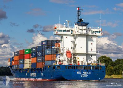
SEABOARD BLUE
Container Ship
Current Trip
| Time Travelled | 2 days |
|---|---|
| Remaining Time | 10 h, 15 mins |
| Distance Travelled | 622.26 nm |
| Remaining Distance | 418.34 nm |
| AVG Speed | 9.9 Knop |
| MAX Speed | 12.1 Knop |
| AVG Wind | 13.7 knots |
| MAX Wind | 19.9 knots |
| MIN Temp | 23.2°C / 73.76°F |
| MAX Temp | 26.4°C / 79.52°F |
| Djupgående | 7.2 m |
| Position mottagen | 2 d sen |
Current Position
| Longitud | --- |
|---|---|
| Latitude | --- |
| Status | Under way using engine |
| Fart | 10.1 Knop |
| Kurs | 217.5° |
| Område | North Atlantic Ocean |
| Station | T-AIS |
| Position mottagen | 2 d sen |
Info
Information
The current position of SEABOARD BLUE is in North Atlantic Ocean with coordinates 24.53117° / -80.54451° as reported on 2025-02-16 01:38 by AIS to our vessel tracker app. The vessel's current speed is 10.1 Knop and is heading at the port of PUERTO CORTES. The estimated time of arrival as calculated by MyShipTracking vessel tracking app is 2025-02-18 10:08 LT
The vessel SEABOARD BLUE (IMO: 9504059, MMSI: 636022765) is a Container Ship that was built in 2011 ( 14 År gammal ). It's sailing under the flag of [LR] Liberia.
In this page you can find informations about the vessels current position, last detected port calls, and current voyage information. If the vessels is not in coverage by AIS you will find the latest position.
The current position of SEABOARD BLUE is detected by our AIS receivers and we are not responsible for the reliability of the data. The last position was recorded while the vessel was in Coverage by the Ais receivers of our vessel tracking app.
The current draught of SEABOARD BLUE as reported by AIS is 7.2 meters
Weather
| Temperature | 26.3°C / 79.34°F |
|---|---|
| Wind Speed | 15 knots |
| Direction | 91° E |
| Pressure | 1015.6 hPa |
| Humidity | 80.5 % |
| Cloud Coverage | 83 % |
Featured Company
Last Port Calls
| Port | Arrival | Departure | Time In Port |
|---|---|---|---|
| 2025-02-14 18:25 | 2025-02-15 12:09 | 17 h | |
| 2025-02-11 15:29 | 2025-02-12 15:19 | 23 h | |
| 2025-02-06 09:23 | 2025-02-06 23:38 | 14 h | |
| 2025-02-02 19:30 | 2025-02-04 04:27 | 1 d | |
| 2025-01-30 13:23 | 2025-01-31 15:26 | 1 d | |
| 2025-01-26 13:35 | 2025-01-28 03:39 | 1 d | |
| 2025-01-23 10:13 | 2025-01-24 06:59 | 20 h | |
| 2025-01-20 02:19 | 2025-01-20 22:51 | 20 h | |
| 2025-01-16 19:15 | 2025-01-19 09:35 | 2 d | |
| 2025-01-13 20:22 | 2025-01-14 16:12 | 19 h |
Most Visited Ports (Last year)
| Port | Arrivals | |
|---|---|---|
| 51 | ||
| 46 | ||
| 43 |
Last Trips
| Origin | Departure | Destination | Arrival | Distance | |
|---|---|---|---|---|---|
| 2025-02-12 15:19 | 2025-02-14 18:25 | 792.62 nm | |||
| 2025-02-06 23:38 | 2025-02-11 15:29 | 813.83 nm | |||
| 2025-02-04 04:27 | 2025-02-06 09:23 | 794.94 nm | |||
| 2025-01-31 15:26 | 2025-02-02 19:30 | 797.97 nm | |||
| 2025-01-28 03:39 | 2025-01-30 13:23 | 841.11 nm | |||
| 2025-01-24 06:59 | 2025-01-26 13:35 | 847.89 nm | |||
| 2025-01-20 22:51 | 2025-01-23 10:13 | 835.33 nm | |||
| 2025-01-19 09:35 | 2025-01-20 02:19 | 61.54 nm | |||
| 2025-01-14 16:12 | 2025-01-16 19:15 | 798.56 nm | |||
| 2025-01-11 12:38 | 2025-01-13 20:22 | 838.96 nm |
Events
| Tid | Event | Detaljer | Position / Dest | Information |
|---|---|---|---|---|
| 2025-02-16 01:40 | Status ändrad | Default Under way using engine |
24.52854 / -80.54673
HNPCR
|
Fart: 10.1 kn Kurs: 217.5° |
| 2025-02-16 01:38 | UTANFÖR täckningsområde |
24.53117 / -80.54451
North Atlantic Ocean
HNPCR
|
Fart: 10.1 kn Kurs: 217.5° |
|
| 2025-02-15 21:50 | Status ändrad | Under way using engine Default |
25.04716 / -80.14462
HNPCR
|
Fart: 10 kn Kurs: 202° |
| 2025-02-15 21:50 | I täckningsområde |
25.04111 / -80.14889
North Atlantic Ocean
HNPCR
|
Fart: 10.2 kn Kurs: 211.5° |
|
| 2025-02-15 20:59 | Status ändrad | Default Under way using engine |
25.18082 / -80.08354
HNPCR
|
Fart: 10.2 kn Kurs: 195.6° |
| 2025-02-15 20:50 | UTANFÖR täckningsområde |
25.20600 / -80.07579
North Atlantic Ocean
HNPCR
|
Fart: 10.2 kn Kurs: 195.6° |
|
| 2025-02-15 17:47 | Djupgående ändrat | 7.2 7.1 |
25.70535 / -80.04386
HNPCR
|
Fart: 9.8 kn Kurs: 156.5° |
| 2025-02-15 17:47 | ETA ändrat | 2025/02/18 23:00 2025/02/18 14:00 |
25.70535 / -80.04386
HNPCR
|
Fart: 9.8 kn Kurs: 156.5° |
| 2025-02-15 17:09 | AVGÅTT HAMN |
|
25.76173 / -80.12844
HNPCR
|
Fart: 13.2 kn Kurs: 113° |
| 2025-02-15 16:45 | STARTAR förflyttning |
25.76871 / -80.16816
[US] MIAMI
|
Fart: 3.3 kn Kurs: 314° |