
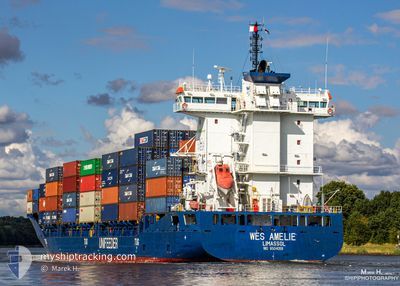
SEABOARD BLUE
Container Ship
Current Trip
| Time Travelled | 2 days |
|---|---|
| Remaining Time | 2 h, 26 mins |
| Distance Travelled | 795.46 nm |
| Remaining Distance | 55.68 nm |
| AVG Speed | 16.2 Noeuds |
| MAX Speed | 18.8 Noeuds |
| AVG Wind | 11 knots |
| MAX Wind | 16.9 knots |
| MIN Temp | 17.3°C / 63.14°F |
| MAX Temp | 26.1°C / 78.98°F |
| Tirant d eau | 7.8 m |
| Position reçue | 3 m depuis |
Current Position
| Longitude | --- |
|---|---|
| Latitude | --- |
| Etat | Under way using engine |
| Vitesse | 18.1 Noeuds |
| Parcours | 23.4° |
| Zone | North Atlantic Ocean |
| Station | T-AIS |
| Position reçue | 3 m depuis |
Info
Information
The current position of SEABOARD BLUE is in North Atlantic Ocean with coordinates 25.11246° / -80.14153° as reported on 2024-11-25 13:13 by AIS to our vessel tracker app. The vessel's current speed is 18.1 Noeuds and is heading at the port of MIAMI. The estimated time of arrival as calculated by MyShipTracking vessel tracking app is 2024-11-25 15:42 LT
The vessel SEABOARD BLUE (IMO: 9504059, MMSI: 636022765) is a Container Ship that was built in 2011 ( 13 Age ). It's sailing under the flag of [LR] Liberia.
In this page you can find informations about the vessels current position, last detected port calls, and current voyage information. If the vessels is not in coverage by AIS you will find the latest position.
The current position of SEABOARD BLUE is detected by our AIS receivers and we are not responsible for the reliability of the data. The last position was recorded while the vessel was in Coverage by the Ais receivers of our vessel tracking app.
The current draught of SEABOARD BLUE as reported by AIS is 7.8 meters
Weather
| Temperature | 23.1°C / 73.58°F |
|---|---|
| Wind Speed | 11 knots |
| Direction | 71° ENE |
| Pressure | 1020.8 hPa |
| Humidity | 73 % |
| Cloud Coverage | --- |
Featured Company
Last Port Calls
| Port | Arrival | Departure | Time In Port |
|---|---|---|---|
| 2024-11-22 00:45 | 2024-11-23 11:26 | 1 d | |
| 2024-11-20 15:04 | 2024-11-21 15:38 | 1 d | |
| 2024-11-17 19:16 | 2024-11-18 11:41 | 16 h | |
| 2024-11-14 11:23 | 2024-11-15 11:45 | 1 d | |
| 2024-11-13 14:13 | 2024-11-14 06:26 | 16 h | |
| 2024-11-10 16:28 | 2024-11-11 11:45 | 19 h | |
| 2024-11-07 21:52 | 2024-11-08 13:18 | 15 h | |
| 2024-11-06 20:27 | 2024-11-07 17:14 | 20 h | |
| 2024-11-03 23:24 | 2024-11-04 17:21 | 17 h | |
| 2024-10-31 11:14 | 2024-11-01 15:39 | 1 d |
Most Visited Ports (Last year)
| Port | Arrivals | |
|---|---|---|
| 53 | ||
| 37 | ||
| 37 |
Last Trips
| Origin | Departure | Destination | Arrival | Distance | |
|---|---|---|---|---|---|
| 2024-11-21 09:38 | 2024-11-21 18:45 | 61.28 nm | |||
| 2024-11-18 06:41 | 2024-11-20 09:04 | 796.23 nm | |||
| 2024-11-15 05:45 | 2024-11-17 14:16 | 836.96 nm | |||
| 2024-11-14 00:26 | 2024-11-14 05:23 | 61.96 nm | |||
| 2024-11-11 06:45 | 2024-11-13 08:13 | 795.85 nm | |||
| 2024-11-08 07:18 | 2024-11-10 11:28 | 837.27 nm | |||
| 2024-11-07 11:14 | 2024-11-07 15:52 | 62.64 nm | |||
| 2024-11-04 12:21 | 2024-11-06 14:27 | 795.30 nm | |||
| 2024-11-01 09:39 | 2024-11-03 18:24 | 843.90 nm | |||
| 2024-10-30 23:28 | 2024-10-31 05:14 | 61.53 nm |
Events
| Heure | Evenement | Détails | Position/ Destination | Info |
|---|---|---|---|---|
| 2024-11-25 13:03 | Etat Changé | Under way using engine Default |
25.06548 / -80.16559
USMIA
|
Vitesse: 17.7 kn Parcours: 31° |
| 2024-11-25 12:48 | Etat Changé | Default Under way using engine |
25.00391 / -80.20573
USMIA
|
Vitesse: 17.7 kn Parcours: 32° |
| 2024-11-25 12:32 | Etat Changé | Under way using engine Default |
24.93319 / -80.25295
USMIA
|
Vitesse: 17.9 kn Parcours: 32° |
| 2024-11-25 12:25 | Etat Changé | Default Under way using engine |
24.90648 / -80.27129
USMIA
|
Vitesse: 17.9 kn Parcours: 32° |
| 2024-11-25 11:21 | Tirant d'eau modifié | 7.8 7.3 |
24.62664 / -80.45987
USMIA
|
Vitesse: 18.8 kn Parcours: 32.9° |
| 2024-11-25 11:21 | Changement de destination | USMIA GTSTC |
24.62664 / -80.45987
USMIA
|
Vitesse: 18.8 kn Parcours: 32.9° |
| 2024-11-25 11:21 | Changement d'ETA | 2024/11/25 16:00 2024/11/21 19:30 |
24.62664 / -80.45987
USMIA
|
Vitesse: 18.8 kn Parcours: 32.9° |
| 2024-11-25 10:58 | Changement de zone | United States part of the North Atlantic Ocean Guatemalan part of the Caribbean Sea |
24.52884 / -80.52688
North Atlantic Ocean
|
Vitesse: 18 kn Parcours: 30.8° |
| 2024-11-25 10:58 | Etat Changé | Under way using engine Default |
24.52582 / -80.52887
GTSTC
|
Vitesse: 17.9 kn Parcours: 29° |
| 2024-11-25 10:58 | Dans la zone couverte |
24.52884 / -80.52688
North Atlantic Ocean
|
Vitesse: 18 kn Parcours: 30.8° |