
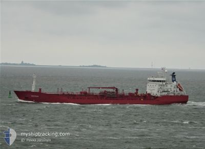
SEA PROSPECT
General Cargo
Current Trip
SESOO
| Time Travelled | 1 day |
|---|---|
| Remaining Time | --- |
| Distance Travelled | 290.89 nm |
| Remaining Distance | --- |
| AVG Speed | 11.7 Knop |
| MAX Speed | 12.2 Knop |
| AVG Wind | 10.9 knots |
| MAX Wind | 16.2 knots |
| MIN Temp | -3.7°C / 25.34°F |
| MAX Temp | -0.8°C / 30.56°F |
| Djupgående | 7.5 m |
| Position mottagen | 15 h, 12 m sen |
Current Position
| Longitud | --- |
|---|---|
| Latitude | --- |
| Status | Under way using engine |
| Fart | 12.1 Knop |
| Kurs | 214.7° |
| Område | Gulf of Bothnia |
| Station | T-AIS |
| Position mottagen | 15 h, 12 m sen |
Information
The current position of SEA PROSPECT is in Gulf of Bothnia with coordinates 61.35395° / 17.60688° as reported on 2025-03-11 17:20 by AIS to our vessel tracker app. The vessel's current speed is 12.1 Knop
The vessel SEA PROSPECT (IMO: 9516143, MMSI: 257222000) is a General Cargo that was built in 2012 ( 13 År gammal ). It's sailing under the flag of [NO] Norway.
In this page you can find informations about the vessels current position, last detected port calls, and current voyage information. If the vessels is not in coverage by AIS you will find the latest position.
The current position of SEA PROSPECT is detected by our AIS receivers and we are not responsible for the reliability of the data. The last position was recorded while the vessel was in Coverage by the Ais receivers of our vessel tracking app.
The current draught of SEA PROSPECT as reported by AIS is 7.5 meters
Weather
| Temperature | -0.8°C / 30.56°F |
|---|---|
| Wind Speed | 9 knots |
| Direction | 75° ENE |
| Pressure | 1004.9 hPa |
| Humidity | 71.7 % |
| Cloud Coverage | 100 % |
Featured Company
Last Port Calls
| Port | Arrival | Departure | Time In Port |
|---|---|---|---|
| 2025-03-09 16:53 | 2025-03-10 18:25 | 1 d | |
| 2025-03-07 03:37 | 2025-03-08 17:22 | 1 d | |
| 2025-03-05 07:04 | 2025-03-05 21:15 | 14 h | |
| 2025-02-27 08:08 | 2025-02-28 04:24 | 20 h | |
| 2025-02-20 16:22 | |||
| 2025-02-06 15:46 | 2025-02-08 15:24 | 1 d | |
| 2025-02-03 03:09 | 2025-02-04 23:47 | 1 d | |
| 2025-01-18 19:18 | |||
| 2025-01-15 05:57 | 2025-01-15 12:41 | 6 h | |
| 2025-01-02 00:14 | 2025-01-04 22:10 | 2 d |
Most Visited Ports (Last year)
| Port | Arrivals | |
|---|---|---|
| 6 | ||
| 6 | ||
| 5 | ||
| 3 | ||
| 2 | ||
| 2 |
Last Trips
| Origin | Departure | Destination | Arrival | Distance | |
|---|---|---|---|---|---|
| 2025-03-08 18:22 | 2025-03-09 17:53 | 274.04 nm | |||
| 2025-03-05 23:15 | 2025-03-07 04:37 | 325.03 nm | |||
| 2025-02-28 05:24 | 2025-03-05 09:04 | 1205.13 nm | |||
| 2025-02-20 16:22 | 2025-02-27 09:08 | 894.67 nm | |||
| 2025-02-05 00:47 | 2025-02-06 16:46 | 481.44 nm | |||
| 2025-01-18 21:18 | 2025-02-03 04:09 | 2708.99 nm | |||
| 2025-01-04 22:10 | 2025-01-15 07:57 | 2046.38 nm | |||
| 2024-12-23 05:59 | 2025-01-02 00:14 | 2153.59 nm |
Events
| Tid | Event | Detaljer | Position / Dest | Information |
|---|---|---|---|---|
| 2025-03-12 08:14 | STARTAR förflyttning | 3.14 nm, East of VALLVIK |
61.18812 / 17.28270
SESOO
|
Fart: 3.1 kn Kurs: 300° |
| 2025-03-11 19:01 | STOPPAR förflyttning | 3.1 nm, East of VALLVIK |
61.18444 / 17.28045
SESOO
|
Fart: 0.2 kn Kurs: 50° |
| 2025-03-11 17:26 | Status ändrad | Default Under way using engine |
61.33881 / 17.58391
SESOO
|
Fart: 12.1 kn Kurs: 214.7° |
| 2025-03-11 17:20 | Status ändrad | Under way using engine Default |
61.35395 / 17.60688
SESOO
|
Fart: 12 kn Kurs: 216° |
| 2025-03-11 17:20 | UTANFÖR täckningsområde |
61.35395 / 17.60688
Gulf of Bothnia
SESOO
|
Fart: 12.1 kn Kurs: 214.7° |
|
| 2025-03-11 16:42 | Status ändrad | Default Under way using engine |
61.45784 / 17.76628
SESOO
|
Fart: 12 kn Kurs: 214.7° |
| 2025-03-11 16:17 | Djupgående ändrat | 7.5 6.7 |
61.52630 / 17.86448
SESOO
|
Fart: 11.9 kn Kurs: 214.7° |
| 2025-03-11 16:17 | Destination ändrad | SESOO SEPIT |
61.52630 / 17.86448
SESOO
|
Fart: 11.9 kn Kurs: 214.7° |
| 2025-03-11 16:17 | ETA ändrat | 2025/03/11 19:00 2025/03/09 16:00 |
61.52630 / 17.86448
SESOO
|
Fart: 11.9 kn Kurs: 214.7° |
| 2025-03-11 16:06 | Status ändrad | Under way using engine Default |
61.55467 / 17.90530
SEPIT
|
Fart: 12 kn Kurs: 214° |