
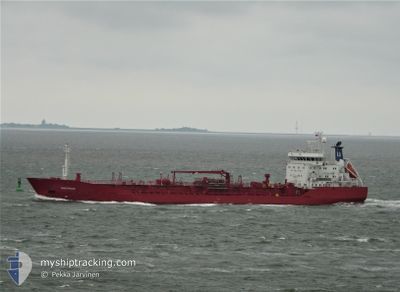
SEA PROSPECT
General Cargo
Current Trip
| Time Travelled | 5 days |
|---|---|
| Remaining Time | --- |
| Distance Travelled | 1395.87 nm |
| Remaining Distance | --- |
| AVG Speed | 10.5 Noeuds |
| MAX Speed | 12.5 Noeuds |
| AVG Wind | 15 knots |
| MAX Wind | 24.7 knots |
| MIN Temp | 17.7°C / 63.86°F |
| MAX Temp | 24.6°C / 76.28°F |
| Tirant d eau | 8.1 m |
| Position reçue | Maintenant |
Current Position
| Longitude | -9.85553° |
|---|---|
| Latitude | 39.01122° |
| Etat | Under way using engine |
| Vitesse | 10 Noeuds |
| Parcours | 358.3° |
| Zone | North Atlantic Ocean |
| Station | T-AIS |
| Position reçue | Maintenant |
Info
Information
The current position of SEA PROSPECT is in North Atlantic Ocean with coordinates 39.01122° / -9.85553° as reported on 2024-07-02 01:11 by AIS to our vessel tracker app. The vessel's current speed is 10 Noeuds and is heading at the port of AARHUS. The estimated time of arrival as calculated by MyShipTracking vessel tracking app is 2024-07-08 06:00 LT
The vessel SEA PROSPECT (IMO: 9516143, MMSI: 257222000) is a General Cargo that was built in 2012 ( 12 Age ). It's sailing under the flag of [NO] Norway.
In this page you can find informations about the vessels current position, last detected port calls, and current voyage information. If the vessels is not in coverage by AIS you will find the latest position.
The current position of SEA PROSPECT is detected by our AIS receivers and we are not responsible for the reliability of the data. The last position was recorded while the vessel was in Coverage by the Ais receivers of our vessel tracking app.
The current draught of SEA PROSPECT as reported by AIS is 8.1 meters
Weather
| Temperature | 17.7°C / 63.86°F |
|---|---|
| Wind Speed | 15 knots |
| Direction | 357° N |
| Pressure | 1020.1 hPa |
| Humidity | 93.6 % |
| Cloud Coverage | --- |
Featured Company
Last Port Calls
| Port | Arrival | Departure | Time In Port |
|---|---|---|---|
| 2024-06-26 05:00 | 2024-06-26 17:25 | 12 h | |
| 2024-06-21 07:21 | 2024-06-24 10:21 | 3 d | |
| 2024-06-10 21:16 | 2024-06-10 23:18 | 2 h | |
| 2024-06-10 10:58 | 2024-06-10 12:18 | 1 h | |
| 2024-06-04 17:43 | 2024-06-07 14:29 | 2 d | |
| 2024-05-31 07:31 | 2024-06-01 17:28 | 1 d | |
| 2024-05-23 10:43 | 2024-05-23 19:27 | 8 h | |
| 2024-05-20 09:50 | 2024-05-21 13:45 | 1 d | |
| 2024-05-18 11:53 | 2024-05-19 09:29 | 21 h | |
| 2024-05-04 10:00 | 2024-05-08 04:16 | 3 d |
Most Visited Ports (Last year)
| Port | Arrivals | |
|---|---|---|
| 5 | ||
| 4 | ||
| 4 | ||
| 3 | ||
| 3 | ||
| 3 |
Last Trips
| Origin | Departure | Destination | Arrival | Distance | |
|---|---|---|---|---|---|
| 2024-06-24 11:21 | 2024-06-26 06:00 | 88.56 nm | |||
| 2024-06-11 01:18 | 2024-06-21 08:21 | 2701.52 nm | |||
| 2024-06-10 14:18 | 2024-06-10 23:16 | 49.57 nm | |||
| 2024-06-07 17:29 | 2024-06-10 12:58 | 713.49 nm | |||
| 2024-06-01 19:28 | 2024-06-04 20:43 | 862.81 nm | |||
| 2024-05-23 21:27 | 2024-05-31 09:31 | 2105.50 nm | |||
| 2024-05-21 14:45 | 2024-05-23 12:43 | 411.23 nm | |||
| 2024-05-19 10:29 | 2024-05-20 10:50 | 278.13 nm | |||
| 2024-05-08 06:16 | 2024-05-18 12:53 | 2651.45 nm | |||
| 2024-05-03 10:40 | 2024-05-04 12:00 | 265.92 nm |
Events
| Heure | Evenement | Détails | Position/ Destination | Info |
|---|---|---|---|---|
| 2024-07-01 21:21 | Changement d'ETA | 2024/07/08 06:00 2024/07/07 22:00 |
38.38327 / -9.75468
DKAAR
|
Vitesse: 9.4 kn Parcours: 345.7° |
| 2024-07-01 16:48 | Etat Changé | Under way using engine Default |
37.64887 / -9.54145
DKAAR
|
Vitesse: 10.5 kn Parcours: 348° |
| 2024-07-01 16:40 | Etat Changé | Default Under way using engine |
37.62381 / -9.53466
DKAAR
|
Vitesse: 10.6 kn Parcours: 347.6° |
| 2024-07-01 16:39 | Etat Changé | Under way using engine Default |
37.62236 / -9.53427
DKAAR
|
Vitesse: 10.3 kn Parcours: 347° |
| 2024-07-01 16:39 | Dans la zone couverte |
37.62236 / -9.53427
North Atlantic Ocean
DKAAR
|
Vitesse: 10.6 kn Parcours: 347.6° |
|
| 2024-07-01 16:39 | Changement de zone | Portuguese part of the North Atlantic Ocean Spanish part of the Strait of Gibraltar |
37.62236 / -9.53427
North Atlantic Ocean
DKAAR
|
Vitesse: 10.6 kn Parcours: 347.6° |
| 2024-06-30 19:04 | Etat Changé | Default Under way using engine |
35.96584 / -5.62303
DKAAR
|
Vitesse: 10.2 kn Parcours: 252.6° |
| 2024-06-30 18:57 | Hors de la zone couverte |
35.96906 / -5.60043
Strait of Gibraltar
DKAAR
|
Vitesse: 10.2 kn Parcours: 252.6° |
|
| 2024-06-30 18:22 | Etat Changé | Under way using engine Default |
35.99865 / -5.49179
DKAAR
|
Vitesse: 8.8 kn Parcours: 255° |
| 2024-06-30 18:19 | Etat Changé | Default Under way using engine |
36.00011 / -5.48486
DKAAR
|
Vitesse: 8.6 kn Parcours: 265.4° |