
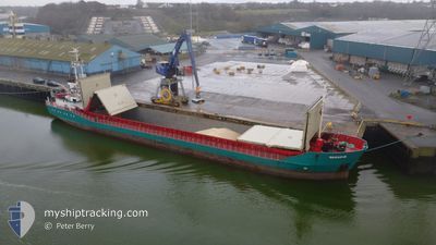
SARAH-B
General Cargo
Current Trip
| Time Travelled | 4 days |
|---|---|
| Remaining Time | 1 day |
| Distance Travelled | 873.65 nm |
| Remaining Distance | 279.18 nm |
| AVG Speed | 8.7 Knop |
| MAX Speed | 11.5 Knop |
| AVG Wind | 9.8 knots |
| MAX Wind | 20.8 knots |
| MIN Temp | 4.8°C / 40.64°F |
| MAX Temp | 10.2°C / 50.36°F |
| Djupgående | 4.2 m |
| Position mottagen | 1 m sen |
Current Position
| Longitud | --- |
|---|---|
| Latitude | --- |
| Status | Under way using engine |
| Fart | 8.3 Knop |
| Kurs | 255.5° |
| Område | English Channel |
| Station | T-AIS |
| Position mottagen | 1 m sen |
Information
The current position of SARAH-B is in English Channel with coordinates 50.13961° / -3.69074° as reported on 2025-03-11 19:54 by AIS to our vessel tracker app. The vessel's current speed is 8.3 Knop and is heading at the port of WARRENPOINT. The estimated time of arrival as calculated by MyShipTracking vessel tracking app is 2025-03-13 06:04 LT
The vessel SARAH-B (IMO: 9119622, MMSI: 218836000) is a General Cargo that was built in 1995 ( 30 År gammal ). It's sailing under the flag of [DE] Germany.
In this page you can find informations about the vessels current position, last detected port calls, and current voyage information. If the vessels is not in coverage by AIS you will find the latest position.
The current position of SARAH-B is detected by our AIS receivers and we are not responsible for the reliability of the data. The last position was recorded while the vessel was in Coverage by the Ais receivers of our vessel tracking app.
The current draught of SARAH-B as reported by AIS is 4.2 meters
Weather
| Temperature | 7.2°C / 44.96°F |
|---|---|
| Wind Speed | 6 knots |
| Direction | 33° NNE |
| Pressure | 1008 hPa |
| Humidity | 63.7 % |
| Cloud Coverage | 100 % |
Featured Company
Last Port Calls
| Port | Arrival | Departure | Time In Port |
|---|---|---|---|
| 2025-03-06 08:27 | 2025-03-07 17:35 | 1 d | |
| 2025-03-05 09:09 | 2025-03-05 21:27 | 12 h | |
| 2025-03-01 22:01 | 2025-03-03 16:50 | 1 d | |
| 2025-02-27 06:13 | 2025-02-27 17:10 | 10 h | |
| 2025-02-25 01:15 | 2025-02-25 21:24 | 20 h | |
| 2025-02-20 11:13 | 2025-02-22 23:54 | 2 d | |
| 2025-02-16 13:10 | 2025-02-18 09:53 | 1 d | |
| 2025-02-15 19:17 | 2025-02-15 20:17 | 59 m | |
| 2025-02-15 00:41 | 2025-02-15 01:17 | 35 m | |
| 2025-02-12 14:46 | 2025-02-13 11:25 | 20 h |
Most Visited Ports (Last year)
| Port | Arrivals | |
|---|---|---|
| 10 | ||
| 5 | ||
| 4 | ||
| 4 | ||
| 4 | ||
| 4 |
Last Trips
| Origin | Departure | Destination | Arrival | Distance | |
|---|---|---|---|---|---|
| 2025-03-05 22:27 | 2025-03-06 09:27 | 92.99 nm | |||
| 2025-03-03 17:50 | 2025-03-05 10:09 | 288.94 nm | |||
| 2025-02-27 17:10 | 2025-03-01 23:01 | 413.54 nm | |||
| 2025-02-25 22:24 | 2025-02-27 06:13 | 253.58 nm | |||
| 2025-02-22 23:54 | 2025-02-25 02:15 | 357.75 nm | |||
| 2025-02-18 10:53 | 2025-02-20 11:13 | 401.92 nm | |||
| 2025-02-15 21:17 | 2025-02-16 14:10 | 147.58 nm | |||
| 2025-02-15 02:17 | 2025-02-15 20:17 | 2.13 nm | |||
| 2025-02-13 12:25 | 2025-02-15 01:41 | 283.38 nm | |||
| 2025-02-11 20:38 | 2025-02-12 15:46 | 169.59 nm |
Events
| Tid | Event | Detaljer | Position / Dest | Information |
|---|---|---|---|---|
| 2025-03-11 19:08 | Status ändrad | Under way using engine Default |
50.16638 / -3.53611
GBWPT
|
Fart: 7.9 kn Kurs: 256° |
| 2025-03-11 19:08 | Status ändrad | Default Under way using engine |
50.16666 / -3.53446
GBWPT
|
Fart: 7.8 kn Kurs: 256.1° |
| 2025-03-11 18:00 | Status ändrad | Under way using engine Default |
50.20338 / -3.31356
GBWPT
|
Fart: 7.5 kn Kurs: 252° |
| 2025-03-11 18:00 | Status ändrad | Default Under way using engine |
50.20367 / -3.31211
GBWPT
|
Fart: 7.5 kn Kurs: 253.4° |
| 2025-03-11 17:59 | Status ändrad | Under way using engine Default |
50.20413 / -3.30935
GBWPT
|
Fart: 7.3 kn Kurs: 254° |
| 2025-03-11 17:48 | I täckningsområde |
50.20289 / -3.31627
English Channel
GBWPT
|
Fart: 7.6 kn Kurs: 253.4° |
|
| 2025-03-11 16:24 | Status ändrad | Default Under way using engine |
50.25788 / -2.99963
GBWPT
|
Fart: 8 kn Kurs: 251° |
| 2025-03-11 16:15 | UTANFÖR täckningsområde |
50.26347 / -2.97215
English Channel
GBWPT
|
Fart: 8 kn Kurs: 251° |
|
| 2025-03-11 14:05 | Status ändrad | Under way using engine Default |
50.34018 / -2.47837
GBWPT
|
Fart: 10.2 kn Kurs: 258° |
| 2025-03-11 13:52 | Status ändrad | Default Under way using engine |
50.34874 / -2.42083
GBWPT
|
Fart: 10.4 kn Kurs: 257.3° |