
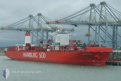
SAN ANTONIO MAERSK
Container Ship
Current Trip
| Trip Time | 1 day |
|---|---|
| Trip Distance | 192.76 nm |
| AVG Speed | 7.7 Knop |
| MAX Speed | 7.7 Knop |
| Djupgående | 10.2 m |
| AVG Wind | 11.9 knots |
| MAX Wind | 25.9 knots |
| MIN Temp | 19.6°C / 67.28°F |
| MAX Temp | 32.1°C / 89.78°F |
| Position mottagen | 13 h, 8 m sen |
Current Position
| Longitud | -48.45266° |
|---|---|
| Latitude | -25.49165° |
| Status | Under way using engine |
| Fart | 7.7 Knop |
| Kurs | 274.5° |
| Område | South Atlantic Ocean |
| Station | T-AIS |
| Position mottagen | 13 h, 8 m sen |
Info
Information
The current position of SAN ANTONIO MAERSK is in South Atlantic Ocean with coordinates -25.49165° / -48.45266° as reported on 2024-05-14 00:42 by AIS to our vessel tracker app. The vessel's current speed is 7.7 Knop and is currently inside the port of PARANAGUA.
The vessel SAN ANTONIO MAERSK (IMO: 9622241, MMSI: 219095000) is a Container Ship that was built in 2014 ( 10 År gammal ). It's sailing under the flag of [DK] Denmark.
In this page you can find informations about the vessels current position, last detected port calls, and current voyage information. If the vessels is not in coverage by AIS you will find the latest position.
The current position of SAN ANTONIO MAERSK is detected by our AIS receivers and we are not responsible for the reliability of the data. The last position was recorded while the vessel was in Coverage by the Ais receivers of our vessel tracking app.
The current draught of SAN ANTONIO MAERSK as reported by AIS is 10.2 meters
Weather
| Temperature | 17.2°C / 62.96°F |
|---|---|
| Wind Speed | 6 knots |
| Direction | 179° S |
| Pressure | 1019.5 hPa |
| Humidity | 97.2 % |
| Cloud Coverage | 100 % |
Featured Company
Last Port Calls
| Port | Arrival | Departure | Time In Port |
|---|---|---|---|
| 2024-05-14 01:09 | |||
| 2024-05-11 06:35 | 2024-05-12 15:04 | 1 d | |
| 2024-04-28 11:44 | 2024-04-29 03:07 | 15 h | |
| 2024-04-24 00:55 | 2024-04-24 22:48 | 21 h | |
| 2024-04-19 11:40 | 2024-04-20 18:10 | 1 d | |
| 2024-04-18 04:14 | 2024-04-19 00:53 | 20 h | |
| 2024-04-16 06:10 | 2024-04-16 23:43 | 17 h | |
| 2024-04-13 00:07 | 2024-04-15 07:25 | 2 d | |
| 2024-03-25 11:16 | 2024-03-26 19:49 | 1 d | |
| 2024-03-23 23:15 | 2024-03-24 17:39 | 18 h |
Last Trips
| Origin | Departure | Destination | Arrival | Distance | |
|---|---|---|---|---|---|
| 2024-05-12 12:04 | 2024-05-13 22:09 | 192.76 nm | |||
| 2024-04-29 04:07 | 2024-05-11 03:35 | 4438.22 nm | |||
| 2024-04-25 00:48 | 2024-04-28 12:44 | 1424.57 nm | |||
| 2024-04-20 20:10 | 2024-04-24 02:55 | 457.17 nm | |||
| 2024-04-19 02:53 | 2024-04-19 13:40 | 127.75 nm | |||
| 2024-04-17 00:43 | 2024-04-18 06:14 | 387.03 nm | |||
| 2024-04-15 09:25 | 2024-04-16 07:10 | 199.95 nm | |||
| 2024-03-26 16:49 | 2024-04-13 02:07 | 5837.59 nm | |||
| 2024-03-24 14:39 | 2024-03-25 08:16 | 176.64 nm | |||
| 2024-03-18 08:13 | 2024-03-23 20:15 | 1048.95 nm |
Events
| Tid | Event | Detaljer | Position / Dest | Information |
|---|---|---|---|---|
| 2024-05-14 01:21 | STOPPAR förflyttning |
-25.50038 / -48.49836
[BR] PARANAGUA
|
Fart: 0.2 kn Kurs: 261° |
|
| 2024-05-14 01:09 | ANLÄNDER HAMN |
|
-25.49882 / -48.49897
[BR] PARANAGUA
|
Fart: 4.9 kn Kurs: 245° |
| 2024-05-14 00:50 | Status ändrad | Default Under way using engine |
-25.49124 / -48.47154
BRSSZ > BRPNG
|
Fart: 7.7 kn Kurs: 274.5° |
| 2024-05-14 00:42 | Status ändrad | Under way using engine Default |
-25.49165 / -48.45266
BRSSZ > BRPNG
|
Fart: 8 kn Kurs: 278° |
| 2024-05-14 00:42 | UTANFÖR täckningsområde |
-25.49165 / -48.45266
South Atlantic Ocean
[BR] PARANAGUA
|
Fart: 7.7 kn Kurs: 274.5° |
|
| 2024-05-13 23:53 | Status ändrad | Default Under way using engine |
-25.55743 / -48.34134
BRSSZ > BRPNG
|
Fart: 8.5 kn Kurs: 318.1° |
| 2024-05-13 23:53 | I täckningsområde |
-25.55779 / -48.34099
South Atlantic Ocean
|
Fart: 8.5 kn Kurs: 318.1° |
|
| 2024-05-13 23:53 | Status ändrad | Under way using engine Default |
-25.55779 / -48.34099
BRSSZ > BRPNG
|
Fart: 8.8 kn Kurs: 317° |
| 2024-05-13 16:22 | STARTAR förflyttning | 21.05 nm, South East of ILHA DO MEL |
-25.69201 / -47.95443
BRSSZ > BRPNG
|
Fart: 3.2 kn Kurs: 109° |
| 2024-05-13 14:12 | UTANFÖR täckningsområde |
-25.72819 / -47.96568
South Atlantic Ocean
BRSSZ > BRPNG
|
Fart: 0.3 kn Kurs: 15.6° |