
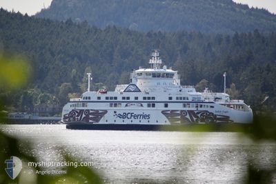
SALISH EAGLE
Passenger
Current Trip
| Time Travelled | 18 mins |
|---|---|
| Remaining Time | 2 h, 22 mins |
| Distance Travelled | 3.38 nm |
| Remaining Distance | --- |
| AVG Speed | 14.6 Knop |
| MAX Speed | 14.7 Knop |
| AVG Wind | 4.5 knots |
| MAX Wind | 5 knots |
| MIN Temp | 6.2°C / 43.16°F |
| MAX Temp | 6.4°C / 43.52°F |
| Djupgående | 4.7 m |
| Position mottagen | 1 m sen |
Current Position
| Longitud | --- |
|---|---|
| Latitude | --- |
| Status | Under way using engine |
| Fart | 14.7 Knop |
| Kurs | 220.3° |
| Område | The Coastal Waters of Southeast Alaska and British Columbia |
| Station | T-AIS |
| Position mottagen | 1 m sen |
Info
Information
The current position of SALISH EAGLE is in The Coastal Waters of Southeast Alaska and British Columbia with coordinates 48.95445° / -123.22118° as reported on 2026-01-05 02:54 by AIS to our vessel tracker app. The vessel's current speed is 14.7 Knop and is heading at the port of TSAWWASSEN. The estimated time of arrival as calculated by MyShipTracking vessel tracking app is 2026-01-04 21:18 LT
The vessel SALISH EAGLE (IMO: 9750282, MMSI: 316030626) is a Passenger It's sailing under the flag of [CA] Canada.
In this page you can find informations about the vessels current position, last detected port calls, and current voyage information. If the vessels is not in coverage by AIS you will find the latest position.
The current position of SALISH EAGLE is detected by our AIS receivers and we are not responsible for the reliability of the data. The last position was recorded while the vessel was in Coverage by the Ais receivers of our vessel tracking app.
The current draught of SALISH EAGLE as reported by AIS is 4.7 meters
Weather
| Temperature | 7.2°C / 44.96°F |
|---|---|
| Wind Speed | 7 knots |
| Direction | 129° SE |
| Pressure | 999.9 hPa |
| Humidity | 84.3 % |
| Cloud Coverage | 100 % |
Featured Company
Last Port Calls
| Port | Arrival | Departure | Time In Port |
|---|---|---|---|
| 2026-01-04 18:15 | 2026-01-04 18:38 | 22 m | |
| 2026-01-04 17:18 | 2026-01-04 17:39 | 20 m | |
| 2026-01-04 15:30 | 2026-01-04 15:49 | 18 m | |
| 2026-01-04 14:02 | 2026-01-04 15:02 | 59 m | |
| 2026-01-04 13:14 | 2026-01-04 13:32 | 18 m | |
| 2026-01-04 10:31 | 2026-01-04 11:20 | 48 m | |
| 2026-01-04 07:53 | 2026-01-04 08:14 | 20 m | |
| 2026-01-04 00:07 | 2026-01-04 07:23 | 7 h | |
| 2026-01-03 17:55 | 2026-01-03 22:07 | 4 h | |
| 2026-01-03 14:26 | 2026-01-03 15:38 | 1 h |
Most Visited Ports (Last year)
| Port | Arrivals | |
|---|---|---|
| 1019 | ||
| 934 | ||
| 729 | ||
| 11 |
Last Trips
| Origin | Departure | Destination | Arrival | Distance | |
|---|---|---|---|---|---|
| 2026-01-04 17:39 | 2026-01-04 18:15 | 2.18 nm | |||
| 2026-01-04 15:49 | 2026-01-04 17:18 | 17.47 nm | |||
| 2026-01-04 15:02 | 2026-01-04 15:30 | 6.38 nm | |||
| 2026-01-04 13:32 | 2026-01-04 14:02 | 6.13 nm | |||
| 2026-01-04 11:20 | 2026-01-04 13:14 | 17.92 nm | |||
| 2026-01-04 08:14 | 2026-01-04 10:31 | 18.27 nm | |||
| 2026-01-04 07:23 | 2026-01-04 07:53 | 6.42 nm | |||
| 2026-01-03 22:07 | 2026-01-04 00:07 | 17.20 nm | |||
| 2026-01-03 15:38 | 2026-01-03 17:55 | 20.56 nm | |||
| 2026-01-03 13:08 | 2026-01-03 14:26 | 14.86 nm |
Events
| Tid | Event | Detaljer | Position / Dest | Information |
|---|---|---|---|---|
| 2026-01-05 02:44 | Djupgående ändrat | 4.7 4.6 |
48.98494 / -123.17687
SGI - TSA
|
Fart: 14.3 kn Kurs: 235.2° |
| 2026-01-05 02:42 | Djupgående ändrat | 4.6 4.7 |
48.98940 / -123.16687
SGI - TSA
|
Fart: 14.2 kn Kurs: 236.2° |
| 2026-01-05 02:38 | AVGÅTT HAMN |
|
48.99746 / -123.14803
SGI - TSA
|
Fart: 13.6 kn Kurs: 241° |
| 2026-01-05 02:38 | Djupgående ändrat | 4.7 4.6 |
48.99878 / -123.14488
[CA] TSAWWASSEN
|
Fart: 13.4 kn Kurs: 241° |
| 2026-01-05 02:37 | Byter havsområde | United States part of the The Coastal Waters of Southeast Alaska and British Columbia Canadian part of the The Coastal Waters of Southeast Alaska and British Columbia |
48.99878 / -123.14488
The Coastal Waters of Southeast Alaska and British Columbia
|
Fart: 13.4 kn Kurs: 236.9° |
| 2026-01-05 02:36 | Djupgående ändrat | 4.6 4.7 |
49.00265 / -123.13795
[CA] TSAWWASSEN
|
Fart: 11.7 kn Kurs: 225° |
| 2026-01-05 02:35 | STARTAR förflyttning |
49.00476 / -123.13500
[CA] TSAWWASSEN
|
Fart: 8.4 kn Kurs: 225° |
|
| 2026-01-05 02:31 | Djupgående ändrat | 4.7 4.6 |
49.00618 / -123.13279
[CA] TSAWWASSEN
|
Fart: Kurs: 223° |
| 2026-01-05 02:30 | Djupgående ändrat | 4.6 4.7 |
49.00626 / -123.13291
[CA] TSAWWASSEN
|
Fart: Kurs: 43° |
| 2026-01-05 02:25 | Djupgående ändrat | 4.7 4.6 |
49.00626 / -123.13291
[CA] TSAWWASSEN
|
Fart: Kurs: 43° |