
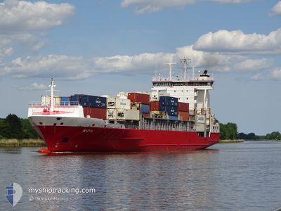
RUTH
Container Ship
Current Trip
| Trip Time | 1 day |
|---|---|
| Trip Distance | 221.12 nm |
| AVG Speed | 10 Knop |
| MAX Speed | 10 Knop |
| Djupgående | 8.2 m |
| AVG Wind | 11.1 knots |
| MAX Wind | 20.7 knots |
| MIN Temp | 8.9°C / 48.02°F |
| MAX Temp | 21.4°C / 70.52°F |
| Position mottagen | 5 m sen |
Current Position
| Longitud | 9.74688° |
|---|---|
| Latitude | 55.55782° |
| Status | Moored |
| Fart | |
| Kurs | 82° |
| Område | Kattegat |
| Station | T-AIS |
| Position mottagen | 5 m sen |
Info
Information
The current position of RUTH is in Kattegat with coordinates 55.55782° / 9.74688° as reported on 2024-05-02 19:28 by AIS to our vessel tracker app. The vessel's current speed is 0 Knop and is currently inside the port of FREDERICIA.
The vessel RUTH (IMO: 9376036, MMSI: 212613000) is a Container Ship that was built in 2008 ( 16 År gammal ). It's sailing under the flag of [CY] Cyprus.
In this page you can find informations about the vessels current position, last detected port calls, and current voyage information. If the vessels is not in coverage by AIS you will find the latest position.
The current position of RUTH is detected by our AIS receivers and we are not responsible for the reliability of the data. The last position was recorded while the vessel was in Coverage by the Ais receivers of our vessel tracking app.
The current draught of RUTH as reported by AIS is 7.7 meters
Weather
| Temperature | 12.7°C / 54.86°F |
|---|---|
| Wind Speed | 16 knots |
| Direction | 74° ENE |
| Pressure | 1008 hPa |
| Humidity | 81.4 % |
| Cloud Coverage | 6 % |
Featured Company
Last Port Calls
| Port | Arrival | Departure | Time In Port |
|---|---|---|---|
| 2024-05-01 10:11 | |||
| 2024-04-29 03:47 | 2024-04-30 09:59 | 1 d | |
| 2024-04-28 10:04 | 2024-04-28 18:12 | 8 h | |
| 2024-04-27 21:42 | 2024-04-28 06:05 | 8 h | |
| 2024-04-26 06:10 | 2024-04-26 16:45 | 10 h | |
| 2024-04-25 08:31 | 2024-04-26 00:08 | 15 h | |
| 2024-04-22 02:20 | 2024-04-24 09:02 | 2 d | |
| 2024-04-21 12:12 | 2024-04-21 18:55 | 6 h | |
| 2024-04-20 18:34 | 2024-04-21 09:07 | 14 h | |
| 2024-04-20 03:12 | 2024-04-20 03:54 | 41 m |
Most Visited Ports (Last year)
| Port | Arrivals | |
|---|---|---|
| 28 | ||
| 25 | ||
| 23 | ||
| 22 | ||
| 18 | ||
| 17 |
Last Trips
| Origin | Departure | Destination | Arrival | Distance | |
|---|---|---|---|---|---|
| 2024-04-30 11:59 | 2024-05-01 12:11 | 221.12 nm | |||
| 2024-04-28 20:12 | 2024-04-29 05:47 | 115.57 nm | |||
| 2024-04-28 08:05 | 2024-04-28 12:04 | 48.50 nm | |||
| 2024-04-26 18:45 | 2024-04-27 23:42 | 272.45 nm | |||
| 2024-04-26 02:08 | 2024-04-26 08:10 | 55.93 nm | |||
| 2024-04-24 11:02 | 2024-04-25 10:31 | 221.88 nm | |||
| 2024-04-21 20:55 | 2024-04-22 04:20 | 106.77 nm | |||
| 2024-04-21 11:07 | 2024-04-21 14:12 | 46.40 nm | |||
| 2024-04-20 05:54 | 2024-04-20 20:34 | 132.46 nm | |||
| 2024-04-19 16:10 | 2024-04-20 05:12 | 137.00 nm |
Events
| Tid | Event | Detaljer | Position / Dest | Information |
|---|---|---|---|---|
| 2024-05-02 17:01 | Djupgående ändrat | 7.7 8.2 |
55.55783 / 9.74688
[DK] FREDERICIA
|
Fart: Kurs: 81° |
| 2024-05-02 17:01 | ETA ändrat | 2024/05/03 05:00 2024/05/02 06:00 |
55.55783 / 9.74688
[DK] FREDERICIA
|
Fart: Kurs: 81° |
| 2024-05-02 16:55 | Destination ändrad | DKAAR DKFRC |
55.55783 / 9.74688
[DK] FREDERICIA
|
Fart: Kurs: 81° |
| 2024-05-01 10:29 | Status ändrad | Moored Under way using engine |
55.55783 / 9.74688
[DK] FREDERICIA
|
Fart: Kurs: 81° |
| 2024-05-01 10:18 | STOPPAR förflyttning |
55.55790 / 9.74697
[DK] FREDERICIA
|
Fart: 0.3 kn Kurs: 58° |
|
| 2024-05-01 10:11 | ANLÄNDER HAMN |
|
55.55562 / 9.74555
[DK] FREDERICIA
|
Fart: 2.5 kn Kurs: 335° |
| 2024-05-01 01:47 | Byter havsområde | Danish part of the Kattegat Danish part of the Baltic Sea |
54.74592 / 10.87966
Kattegat
DKFRC
|
Fart: 11.7 kn Kurs: 353.5° |
| 2024-05-01 00:20 | Byter havsområde | Danish part of the Baltic Sea German part of the Baltic Sea |
54.56410 / 10.59459
Baltic Sea
DKFRC
|
Fart: 10.1 kn Kurs: 51.8° |
| 2024-04-30 22:58 | Byter havsområde | German part of the Baltic Sea German part of the North Sea |
54.46031 / 10.25993
Baltic Sea
DKFRC
|
Fart: 11.3 kn Kurs: 34.9° |
| 2024-04-30 22:21 | STARTAR förflyttning | 1.31 nm, South West of STICKENHΟRN SPORT |
54.36475 / 10.14742
DKFRC
|
Fart: 4.1 kn Kurs: 103° |