
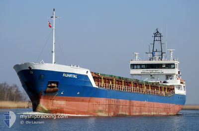
RUHRTAL
General Cargo
Current Trip
| Trip Time | 3 days |
|---|---|
| Trip Distance | 629.30 nm |
| AVG Speed | 7.3 Knop |
| MAX Speed | 11.9 Knop |
| Djupgående | 5 m |
| AVG Wind | 6 knots |
| MAX Wind | 24 knots |
| MIN Temp | -2°C / 28.4°F |
| MAX Temp | 9.8°C / 49.64°F |
| Position mottagen | 2 d sen |
Current Position
| Longitud | --- |
|---|---|
| Latitude | --- |
| Status | Under way using engine |
| Fart | 10.3 Knop |
| Kurs | 61.2° |
| Område | Kattegat |
| Station | T-AIS |
| Position mottagen | 2 d sen |
Info
Information
The current position of RUHRTAL is in Kattegat with coordinates 58.74182° / 13.08853° as reported on 2024-12-12 22:59 by AIS to our vessel tracker app. The vessel's current speed is 10.3 Knop and is currently inside the port of OTTERBACKEN.
The vessel RUHRTAL (IMO: 9313682, MMSI: 255806465) is a General Cargo that was built in 2005 ( 19 År gammal ). It's sailing under the flag of [PT] Portugal.
In this page you can find informations about the vessels current position, last detected port calls, and current voyage information. If the vessels is not in coverage by AIS you will find the latest position.
The current position of RUHRTAL is detected by our AIS receivers and we are not responsible for the reliability of the data. The last position was recorded while the vessel was in Coverage by the Ais receivers of our vessel tracking app.
The current draught of RUHRTAL as reported by AIS is 5 meters
Weather
| Temperature | 3.3°C / 37.94°F |
|---|---|
| Wind Speed | 18 knots |
| Direction | 320° NW |
| Pressure | 1001.3 hPa |
| Humidity | 60.3 % |
| Cloud Coverage | 29 % |
Featured Company
Last Port Calls
| Port | Arrival | Departure | Time In Port |
|---|---|---|---|
| 2024-12-13 02:41 | |||
| 2024-12-06 08:22 | 2024-12-10 00:15 | 3 d | |
| 2024-12-05 20:30 | 2024-12-05 21:02 | 32 m | |
| 2024-12-01 03:58 | 2024-12-03 18:56 | 2 d | |
| 2024-11-28 05:20 | 2024-11-29 16:21 | 1 d | |
| 2024-11-26 19:59 | 2024-11-27 15:57 | 19 h | |
| 2024-11-22 06:33 | 2024-11-25 21:15 | 3 d | |
| 2024-11-20 21:21 | 2024-11-21 11:53 | 14 h | |
| 2024-11-15 21:48 | 2024-11-16 22:32 | 1 d | |
| 2024-11-09 21:10 | 2024-11-13 14:38 | 3 d |
Last Trips
| Origin | Departure | Destination | Arrival | Distance | |
|---|---|---|---|---|---|
| 2024-12-10 00:15 | 2024-12-13 03:41 | 629.30 nm | |||
| 2024-12-05 21:02 | 2024-12-06 08:22 | 40.12 nm | |||
| 2024-12-03 19:56 | 2024-12-05 20:30 | 390.18 nm | |||
| 2024-11-29 17:21 | 2024-12-01 04:58 | 287.32 nm | |||
| 2024-11-27 16:57 | 2024-11-28 06:20 | 125.48 nm | |||
| 2024-11-25 22:15 | 2024-11-26 20:59 | 224.34 nm | |||
| 2024-11-21 12:53 | 2024-11-22 07:33 | 196.28 nm | |||
| 2024-11-16 23:32 | 2024-11-20 22:21 | 641.76 nm | |||
| 2024-11-13 15:38 | 2024-11-15 22:48 | 509.11 nm | |||
| 2024-11-08 18:14 | 2024-11-09 22:10 | 268.58 nm |
Events
| Tid | Event | Detaljer | Position / Dest | Information |
|---|---|---|---|---|
| 2024-12-13 02:53 | STOPPAR förflyttning |
58.95067 / 14.03561
[SE] OTTERBACKEN
|
Fart: Kurs: 82° |
|
| 2024-12-13 02:41 | ANLÄNDER HAMN |
|
58.95021 / 14.03174
[SE] OTTERBACKEN
|
Fart: 3.3 kn Kurs: 38° |
| 2024-12-12 23:05 | Status ändrad | Default Under way using engine |
58.75006 / 13.11739
SE OTT
|
Fart: 10.3 kn Kurs: 61.2° |
| 2024-12-12 22:59 | Status ändrad | Under way using engine Default |
58.74182 / 13.08853
SE OTT
|
Fart: 10.3 kn Kurs: 61° |
| 2024-12-12 22:59 | UTANFÖR täckningsområde |
58.74182 / 13.08853
Kattegat
SE OTT
|
Fart: 10.3 kn Kurs: 61.2° |
|
| 2024-12-12 22:09 | Status ändrad | Default Under way using engine |
58.67217 / 12.84941
SE OTT
|
Fart: 10.2 kn Kurs: 59.9° |
| 2024-12-12 22:02 | Status ändrad | Under way using engine Default |
58.66192 / 12.81517
SE OTT
|
Fart: 10.2 kn Kurs: 60° |
| 2024-12-12 21:49 | I täckningsområde |
58.66242 / 12.81683
Kattegat
SE OTT
|
Fart: 10.2 kn Kurs: 59.9° |
|
| 2024-12-12 20:53 | Status ändrad | Default Under way using engine |
58.51906 / 12.56363
SE OTT
|
Fart: 10.1 kn Kurs: 39.2° |
| 2024-12-12 20:45 | UTANFÖR täckningsområde |
58.50303 / 12.53868
Kattegat
SE OTT
|
Fart: 10.1 kn Kurs: 39.2° |