

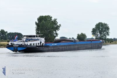
RANGER
Cargo

Current Trip
| Time Travelled | 4 days |
|---|---|
| Remaining Time | --- |
| Distance Travelled | 328.45 nm |
| Remaining Distance | --- |
| AVG Speed | 7.4 Knop |
| MAX Speed | 11.3 Knop |
| AVG Wind | 4.1 knots |
| MAX Wind | 7 knots |
| MIN Temp | -3.3°C / 26.06°F |
| MAX Temp | 2.8°C / 37.04°F |
| Djupgående | 3.6 m |
| Position mottagen | Nu |
Current Position
| Longitud | --- |
|---|---|
| Latitude | --- |
| Status | Under way using engine |
| Fart | 10.1 Knop |
| Kurs | 234.9° |
| Område | North Sea |
| Station | T-AIS |
| Position mottagen | Nu |
Information
The current position of RANGER is in North Sea with coordinates 51.57274° / 6.63737° as reported on 2025-02-18 04:04 by AIS to our vessel tracker app. The vessel's current speed is 10.1 Knop
The vessel RANGER (MMSI: 244690071) is a Cargo It's sailing under the flag of [NL] Netherlands.
In this page you can find informations about the vessels current position, last detected port calls, and current voyage information. If the vessels is not in coverage by AIS you will find the latest position.
The current position of RANGER is detected by our AIS receivers and we are not responsible for the reliability of the data. The last position was recorded while the vessel was in Coverage by the Ais receivers of our vessel tracking app.
The current draught of RANGER as reported by AIS is 3.6 meters
Weather
| Temperature | -2°C / 28.4°F |
|---|---|
| Wind Speed | 4 knots |
| Direction | 69° ENE |
| Pressure | 1025.7 hPa |
| Humidity | 59.1 % |
| Cloud Coverage | 10 % |


Featured Company
Last Port Calls
| Port | Arrival | Departure | Time In Port |
|---|---|---|---|
| 2025-02-13 21:39 | 2025-02-13 22:14 | 35 m | |
| 2025-02-13 13:56 | 2025-02-13 14:31 | 34 m | |
| 2025-02-11 19:06 | 2025-02-12 00:46 | 5 h | |
| 2025-02-11 10:17 | 2025-02-11 13:07 | 2 h | |
| 2025-02-07 14:48 | 2025-02-07 20:55 | 6 h | |
| 2025-02-04 14:06 | 2025-02-05 17:17 | 1 d | |
| 2025-02-03 18:09 | 2025-02-04 07:57 | 13 h | |
| 2025-01-30 20:12 | 2025-01-31 04:31 | 8 h | |
| 2025-01-29 22:47 | 2025-01-30 04:01 | 5 h | |
| 2025-01-27 20:12 | 2025-01-29 15:43 | 1 d |
Last Trips
| Origin | Departure | Destination | Arrival | Distance | |
|---|---|---|---|---|---|
| 2025-02-13 15:31 | 2025-02-13 22:39 | 33.49 nm | |||
| 2025-02-12 01:46 | 2025-02-13 14:56 | 24.01 nm | |||
| 2025-02-11 14:07 | 2025-02-11 20:06 | 22.59 nm | |||
| 2025-02-07 21:55 | 2025-02-11 11:17 | 146.34 nm | |||
| 2025-02-05 18:17 | 2025-02-07 15:48 | 25.39 nm | |||
| 2025-02-04 08:57 | 2025-02-04 15:06 | 33.11 nm | |||
| 2025-01-31 05:31 | 2025-02-03 19:09 | 222.40 nm | |||
| 2025-01-30 05:01 | 2025-01-30 21:12 | 88.05 nm | |||
| 2025-01-29 16:43 | 2025-01-29 23:47 | 49.72 nm | |||
| 2025-01-27 18:25 | 2025-01-27 21:12 | 31.09 nm |
Events
| Tid | Event | Detaljer | Position / Dest | Information |
|---|---|---|---|---|
| 2025-02-17 18:13 | I täckningsområde |
50.44985 / 7.38023
North Sea
|
Fart: 10.9 kn Kurs: 307.6° |
|
| 2025-02-17 15:06 | UTANFÖR täckningsområde |
50.15130 / 7.71974
North Sea
|
Fart: 9.7 kn Kurs: 302.3° |
|
| 2025-02-17 15:06 | I täckningsområde |
50.15130 / 7.71974
North Sea
|
Fart: 9.7 kn Kurs: 302.3° |
|
| 2025-02-15 09:48 | UTANFÖR täckningsområde |
50.47559 / 7.34560
North Sea
|
Fart: 5.2 kn Kurs: 148.8° |
|
| 2025-02-15 04:07 | STARTAR förflyttning | 2.85 nm, North East of GODORF |
50.87505 / 7.04693
|
Fart: 3.1 kn Kurs: 232.6° |
| 2025-02-15 04:03 | Status ändrad | Under way using engine Moored |
50.87582 / 7.04977
|
Fart: Kurs: 511° |
| 2025-02-14 21:47 | Status ändrad | Moored Under way using engine |
50.87582 / 7.05011
|
Fart: Kurs: 511° |
| 2025-02-14 21:27 | STOPPAR förflyttning | 2.97 nm, North East of GODORF |
50.87581 / 7.04995
|
Fart: 0.3 kn Kurs: 511° |
| 2025-02-14 08:28 | I täckningsområde |
51.66147 / 6.52051
North Sea
|
Fart: 6.4 kn Kurs: 84.4° |
|
| 2025-02-14 06:06 | UTANFÖR täckningsområde |
51.82457 / 6.25500
North Sea
|
Fart: 7.1 kn Kurs: 114.2° |