

PROMISE
General Cargo

Current Trip
| Time Travelled | 4 days |
|---|---|
| Remaining Time | 11 h, 30 mins |
| Distance Travelled | 654.40 nm |
| Remaining Distance | 374.22 nm |
| AVG Speed | 10.3 Knop |
| MAX Speed | 13.8 Knop |
| AVG Wind | 5.9 knots |
| MAX Wind | 14.3 knots |
| MIN Temp | -3.5°C / 25.7°F |
| MAX Temp | 14.4°C / 57.92°F |
| Djupgående | 4.9 m |
| Position mottagen | 1 d sen |
Current Position
| Longitud | --- |
|---|---|
| Latitude | --- |
| Status | Under way using engine |
| Fart | 10.1 Knop |
| Kurs | 87.2° |
| Område | Mediterranean Sea - Eastern Basin |
| Station | T-AIS |
| Position mottagen | 1 d sen |
Information
The current position of PROMISE is in Mediterranean Sea - Eastern Basin with coordinates 35.70126° / 28.76783° as reported on 2025-02-27 07:50 by AIS to our vessel tracker app. The vessel's current speed is 10.1 Knop and is heading at the port of ISKENDERUN. The estimated time of arrival as calculated by MyShipTracking vessel tracking app is 2025-02-28 21:07 LT
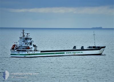
The vessel PROMISE (IMO: 9371816, MMSI: 245959000) is a General Cargo that was built in 2008 ( 17 År gammal ). It's sailing under the flag of [NL] Netherlands.
In this page you can find informations about the vessels current position, last detected port calls, and current voyage information. If the vessels is not in coverage by AIS you will find the latest position.
The current position of PROMISE is detected by our AIS receivers and we are not responsible for the reliability of the data. The last position was recorded while the vessel was in Coverage by the Ais receivers of our vessel tracking app.
The current draught of PROMISE as reported by AIS is 4.9 meters
Weather
| Temperature | 13.5°C / 56.3°F |
|---|---|
| Wind Speed | 8 knots |
| Direction | 45° NE |
| Pressure | 1021 hPa |
| Humidity | 67.9 % |
| Cloud Coverage | 100 % |


Featured Company
Last Port Calls
| Port | Arrival | Departure | Time In Port |
|---|---|---|---|
| 2025-02-21 05:57 | 2025-02-23 18:05 | 2 d | |
| 2025-02-18 03:24 | 2025-02-19 02:28 | 23 h | |
| 2025-02-15 19:25 | 2025-02-16 18:30 | 23 h | |
| 2025-02-03 18:02 | 2025-02-03 23:26 | 5 h | |
| 2025-01-18 15:23 | 2025-01-19 05:04 | 13 h | |
| 2025-01-05 03:19 | 2025-01-05 07:55 | 4 h | |
| 2024-12-20 03:45 | 2024-12-28 15:42 | 8 d | |
| 2024-12-16 12:43 | 2024-12-19 13:04 | 3 d | |
| 2024-12-01 06:02 |
Last Trips
| Origin | Departure | Destination | Arrival | Distance | |
|---|---|---|---|---|---|
| 2025-02-19 05:28 | 2025-02-21 07:57 | 312.75 nm | |||
| 2025-02-16 21:30 | 2025-02-18 06:24 | 279.74 nm | |||
| 2025-02-04 00:26 | 2025-02-15 22:25 | 1648.46 nm | |||
| 2025-01-19 06:04 | 2025-02-03 19:02 | 2232.45 nm | |||
| 2025-01-05 08:55 | 2025-01-18 16:23 | 2066.96 nm | |||
| 2024-12-28 16:42 | 2025-01-05 04:19 | 1677.51 nm | |||
| 2024-12-19 14:04 | 2024-12-20 04:45 | 35.49 nm | |||
| 2024-12-01 07:02 | 2024-12-16 13:43 | 3102.04 nm |
Events
| Tid | Event | Detaljer | Position / Dest | Information |
|---|---|---|---|---|
| 2025-02-27 07:50 | UTANFÖR täckningsområde |
35.70126 / 28.76783
Mediterranean Sea - Eastern Basin
TRISK
|
Fart: 10.1 kn Kurs: 87.2° |
|
| 2025-02-27 03:47 | Status ändrad | Under way using engine Default |
35.70146 / 27.94060
TRISK
|
Fart: 10 kn Kurs: 131° |
| 2025-02-27 03:16 | Status ändrad | Default Under way using engine |
35.70901 / 27.84083
TRISK
|
Fart: 10 kn Kurs: 131.3° |
| 2025-02-27 02:13 | Byter havsområde | Greek part of the Mediterranean Sea - Eastern Basin Greek part of the Aegean Sea |
35.83321 / 27.68081
Mediterranean Sea - Eastern Basin
TRISK
|
Fart: 10.2 kn Kurs: 134.2° |
| 2025-02-26 12:23 | ETA ändrat | 2025/03/01 01:00 2025/03/01 10:00 |
37.55366 / 25.89578
TRISK
|
Fart: 9.7 kn Kurs: 168.3° |
| 2025-02-26 12:17 | ETA ändrat | 2025/03/01 10:00 2025/02/28 10:00 |
37.57015 / 25.89149
TRISK
|
Fart: 10.1 kn Kurs: 167.8° |
| 2025-02-26 09:43 | Status ändrad | Under way using engine Default |
38.01384 / 25.81258
TRISK
|
Fart: 10.2 kn Kurs: 170° |
| 2025-02-26 09:43 | I täckningsområde |
38.01384 / 25.81258
Aegean Sea
TRISK
|
Fart: 10.3 kn Kurs: 172° |
|
| 2025-02-26 06:05 | Status ändrad | Default Under way using engine |
38.61584 / 25.71801
TRISK
|
Fart: 9.8 kn Kurs: 181.8° |
| 2025-02-26 05:54 | UTANFÖR täckningsområde |
38.64780 / 25.71800
Aegean Sea
TRISK
|
Fart: 9.8 kn Kurs: 181.8° |