
PRINCESS COCO
General Cargo
Current Trip
| Trip Time | 20 days |
|---|---|
| Trip Distance | 3772.91 nm |
| AVG Speed | 9.2 Knop |
| MAX Speed | 11.2 Knop |
| Djupgående | 10.5 m |
| AVG Wind | 6.4 knots |
| MAX Wind | 21.1 knots |
| MIN Temp | 23.8°C / 74.84°F |
| MAX Temp | 31.2°C / 88.16°F |
| Position mottagen | 8 d sen |
Current Position
| Longitud | 104.13821° |
|---|---|
| Latitude | 1.25966° |
| Status | Under way using engine |
| Fart | 9.6 Knop |
| Kurs | 84.1° |
| Område | Singapore Strait |
| Station | T-AIS |
| Position mottagen | 8 d sen |
Info
Information
The current position of PRINCESS COCO is in Singapore Strait with coordinates 1.25966° / 104.13821° as reported on 2024-04-19 14:54 by AIS to our vessel tracker app. The vessel's current speed is 9.6 Knop and is currently inside the port of KEMAMAN.
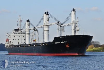
The vessel PRINCESS COCO (IMO: 9149665, MMSI: 636018359) is a General Cargo that was built in 1997 ( 27 År gammal ). It's sailing under the flag of [LR] Liberia.
In this page you can find informations about the vessels current position, last detected port calls, and current voyage information. If the vessels is not in coverage by AIS you will find the latest position.
The current position of PRINCESS COCO is detected by our AIS receivers and we are not responsible for the reliability of the data. The last position was recorded while the vessel was in Coverage by the Ais receivers of our vessel tracking app.
The current draught of PRINCESS COCO as reported by AIS is 10.5 meters
Weather
| Temperature | 28.6°C / 83.48°F |
|---|---|
| Wind Speed | 2 knots |
| Direction | 179° S |
| Pressure | 1008.6 hPa |
| Humidity | 75.8 % |
| Cloud Coverage | 7 % |
Featured Company
Most Visited Ports (Last year)
| Port | Arrivals | |
|---|---|---|
| 4 | ||
| 3 | ||
| 2 | ||
| 1 | ||
| 1 | ||
| 1 |
Events
| Tid | Event | Detaljer | Position / Dest | Information |
|---|---|---|---|---|
| 2024-04-25 10:11 | STOPPAR förflyttning |
4.25066 / 103.46855
[MY] KEMAMAN
|
Fart: 0.2 kn Kurs: 10° |
|
| 2024-04-25 09:44 | ANLÄNDER HAMN |
|
4.24492 / 103.46954
[MY] KEMAMAN
|
Fart: 5.7 kn Kurs: 322° |
| 2024-04-20 13:34 | STOPPAR förflyttning | 5.86 nm, East of KEMAMAN |
4.22631 / 103.56116
KEMAMAN
|
Fart: 0.3 kn Kurs: 304° |
| 2024-04-19 15:52 | Status ändrad | Default Under way using engine |
1.28147 / 104.28705
KEMAMAN
|
Fart: 9.6 kn Kurs: 84.1° |
| 2024-04-19 14:54 | UTANFÖR täckningsområde |
1.25966 / 104.13821
Singapore Strait
KEMAMAN
|
Fart: 9.6 kn Kurs: 84.1° |
|
| 2024-04-19 13:29 | Byter havsområde | Indonesian part of the Singapore Strait Singaporean part of the Singapore Strait |
1.22748 / 103.93220
Singapore Strait
KEMAMAN
|
Fart: 4.8 kn Kurs: 83.1° |
| 2024-04-19 12:46 | STARTAR förflyttning | 2.32 nm, East of SINGAPORE |
1.25122 / 103.89269
KEMAMAN
|
Fart: 3.1 kn Kurs: 127° |
| 2024-04-19 12:38 | Destination ändrad | KEMAMAN SINGAPORE |
1.25367 / 103.89002
KEMAMAN
|
Fart: 0.6 kn Kurs: 77° |
| 2024-04-19 12:38 | ETA ändrat | 2024/04/20 12:00 2024/04/18 09:00 |
1.25367 / 103.89002
KEMAMAN
|
Fart: 0.6 kn Kurs: 77° |
| 2024-04-19 12:37 | Status ändrad | Under way using engine At anchor |
1.25357 / 103.88994
SINGAPORE
|
Fart: 0.3 kn Kurs: 62° |