
POLES
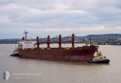
Bulk Carrier
Current Trip
| Trip Time | --- |
|---|---|
| Trip Distance | --- |
| AVG Speed | --- |
| MAX Speed | --- |
| Djupgående | --- |
| AVG Wind | --- |
| MAX Wind | --- |
| MIN Temp | --- |
| MAX Temp | --- |
| Position mottagen | 2 d sen |
Current Position
| Longitud | --- |
|---|---|
| Latitude | --- |
| Status | Under way using engine |
| Fart | 8.1 Knop |
| Kurs | 290.4° |
| Område | North Atlantic Ocean |
| Station | T-AIS |
| Position mottagen | 2 d sen |
Info
Information
The current position of POLES is in North Atlantic Ocean with coordinates 51.39637° / -10.19652° as reported on 2024-11-25 15:13 by AIS to our vessel tracker app. The vessel's current speed is 8.1 Knop and is currently inside the port of AUGHINISH.
The vessel POLES (IMO: 9254989, MMSI: 215295000) is a Bulk Carrier that was built in 2002 ( 22 År gammal ). It's sailing under the flag of [MT] Malta.
In this page you can find informations about the vessels current position, last detected port calls, and current voyage information. If the vessels is not in coverage by AIS you will find the latest position.
The current position of POLES is detected by our AIS receivers and we are not responsible for the reliability of the data. The last position was recorded while the vessel was in Coverage by the Ais receivers of our vessel tracking app.
The current draught of POLES as reported by AIS is 11.7 meters
Weather
| Temperature | 1.8°C / 35.24°F |
|---|---|
| Wind Speed | 2 knots |
| Direction | 34° NE |
| Pressure | 1017.3 hPa |
| Humidity | 91 % |
| Cloud Coverage | 1 % |
Featured Company
Last Port Calls
| Port | Arrival | Departure | Time In Port |
|---|---|---|---|
| 2024-10-25 12:56 | 2024-10-30 17:54 | 5 d | |
| 2024-10-05 01:01 | 2024-10-08 15:02 | 3 d | |
| 2024-10-01 08:09 | 2024-10-02 14:01 | 1 d | |
| 2024-09-29 19:56 | 2024-10-01 08:02 | 1 d | |
| 2024-09-28 22:23 | 2024-09-29 19:26 | 21 h | |
| 2024-09-28 21:14 | 2024-09-28 21:41 | 26 m | |
| 2024-09-28 06:19 | |||
| 2024-09-25 17:08 | 2024-09-28 05:58 | 2 d | |
| 2024-09-23 12:34 | 2024-09-25 17:04 | 2 d |
Last Trips
| Origin | Departure | Destination | Arrival | Distance | |
|---|---|---|---|---|---|
| 2024-10-02 17:01 | 2024-10-25 12:56 | 4119.52 nm | |||
| 2024-10-02 17:01 | 2024-10-05 03:01 | 204.99 nm | |||
| 2024-10-01 11:02 | 2024-10-01 11:09 | 1.12 nm | |||
| 2024-09-29 22:26 | 2024-09-29 22:56 | 4.73 nm | |||
| 2024-09-29 00:41 | 2024-09-29 01:23 | 4.82 nm | |||
| 2024-09-29 00:41 | 2024-09-29 00:14 | 4.82 nm | |||
| 2024-09-28 08:58 | 2024-09-28 09:19 | 6.24 nm | |||
| 2024-09-25 20:04 | 2024-09-25 20:08 | 2.34 nm | |||
| 2024-08-23 23:08 | 2024-09-23 15:34 | 5573.40 nm |
Events
| Tid | Event | Detaljer | Position / Dest | Information |
|---|---|---|---|---|
| 2024-11-25 15:13 | UTANFÖR täckningsområde |
51.39637 / -10.19652
North Atlantic Ocean
IEAUG
|
Fart: 8.1 kn Kurs: 290.4° |
|
| 2024-11-25 14:47 | Byter havsområde | Irish part of the North Atlantic Ocean Irish part of the Celtic Sea |
51.37464 / -10.11150
North Atlantic Ocean
IEAUG
|
Fart: 7.5 kn Kurs: 293.2° |
| 2024-11-25 13:18 | Status ändrad | Under way using engine Default |
51.31574 / -9.83061
IEAUG
|
Fart: 6.9 kn Kurs: 273° |
| 2024-11-25 13:03 | Status ändrad | Default Under way using engine |
51.31704 / -9.78259
IEAUG
|
Fart: 6.8 kn Kurs: 264.6° |
| 2024-11-25 09:59 | ETA ändrat | 2024/11/26 06:00 2024/11/25 21:00 |
51.39386 / -9.21911
IEAUG
|
Fart: 7.2 kn Kurs: 254.2° |
| 2024-11-25 08:03 | Status ändrad | Under way using engine Default |
51.42672 / -8.84205
IEAUG
|
Fart: 7.7 kn Kurs: 259° |
| 2024-11-25 08:02 | Status ändrad | Default Under way using engine |
51.42730 / -8.83755
IEAUG
|
Fart: 8 kn Kurs: 257.6° |
| 2024-11-24 23:14 | I täckningsområde |
51.69325 / -7.31616
Celtic Sea
IEAUG
|
Fart: 6.1 kn Kurs: 252.5° |
|
| 2024-11-24 14:07 | UTANFÖR täckningsområde |
51.65183 / -7.11120
Celtic Sea
IEAUG
|
Fart: 7.9 kn Kurs: 26.8° |
|
| 2024-11-24 12:08 | ETA ändrat | 2024/11/25 21:00 2024/11/25 19:00 |
51.38237 / -7.32045
IEAUG
|
Fart: 10.3 kn Kurs: 28.8° |