
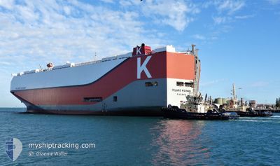
POLARIS HIGHWAY
Cargo
Current Trip
| Time Travelled | 22 h, 32 mins |
|---|---|
| Remaining Time | 6 days |
| Distance Travelled | 389.34 nm |
| Remaining Distance | 2906.93 nm |
| AVG Speed | 16.6 Knop |
| MAX Speed | 19.7 Knop |
| AVG Wind | 8.2 knots |
| MAX Wind | 13.2 knots |
| MIN Temp | 25.6°C / 78.08°F |
| MAX Temp | 29.5°C / 85.1°F |
| Djupgående | 9.3 m |
| Position mottagen | 20 h, 51 m sen |
Current Position
| Longitud | --- |
|---|---|
| Latitude | --- |
| Status | Under way using engine |
| Fart | 17.5 Knop |
| Kurs | 278.2° |
| Område | Singapore Strait |
| Station | T-AIS |
| Position mottagen | 20 h, 51 m sen |
Info
Information
The current position of POLARIS HIGHWAY is in Singapore Strait with coordinates 1.21936° / 103.48740° as reported on 2025-03-10 06:01 by AIS to our vessel tracker app. The vessel's current speed is 17.5 Knop and is heading at the port of SOHAR. The estimated time of arrival as calculated by MyShipTracking vessel tracking app is 2025-03-17 17:48 LT
The vessel POLARIS HIGHWAY (IMO: 9728095, MMSI: 356874000) is a Cargo It's sailing under the flag of [PA] Panama.
In this page you can find informations about the vessels current position, last detected port calls, and current voyage information. If the vessels is not in coverage by AIS you will find the latest position.
The current position of POLARIS HIGHWAY is detected by our AIS receivers and we are not responsible for the reliability of the data. The last position was recorded while the vessel was in Coverage by the Ais receivers of our vessel tracking app.
The current draught of POLARIS HIGHWAY as reported by AIS is 9.3 meters
Weather
| Temperature | 28.6°C / 83.48°F |
|---|---|
| Wind Speed | 10 knots |
| Direction | 35° NE |
| Pressure | 1011.2 hPa |
| Humidity | 76.7 % |
| Cloud Coverage | 87 % |
Featured Company
Most Visited Ports (Last year)
| Port | Arrivals | |
|---|---|---|
| 8 | ||
| 8 | ||
| 8 | ||
| 7 | ||
| 7 | ||
| 7 |
Last Trips
Events
| Tid | Event | Detaljer | Position / Dest | Information |
|---|---|---|---|---|
| 2025-03-10 06:10 | Status ändrad | Default Under way using engine |
1.22767 / 103.44526
OMSOH
|
Fart: 17.5 kn Kurs: 278.2° |
| 2025-03-10 06:01 | UTANFÖR täckningsområde |
1.21936 / 103.48740
Singapore Strait
OMSOH
|
Fart: 17.5 kn Kurs: 278.2° |
|
| 2025-03-10 05:37 | Byter havsområde | Malaysian part of the Singapore Strait Indonesian part of the Singapore Strait |
1.19909 / 103.59112
Singapore Strait
OMSOH
|
Fart: 13.5 kn Kurs: 275.9° |
| 2025-03-10 05:22 | Byter havsområde | Indonesian part of the Singapore Strait Singaporean part of the Singapore Strait |
1.20074 / 103.64071
Singapore Strait
OMSOH
|
Fart: 9.7 kn Kurs: 261.9° |
| 2025-03-10 04:48 | Destination ändrad | OMSOH SGSIN |
1.23691 / 103.70355
OMSOH
|
Fart: 9 kn Kurs: 235.2° |
| 2025-03-10 04:21 | AVGÅTT HAMN |
|
1.28000 / 103.74646
SGSIN
|
Fart: 3.2 kn Kurs: 211° |
| 2025-03-10 04:21 | STARTAR förflyttning |
1.28025 / 103.74657
[SG] SINGAPORE
|
Fart: 3.2 kn Kurs: 211° |
|
| 2025-03-10 04:00 | Status ändrad | Under way using engine Moored |
1.28297 / 103.75152
[SG] SINGAPORE
|
Fart: Kurs: 30° |
| 2025-03-10 03:45 | ETA ändrat | 2025/03/18 02:00 2025/03/09 16:30 |
1.28297 / 103.75151
[SG] SINGAPORE
|
Fart: Kurs: 31° |
| 2025-03-10 03:13 | Djupgående ändrat | 9.3 9.1 |
1.28297 / 103.75153
[SG] SINGAPORE
|
Fart: Kurs: 31° |