
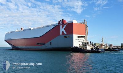
POLARIS HIGHWAY
Cargo
Current Trip
| Time Travelled | 11 h, 27 mins |
|---|---|
| Remaining Time | 3 h, 47 mins |
| Distance Travelled | 117.29 nm |
| Remaining Distance | 40.05 nm |
| AVG Speed | 10.4 Noeuds |
| MAX Speed | 12.8 Noeuds |
| AVG Wind | 10.4 knots |
| MAX Wind | 13.4 knots |
| MIN Temp | 21.7°C / 71.06°F |
| MAX Temp | 25.3°C / 77.54°F |
| Tirant d eau | 8.1 m |
| Position reçue | 1 h, 4 m depuis |
Current Position
| Longitude | -79.90264° |
|---|---|
| Latitude | 32.02210° |
| Etat | Under way using engine |
| Vitesse | 9 Noeuds |
| Parcours | 37.8° |
| Zone | North Atlantic Ocean |
| Station | T-AIS |
| Position reçue | 1 h, 4 m depuis |
Info
Information
The current position of POLARIS HIGHWAY is in North Atlantic Ocean with coordinates 32.02210° / -79.90264° as reported on 2024-05-01 07:41 by AIS to our vessel tracker app. The vessel's current speed is 9 Noeuds and is heading at the port of CHARLESTON. The estimated time of arrival as calculated by MyShipTracking vessel tracking app is 2024-05-01 12:32 LT
The vessel POLARIS HIGHWAY (IMO: 9728095, MMSI: 356874000) is a Cargo It's sailing under the flag of [PA] Panama.
In this page you can find informations about the vessels current position, last detected port calls, and current voyage information. If the vessels is not in coverage by AIS you will find the latest position.
The current position of POLARIS HIGHWAY is detected by our AIS receivers and we are not responsible for the reliability of the data. The last position was recorded while the vessel was in Coverage by the Ais receivers of our vessel tracking app.
The current draught of POLARIS HIGHWAY as reported by AIS is 8.1 meters
Weather
| Temperature | 22°C / 71.6°F |
|---|---|
| Wind Speed | 11 knots |
| Direction | 206° SSW |
| Pressure | 1013.9 hPa |
| Humidity | 82.8 % |
| Cloud Coverage | --- |
Featured Company
Last Port Calls
| Port | Arrival | Departure | Time In Port |
|---|---|---|---|
| 2024-04-29 08:16 | 2024-04-30 21:18 | 1 d | |
| 2024-04-25 08:28 | 2024-04-25 23:26 | 14 h | |
| 2024-04-10 17:28 | 2024-04-12 22:06 | 2 d | |
| 2024-04-06 19:04 | 2024-04-09 14:27 | 2 d | |
| 2024-04-05 23:59 | 2024-04-06 14:32 | 14 h | |
| 2024-04-04 06:21 | 2024-04-04 19:27 | 13 h | |
| 2024-03-24 12:48 | 2024-03-25 11:30 | 22 h | |
| 2024-03-22 08:42 | 2024-03-23 22:57 | 1 d | |
| 2024-03-17 23:43 | 2024-03-18 17:22 | 17 h | |
| 2024-03-17 07:39 | 2024-03-17 23:41 | 16 h |
Most Visited Ports (Last year)
| Port | Arrivals | |
|---|---|---|
| 5 | ||
| 4 | ||
| 3 | ||
| 3 | ||
| 3 | ||
| 2 |
Last Trips
| Origin | Departure | Destination | Arrival | Distance | |
|---|---|---|---|---|---|
| 2024-04-25 19:26 | 2024-04-29 04:16 | 686.30 nm | |||
| 2024-04-13 00:06 | 2024-04-25 04:28 | 3653.50 nm | |||
| 2024-04-09 16:27 | 2024-04-10 19:28 | 338.81 nm | |||
| 2024-04-06 16:32 | 2024-04-06 21:04 | 66.13 nm | |||
| 2024-04-04 20:27 | 2024-04-06 01:59 | 479.77 nm | |||
| 2024-03-25 07:30 | 2024-04-04 07:21 | 3769.76 nm | |||
| 2024-03-23 18:57 | 2024-03-24 08:48 | 166.83 nm | |||
| 2024-03-18 13:22 | 2024-03-22 04:42 | 684.61 nm | |||
| 2024-03-17 19:41 | 2024-03-17 19:43 | 0.20 nm | |||
| 2024-03-17 02:28 | 2024-03-17 03:39 | 5.41 nm |
Events
| Heure | Evenement | Détails | Position/ Destination | Info |
|---|---|---|---|---|
| 2024-05-01 07:56 | Etat Changé | Default Under way using engine |
32.05269 / -79.87582
US CHS
|
Vitesse: 9 kn Parcours: 37.8° |
| 2024-05-01 07:41 | Hors de la zone couverte |
32.02210 / -79.90264
North Atlantic Ocean
US CHS
|
Vitesse: 9 kn Parcours: 37.8° |
|
| 2024-05-01 06:36 | Tirant d'eau modifié | 8.1 8.8 |
31.89098 / -80.02322
US CHS
|
Vitesse: 9.3 kn Parcours: 36.3° |
| 2024-05-01 06:36 | Changement de destination | US CHS USSSI |
31.89098 / -80.02322
US CHS
|
Vitesse: 9.3 kn Parcours: 36.3° |
| 2024-05-01 06:36 | Changement d'ETA | 2024/05/01 10:00 2024/04/28 12:00 |
31.89098 / -80.02322
US CHS
|
Vitesse: 9.3 kn Parcours: 36.3° |
| 2024-05-01 06:13 | Etat Changé | Under way using engine Default |
31.84609 / -80.06330
USSSI
|
Vitesse: 9.1 kn Parcours: 36° |
| 2024-05-01 05:43 | Etat Changé | Default Under way using engine |
31.77865 / -80.12200
USSSI
|
Vitesse: 10.9 kn Parcours: 37.4° |
| 2024-05-01 04:57 | Etat Changé | Under way using engine Default |
31.66792 / -80.21980
USSSI
|
Vitesse: 10.8 kn Parcours: 37° |
| 2024-05-01 04:33 | Etat Changé | Default Under way using engine |
31.61132 / -80.26915
USSSI
|
Vitesse: 10.8 kn Parcours: 36.3° |
| 2024-05-01 03:33 | Etat Changé | Under way using engine Default |
31.46802 / -80.39583
USSSI
|
Vitesse: 10.6 kn Parcours: 37° |