
PIS RINJANI
Tanker
Current Trip
| Time Travelled | 20 days |
|---|---|
| Remaining Time | --- |
| Distance Travelled | 72.09 nm |
| Remaining Distance | --- |
| AVG Speed | 6.6 Knop |
| MAX Speed | 12.4 Knop |
| AVG Wind | 16.9 knots |
| MAX Wind | 29.3 knots |
| MIN Temp | 0.9°C / 33.62°F |
| MAX Temp | 8.4°C / 47.12°F |
| Djupgående | 9 m |
| Position mottagen | 4 m sen |
Current Position
| Longitud | --- |
|---|---|
| Latitude | --- |
| Status | At anchor |
| Fart | 0.1 Knop |
| Kurs | 162° |
| Område | North Sea |
| Station | T-AIS |
| Position mottagen | 4 m sen |
Info
Information
The current position of PIS RINJANI is in North Sea with coordinates 52.21811° / 3.59451° as reported on 2025-02-17 19:14 by AIS to our vessel tracker app. The vessel's current speed is 0.1 Knop
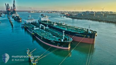
The vessel PIS RINJANI (IMO: 9792864, MMSI: 636020839) is a Tanker It's sailing under the flag of [LR] Liberia.
In this page you can find informations about the vessels current position, last detected port calls, and current voyage information. If the vessels is not in coverage by AIS you will find the latest position.
The current position of PIS RINJANI is detected by our AIS receivers and we are not responsible for the reliability of the data. The last position was recorded while the vessel was in Coverage by the Ais receivers of our vessel tracking app.
The current draught of PIS RINJANI as reported by AIS is 9 meters
Weather
| Temperature | 3°C / 37.4°F |
|---|---|
| Wind Speed | 13 knots |
| Direction | 101° E |
| Pressure | 1024.1 hPa |
| Humidity | 55.6 % |
| Cloud Coverage | 100 % |
Featured Company
Last Port Calls
| Port | Arrival | Departure | Time In Port |
|---|---|---|---|
| 2025-01-28 00:28 | 2025-01-28 16:35 | 16 h | |
| 2025-01-25 22:55 | 2025-01-27 22:21 | 1 d | |
| 2025-01-19 02:37 | 2025-01-25 20:36 | 6 d | |
| 2024-12-08 20:00 | 2024-12-11 00:53 | 2 d | |
| 2024-12-04 20:19 | 2024-12-07 11:00 | 2 d | |
| 2024-12-01 02:34 |
Most Visited Ports (Last year)
| Port | Arrivals | |
|---|---|---|
| 2 | ||
| 2 | ||
| 2 | ||
| 1 | ||
| 1 | ||
| 1 |
Last Trips
| Origin | Departure | Destination | Arrival | Distance | |
|---|---|---|---|---|---|
| 2025-01-27 23:21 | 2025-01-28 01:28 | 19.14 nm | |||
| 2025-01-25 21:36 | 2025-01-25 23:55 | 19.77 nm | |||
| 2024-12-11 04:53 | 2025-01-19 03:37 | 11211.09 nm | |||
| 2024-12-07 14:00 | 2024-12-09 00:00 | 414.23 nm | |||
| 2024-12-01 05:34 | 2024-12-04 23:19 | 252.01 nm |
Events
| Tid | Event | Detaljer | Position / Dest | Information |
|---|---|---|---|---|
| 2025-02-17 19:14 | Status ändrad | At anchor Default |
52.21811 / 3.59451
FOR ORDERS
|
Fart: 0.1 kn Kurs: 167° |
| 2025-02-17 18:59 | Status ändrad | Default At anchor |
52.21837 / 3.59512
FOR ORDERS
|
Fart: 0.1 kn Kurs: 173° |
| 2025-02-17 18:56 | Status ändrad | At anchor Default |
52.21841 / 3.59529
FOR ORDERS
|
Fart: 0.1 kn Kurs: 172° |
| 2025-02-17 18:50 | Status ändrad | Default At anchor |
52.21841 / 3.59546
FOR ORDERS
|
Fart: 0.1 kn Kurs: 176° |
| 2025-02-17 18:44 | Status ändrad | At anchor Default |
52.21853 / 3.59565
FOR ORDERS
|
Fart: 0.2 kn Kurs: 183° |
| 2025-02-17 18:36 | Status ändrad | Default At anchor |
52.21853 / 3.59614
FOR ORDERS
|
Fart: 0.1 kn Kurs: 185° |
| 2025-02-17 18:08 | Status ändrad | At anchor Default |
52.21859 / 3.59678
FOR ORDERS
|
Fart: 0.1 kn Kurs: 190° |
| 2025-02-17 18:05 | Status ändrad | Default At anchor |
52.21857 / 3.59688
FOR ORDERS
|
Fart: 0.2 kn Kurs: 191° |
| 2025-02-17 17:47 | Status ändrad | At anchor Default |
52.21850 / 3.59720
FOR ORDERS
|
Fart: 0.2 kn Kurs: 194° |
| 2025-02-17 17:36 | Status ändrad | Default At anchor |
52.21852 / 3.59738
FOR ORDERS
|
Fart: 0.2 kn Kurs: 197° |