
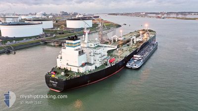
PENELOP
Crude Oil Tanker
Current Trip
| Time Travelled | 3 days |
|---|---|
| Remaining Time | 1 day |
| Distance Travelled | 861.63 nm |
| Remaining Distance | 456.28 nm |
| AVG Speed | 11.6 Knop |
| MAX Speed | 12.9 Knop |
| AVG Wind | 11.9 knots |
| MAX Wind | 31 knots |
| MIN Temp | 15.4°C / 59.72°F |
| MAX Temp | 20.2°C / 68.36°F |
| Djupgående | 14 m |
| Position mottagen | 7 h, 24 m sen |
Current Position
| Longitud | -9.82824° |
|---|---|
| Latitude | 43.41773° |
| Status | Under way using engine |
| Fart | 10.7 Knop |
| Kurs | 19.1° |
| Område | North Atlantic Ocean |
| Station | T-AIS |
| Position mottagen | 7 h, 24 m sen |
Info
Information
The current position of PENELOP is in North Atlantic Ocean with coordinates 43.41773° / -9.82824° as reported on 2024-06-03 23:40 by AIS to our vessel tracker app. The vessel's current speed is 10.7 Knop and is heading at the port of PEMBROKE. The estimated time of arrival as calculated by MyShipTracking vessel tracking app is 2024-06-06 00:45 LT
The vessel PENELOP (IMO: 9325908, MMSI: 309924000) is a Crude Oil Tanker that was built in 2006 ( 18 År gammal ). It's sailing under the flag of [BS] Bahamas.
In this page you can find informations about the vessels current position, last detected port calls, and current voyage information. If the vessels is not in coverage by AIS you will find the latest position.
The current position of PENELOP is detected by our AIS receivers and we are not responsible for the reliability of the data. The last position was recorded while the vessel was in Coverage by the Ais receivers of our vessel tracking app.
The current draught of PENELOP as reported by AIS is 14 meters
Weather
| Temperature | 15.6°C / 60.08°F |
|---|---|
| Wind Speed | 18 knots |
| Direction | 69° ENE |
| Pressure | 1016.7 hPa |
| Humidity | 82.2 % |
| Cloud Coverage | 2 % |
Featured Company
Last Trips
| Origin | Departure | Destination | Arrival | Distance | |
|---|---|---|---|---|---|
| 2024-05-17 04:02 | 2024-05-30 15:04 | 1839.55 nm | |||
| 2024-05-13 20:08 | 2024-05-16 00:07 | 589.58 nm | |||
| 2024-05-02 07:22 | 2024-05-12 16:57 | 563.10 nm | |||
| 2024-04-16 20:33 | 2024-04-26 14:59 | 518.96 nm | |||
| 2024-03-18 10:43 | 2024-04-15 16:19 | 1241.20 nm |
Events
| Tid | Event | Detaljer | Position / Dest | Information |
|---|---|---|---|---|
| 2024-06-03 23:44 | Status ändrad | Default Under way using engine |
43.43101 / -9.82227
DZAZW>GBMLF
|
Fart: 10.7 kn Kurs: 19.1° |
| 2024-06-03 23:40 | UTANFÖR täckningsområde |
43.41773 / -9.82824
North Atlantic Ocean
DZAZW>GBMLF
|
Fart: 10.7 kn Kurs: 19.1° |
|
| 2024-06-03 23:38 | Status ändrad | Under way using engine Default |
43.41305 / -9.83063
DZAZW>GBMLF
|
Fart: 10 kn Kurs: 25° |
| 2024-06-03 23:30 | I täckningsområde |
43.41305 / -9.83063
North Atlantic Ocean
DZAZW>GBMLF
|
Fart: 10.7 kn Kurs: 23.1° |
|
| 2024-06-03 20:45 | Status ändrad | Default Under way using engine |
42.89333 / -9.95167
DZAZW>GBMLF
|
Fart: 11.4 kn Kurs: 357.6° |
| 2024-06-03 20:45 | UTANFÖR täckningsområde |
42.89240 / -9.95162
North Atlantic Ocean
DZAZW>GBMLF
|
Fart: 11.4 kn Kurs: 357.6° |
|
| 2024-06-03 18:18 | Status ändrad | Under way using engine Default |
42.42931 / -9.93875
DZAZW>GBMLF
|
Fart: 11 kn Kurs: 358° |
| 2024-06-03 18:12 | Status ändrad | Default Under way using engine |
42.40833 / -9.93667
DZAZW>GBMLF
|
Fart: 11.8 kn Kurs: 358.6° |
| 2024-06-03 17:34 | Status ändrad | Under way using engine Default |
42.28620 / -9.93481
DZAZW>GBMLF
|
Fart: 11.4 kn Kurs: 359° |
| 2024-06-03 17:33 | Status ändrad | Default Under way using engine |
42.28291 / -9.93480
DZAZW>GBMLF
|
Fart: 11.4 kn Kurs: 358.8° |