

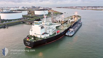
PENELOP
Crude Oil Tanker

Current Trip
| Time Travelled | 13 days |
|---|---|
| Remaining Time | --- |
| Distance Travelled | 364.25 nm |
| Remaining Distance | --- |
| AVG Speed | 7.9 Noeuds |
| MAX Speed | 14.7 Noeuds |
| AVG Wind | 11.3 knots |
| MAX Wind | 20 knots |
| MIN Temp | 2.9°C / 37.22°F |
| MAX Temp | 14.6°C / 58.28°F |
| Tirant d eau | 8.6 m |
| Position reçue | 21 h, 53 m depuis |
Current Position
| Longitude | --- |
|---|---|
| Latitude | --- |
| Etat | Under way using engine |
| Vitesse | 7.2 Noeuds |
| Parcours | 333.6° |
| Zone | North Sea |
| Station | T-AIS |
| Position reçue | 21 h, 53 m depuis |
Information
The current position of PENELOP is in North Sea with coordinates 54.38862° / 1.16474° as reported on 2025-03-26 16:23 by AIS to our vessel tracker app. The vessel's current speed is 7.2 Noeuds and is heading at the port of SULLOM VOE. The estimated time of arrival as calculated by MyShipTracking vessel tracking app is 2025-03-28 22:00 LT
The vessel PENELOP (IMO: 9325908, MMSI: 309924000) is a Crude Oil Tanker that was built in 2006 ( 19 Age ). It's sailing under the flag of [BS] Bahamas.
In this page you can find informations about the vessels current position, last detected port calls, and current voyage information. If the vessels is not in coverage by AIS you will find the latest position.
The current position of PENELOP is detected by our AIS receivers and we are not responsible for the reliability of the data. The last position was recorded while the vessel was in Coverage by the Ais receivers of our vessel tracking app.
The current draught of PENELOP as reported by AIS is 8.6 meters
Weather
| Temperature | 8.3°C / 46.94°F |
|---|---|
| Wind Speed | 19 knots |
| Direction | 217° SW |
| Pressure | 1012.6 hPa |
| Humidity | 91.8 % |
| Cloud Coverage | 100 % |


Featured Company
Last Port Calls
| Port | Arrival | Departure | Time In Port |
|---|---|---|---|
| 2025-03-12 22:42 | 2025-03-14 03:25 | 1 d | |
| 2025-03-09 12:43 | 2025-03-10 12:35 | 23 h | |
| 2025-03-02 08:52 | 2025-03-03 17:25 | 1 d | |
| 2025-02-26 02:56 | 2025-02-27 00:17 | 21 h | |
| 2025-02-12 21:59 | 2025-02-15 01:36 | 2 d | |
| 2025-02-06 15:43 | 2025-02-07 19:14 | 1 d | |
| 2025-02-01 07:13 | 2025-02-02 11:12 | 1 d | |
| 2025-01-28 17:34 | 2025-01-29 18:43 | 1 d | |
| 2025-01-17 05:13 | 2025-01-19 11:32 | 2 d | |
| 2025-01-07 23:20 | 2025-01-08 23:38 | 1 d |
Most Visited Ports (Last year)
| Port | Arrivals | |
|---|---|---|
| 6 | ||
| 5 | ||
| 4 | ||
| 4 | ||
| 2 | ||
| 2 |
Last Trips
| Origin | Departure | Destination | Arrival | Distance | |
|---|---|---|---|---|---|
| 2025-03-10 12:35 | 2025-03-12 22:42 | 652.06 nm | |||
| 2025-03-03 17:25 | 2025-03-09 12:43 | 1143.32 nm | |||
| 2025-02-27 00:17 | 2025-03-02 08:52 | 930.54 nm | |||
| 2025-02-15 01:36 | 2025-02-26 02:56 | 912.61 nm | |||
| 2025-02-07 19:14 | 2025-02-12 21:59 | 749.12 nm | |||
| 2025-02-02 11:12 | 2025-02-06 15:43 | 811.47 nm | |||
| 2025-01-29 18:43 | 2025-02-01 07:13 | 653.24 nm | |||
| 2025-01-19 11:32 | 2025-01-28 17:34 | 1068.08 nm | |||
| 2025-01-08 23:38 | 2025-01-17 05:13 | 668.35 nm | |||
| 2024-11-30 04:31 | 2025-01-07 23:20 | 5072.81 nm |
Events
| Heure | Evenement | Détails | Position/ Destination | Info |
|---|---|---|---|---|
| 2025-03-26 16:30 | Etat Changé | Default Under way using engine |
54.40044 / 1.15475
NLSCE>GBSUL
|
Vitesse: 7.2 kn Parcours: 333.6° |
| 2025-03-26 16:23 | Etat Changé | Under way using engine Default |
54.38862 / 1.16474
NLSCE>GBSUL
|
Vitesse: 7.2 kn Parcours: 333° |
| 2025-03-26 16:23 | Hors de la zone couverte |
54.38862 / 1.16474
North Sea
NLSCE>GBSUL
|
Vitesse: 7.2 kn Parcours: 333.6° |
|
| 2025-03-26 16:10 | Dans la zone couverte |
54.38862 / 1.16474
North Sea
NLSCE>GBSUL
|
Vitesse: 7.2 kn Parcours: 333.6° |
|
| 2025-03-26 15:17 | Etat Changé | Default Under way using engine |
54.26619 / 1.25535
NLSCE>GBSUL
|
Vitesse: 7.2 kn Parcours: 336.6° |
| 2025-03-26 15:11 | Etat Changé | Under way using engine Default |
54.25446 / 1.26421
NLSCE>GBSUL
|
Vitesse: 7.2 kn Parcours: 337° |
| 2025-03-26 15:11 | Hors de la zone couverte |
54.25446 / 1.26421
North Sea
NLSCE>GBSUL
|
Vitesse: 7.2 kn Parcours: 336.6° |
|
| 2025-03-26 15:09 | Etat Changé | Default Under way using engine |
54.25196 / 1.26599
NLSCE>GBSUL
|
Vitesse: 7.3 kn Parcours: 338.5° |
| 2025-03-26 14:37 | Etat Changé | Under way using engine Default |
54.19065 / 1.30563
NLSCE>GBSUL
|
Vitesse: 7.4 kn Parcours: 339° |
| 2025-03-26 14:26 | Dans la zone couverte |
54.19161 / 1.30501
North Sea
NLSCE>GBSUL
|
Vitesse: 7.3 kn Parcours: 339.9° |