
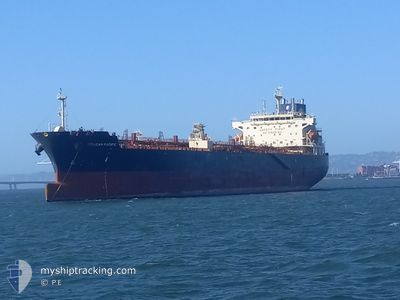
PELICAN PACIFIC
Tanker
Current Trip
CA VAN
| Time Travelled | 1 day |
|---|---|
| Remaining Time | --- |
| Distance Travelled | 3.27 nm |
| Remaining Distance | --- |
| AVG Speed | 5.1 Knop |
| MAX Speed | 5.1 Knop |
| AVG Wind | 3 knots |
| MAX Wind | 5 knots |
| MIN Temp | 3.5°C / 38.3°F |
| MAX Temp | 6.7°C / 44.06°F |
| Djupgående | 8.6 m |
| Position mottagen | 3 m sen |
Current Position
| Longitud | --- |
|---|---|
| Latitude | --- |
| Status | At anchor |
| Fart | |
| Kurs | 40° |
| Område | The Coastal Waters of Southeast Alaska and British Columbia |
| Station | T-AIS |
| Position mottagen | 3 m sen |
Info
Information
The current position of PELICAN PACIFIC is in The Coastal Waters of Southeast Alaska and British Columbia with coordinates 49.29918° / -122.94678° as reported on 2024-12-28 05:00 by AIS to our vessel tracker app. The vessel's current speed is 0 Knop
The vessel PELICAN PACIFIC (IMO: 9876385, MMSI: 563102700) is a Tanker It's sailing under the flag of [SG] Singapore.
In this page you can find informations about the vessels current position, last detected port calls, and current voyage information. If the vessels is not in coverage by AIS you will find the latest position.
The current position of PELICAN PACIFIC is detected by our AIS receivers and we are not responsible for the reliability of the data. The last position was recorded while the vessel was in Coverage by the Ais receivers of our vessel tracking app.
The current draught of PELICAN PACIFIC as reported by AIS is 8.6 meters
Weather
| Temperature | 5.1°C / 41.18°F |
|---|---|
| Wind Speed | 5 knots |
| Direction | 57° ENE |
| Pressure | 1003.1 hPa |
| Humidity | 93.8 % |
| Cloud Coverage | 100 % |
Featured Company
Last Port Calls
| Port | Arrival | Departure | Time In Port |
|---|---|---|---|
| 2024-12-26 19:36 | 2024-12-26 20:46 | 1 h | |
| 2024-12-18 19:40 | 2024-12-20 05:31 | 1 d | |
| 2024-11-27 20:17 | 2024-11-28 19:23 | 23 h | |
| 2024-11-13 06:18 | 2024-11-13 23:29 | 17 h | |
| 2024-11-07 09:52 | 2024-11-09 16:15 | 2 d | |
| 2024-10-24 10:25 | 2024-10-24 20:54 | 10 h | |
| 2024-10-23 15:49 | 2024-10-24 03:01 | 11 h | |
| 2024-10-13 00:29 | 2024-10-14 07:49 | 1 d |
Most Visited Ports (Last year)
| Port | Arrivals | |
|---|---|---|
| 15 | ||
| 11 | ||
| 4 | ||
| 1 | ||
| 1 |
Last Trips
| Origin | Departure | Destination | Arrival | Distance | |
|---|---|---|---|---|---|
| 2024-12-19 21:31 | 2024-12-26 11:36 | 1313.67 nm | |||
| 2024-11-28 11:23 | 2024-12-18 11:40 | 1175.96 nm | |||
| 2024-11-13 15:29 | 2024-11-27 12:17 | 1405.65 nm | |||
| 2024-11-09 08:15 | 2024-11-12 22:18 | 634.86 nm | |||
| 2024-10-24 13:54 | 2024-11-07 01:52 | 1324.95 nm | |||
| 2024-10-23 20:01 | 2024-10-24 03:25 | 94.10 nm | |||
| 2024-10-14 00:49 | 2024-10-23 08:49 | 1085.47 nm | |||
| 2024-09-27 17:34 | 2024-10-12 17:29 | 1063.87 nm |
Events
| Tid | Event | Detaljer | Position / Dest | Information |
|---|---|---|---|---|
| 2024-12-26 21:42 | Status ändrad | At anchor Under way using engine |
49.30036 / -122.94594
CA VAN
|
Fart: 0.2 kn Kurs: 64° |
| 2024-12-26 21:28 | STOPPAR förflyttning | 5.86 nm, East of VANCOUVER |
49.30036 / -122.94612
CA VAN
|
Fart: 0.3 kn Kurs: 59° |
| 2024-12-26 20:46 | AVGÅTT HAMN |
|
49.29566 / -123.00040
CA VAN
|
Fart: 8.2 kn Kurs: 78° |
| 2024-12-26 19:36 | ANLÄNDER HAMN |
|
49.31720 / -123.14620
[CA] VANCOUVER
|
Fart: 5.4 kn Kurs: 108.3° |
| 2024-12-26 16:17 | Upptäckt i hav | Canadian part of the The Coastal Waters of Southeast Alaska and British Columbia |
49.00607 / -123.24007
The Coastal Waters of Southeast Alaska and British Columbia
|
Fart: 8.7 kn Kurs: 314.4° |
| 2024-12-26 14:59 | Byter havsområde | United States part of the The Coastal Waters of Southeast Alaska and British Columbia Canadian part of the The Coastal Waters of Southeast Alaska and British Columbia |
48.83761 / -123.01989
The Coastal Waters of Southeast Alaska and British Columbia
|
Fart: 11.3 kn Kurs: 331.2° |
| 2024-12-26 14:56 | Byter havsområde | Canadian part of the The Coastal Waters of Southeast Alaska and British Columbia United States part of the The Coastal Waters of Southeast Alaska and British Columbia |
48.82876 / -123.01338
The Coastal Waters of Southeast Alaska and British Columbia
|
Fart: 12.4 kn Kurs: 334.2° |
| 2024-12-26 14:44 | Byter havsområde | United States part of the The Coastal Waters of Southeast Alaska and British Columbia Canadian part of the The Coastal Waters of Southeast Alaska and British Columbia |
48.79164 / -123.00645
The Coastal Waters of Southeast Alaska and British Columbia
|
Fart: 11.5 kn Kurs: 25.8° |
| 2024-12-26 14:26 | Byter havsområde | Canadian part of the The Coastal Waters of Southeast Alaska and British Columbia United States part of the The Coastal Waters of Southeast Alaska and British Columbia |
48.75047 / -123.07049
The Coastal Waters of Southeast Alaska and British Columbia
|
Fart: 12 kn Kurs: 54.6° |
| 2024-12-26 12:41 | Byter havsområde | United States part of the The Coastal Waters of Southeast Alaska and British Columbia Canadian part of the The Coastal Waters of Southeast Alaska and British Columbia |
48.45505 / -123.16026
The Coastal Waters of Southeast Alaska and British Columbia
|
Fart: 12.7 kn Kurs: 358.8° |