
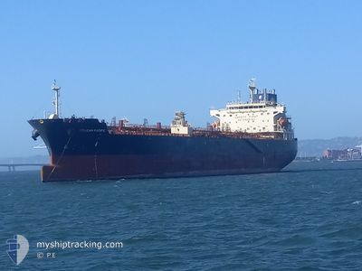
PELICAN PACIFIC
Tanker
Current Trip
| Time Travelled | 19 days |
|---|---|
| Remaining Time | --- |
| Distance Travelled | 3354.39 nm |
| Remaining Distance | --- |
| AVG Speed | 12.3 Knopen |
| MAX Speed | 15.9 Knopen |
| AVG Wind | 9.1 knots |
| MAX Wind | 25 knots |
| MIN Temp | 1.2°C / 34.16°F |
| MAX Temp | 27.4°C / 81.32°F |
| Diepgang | 12.2 M |
| Positie ontvangen | 7 d geleden |
Current Position
| Lengtegraad | --- |
|---|---|
| Breedtegraat | --- |
| Status | Under way using engine |
| Snelheid | 13.2 Knopen |
| Koers | 154.9° |
| Gebied | North Pacific Ocean |
| Station | T-AIS |
| Positie ontvangen | 7 d geleden |
Info
Information
The current position of PELICAN PACIFIC is in North Pacific Ocean with coordinates 35.46388° / -123.10587° as reported on 2025-01-07 09:39 by AIS to our vessel tracker app. The vessel's current speed is 13.2 Knopen and is heading at the port of CALLAO. The estimated time of arrival as calculated by MyShipTracking vessel tracking app is 2025-01-19 08:00 LT
The vessel PELICAN PACIFIC (IMO: 9876385, MMSI: 563102700) is a Tanker It's sailing under the flag of [SG] Singapore.
In this page you can find informations about the vessels current position, last detected port calls, and current voyage information. If the vessels is not in coverage by AIS you will find the latest position.
The current position of PELICAN PACIFIC is detected by our AIS receivers and we are not responsible for the reliability of the data. The last position was recorded while the vessel was in Coverage by the Ais receivers of our vessel tracking app.
The current draught of PELICAN PACIFIC as reported by AIS is 12.2 meters
Weather
| Temperature | 26.4°C / 79.52°F |
|---|---|
| Wind Speed | 13 knots |
| Direction | 74° ENE |
| Pressure | 1010.8 hPa |
| Humidity | 81.3 % |
| Cloud Coverage | 35 % |
Featured Company
Last Port Calls
| Port | Arrival | Departure | Time In Port |
|---|---|---|---|
| 2024-12-26 19:36 | 2024-12-26 20:46 | 1 h | |
| 2024-12-18 19:40 | 2024-12-20 05:31 | 1 d | |
| 2024-11-27 20:17 | 2024-11-28 19:23 | 23 h | |
| 2024-11-13 06:18 | 2024-11-13 23:29 | 17 h | |
| 2024-11-07 09:52 | 2024-11-09 16:15 | 2 d |
Most Visited Ports (Last year)
| Port | Arrivals | |
|---|---|---|
| 15 | ||
| 11 | ||
| 4 | ||
| 1 | ||
| 1 |
Last Trips
| Origin | Departure | Destination | Arrival | Distance | |
|---|---|---|---|---|---|
| 2024-12-19 21:31 | 2024-12-26 11:36 | 1313.67 nm | |||
| 2024-11-28 11:23 | 2024-12-18 11:40 | 1175.96 nm | |||
| 2024-11-13 15:29 | 2024-11-27 12:17 | 1405.65 nm | |||
| 2024-11-09 08:15 | 2024-11-12 22:18 | 634.86 nm | |||
| 2024-10-24 13:54 | 2024-11-07 01:52 | 1324.95 nm |
Events
| Tijd | Evenement | Details | Positie / Bestemming | Info |
|---|---|---|---|---|
| 2025-01-07 09:46 | Status Changed | Default Under way using engine |
35.43981 / -123.09251
PECLL
|
Snelheid: 13.2 kn Koers: 154.9° |
| 2025-01-07 09:39 | Buitenbereik |
35.46388 / -123.10587
North Pacific Ocean
PECLL
|
Snelheid: 13.2 kn Koers: 154.9° |
|
| 2025-01-07 09:33 | Status Changed | Under way using engine Default |
35.48515 / -123.11715
PECLL
|
Snelheid: 13.2 kn Koers: 156° |
| 2025-01-07 09:21 | Status Changed | Default Under way using engine |
35.52481 / -123.13754
PECLL
|
Snelheid: 12.8 kn Koers: 157.5° |
| 2025-01-07 09:15 | Status Changed | Under way using engine Default |
35.54311 / -123.14701
PECLL
|
Snelheid: 13.1 kn Koers: 157° |
| 2025-01-07 09:14 | Status Changed | Default Under way using engine |
35.54951 / -123.15030
PECLL
|
Snelheid: 13.5 kn Koers: 155.8° |
| 2025-01-07 08:29 | Status Changed | Under way using engine Default |
35.70050 / -123.22797
PECLL
|
Snelheid: 13.3 kn Koers: 157° |
| 2025-01-07 08:02 | Status Changed | Default Under way using engine |
35.79382 / -123.27650
PECLL
|
Snelheid: 13.4 kn Koers: 156.8° |
| 2025-01-07 07:54 | Status Changed | Under way using engine Default |
35.82179 / -123.29038
PECLL
|
Snelheid: 13.4 kn Koers: 157° |
| 2025-01-07 07:48 | Status Changed | Default Under way using engine |
35.84179 / -123.30042
PECLL
|
Snelheid: 13 kn Koers: 156.6° |