

PATRIOT
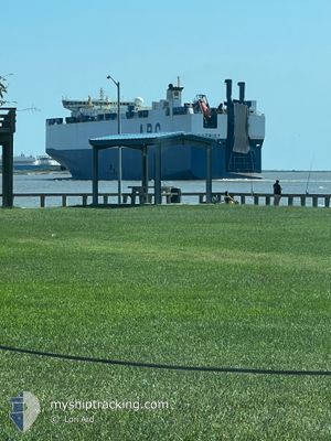
Vehicles Carrier

Current Trip
| Time Travelled | 1 day |
|---|---|
| Remaining Time | 9 days |
| Distance Travelled | 314.86 nm |
| Remaining Distance | 3186.23 nm |
| AVG Speed | 13.3 Knop |
| MAX Speed | 17.3 Knop |
| AVG Wind | 5.6 knots |
| MAX Wind | 10 knots |
| MIN Temp | 8.9°C / 48.02°F |
| MAX Temp | 12.3°C / 54.14°F |
| Djupgående | 10 m |
| Position mottagen | 17 h, 31 m sen |
Current Position
| Longitud | --- |
|---|---|
| Latitude | --- |
| Status | Under way using engine |
| Fart | 13.8 Knop |
| Kurs | 240.6° |
| Område | Celtic Sea |
| Station | T-AIS |
| Position mottagen | 17 h, 31 m sen |
Information
The current position of PATRIOT is in Celtic Sea with coordinates 49.38354° / -5.34087° as reported on 2025-03-26 17:39 by AIS to our vessel tracker app. The vessel's current speed is 13.8 Knop and is heading at the port of BALTIMORE. The estimated time of arrival as calculated by MyShipTracking vessel tracking app is 2025-04-05 12:54 LT
The vessel PATRIOT (IMO: 9316139, MMSI: 303210000) is a Vehicles Carrier that was built in 2006 ( 19 År gammal ). It's sailing under the flag of [US] USA.
In this page you can find informations about the vessels current position, last detected port calls, and current voyage information. If the vessels is not in coverage by AIS you will find the latest position.
The current position of PATRIOT is detected by our AIS receivers and we are not responsible for the reliability of the data. The last position was recorded while the vessel was in Coverage by the Ais receivers of our vessel tracking app.
The current draught of PATRIOT as reported by AIS is 10 meters
Weather
| Temperature | 12.6°C / 54.68°F |
|---|---|
| Wind Speed | 8 knots |
| Direction | 193° SSW |
| Pressure | 1023.3 hPa |
| Humidity | 84.2 % |
| Cloud Coverage | 100 % |


Featured Company
Last Port Calls
| Port | Arrival | Departure | Time In Port |
|---|---|---|---|
| 2025-03-25 11:03 | 2025-03-26 02:21 | 15 h | |
| 2025-03-22 02:55 | 2025-03-24 18:38 | 2 d | |
| 2025-03-18 00:53 | 2025-03-20 19:20 | 2 d | |
| 2025-03-15 14:06 | 2025-03-16 21:20 | 1 d | |
| 2025-03-14 00:09 | 2025-03-14 18:50 | 18 h | |
| 2025-03-03 18:10 | 2025-03-04 03:18 | 9 h | |
| 2025-03-01 05:17 | 2025-03-02 06:20 | 1 d | |
| 2025-02-25 09:41 | 2025-02-26 20:04 | 1 d | |
| 2025-02-18 23:23 | 2025-02-20 22:11 | 1 d | |
| 2025-02-15 16:55 | 2025-02-16 15:47 | 22 h |
Most Visited Ports (Last year)
| Port | Arrivals | |
|---|---|---|
| 10 | ||
| 8 | ||
| 8 | ||
| 6 | ||
| 6 | ||
| 5 |
Last Trips
| Origin | Departure | Destination | Arrival | Distance | |
|---|---|---|---|---|---|
| 2025-03-24 19:38 | 2025-03-25 11:03 | 202.59 nm | |||
| 2025-03-20 20:20 | 2025-03-22 03:55 | 353.62 nm | |||
| 2025-03-16 22:20 | 2025-03-18 01:53 | 321.05 nm | |||
| 2025-03-14 18:50 | 2025-03-15 15:06 | 267.46 nm | |||
| 2025-03-03 22:18 | 2025-03-14 00:09 | 3262.83 nm | |||
| 2025-03-02 01:20 | 2025-03-03 13:10 | 538.75 nm | |||
| 2025-02-26 15:04 | 2025-03-01 00:17 | 683.31 nm | |||
| 2025-02-20 16:11 | 2025-02-25 04:41 | 1442.78 nm | |||
| 2025-02-16 09:47 | 2025-02-18 17:23 | 488.05 nm | |||
| 2025-02-09 13:43 | 2025-02-15 10:55 | 1290.95 nm |
Events
| Tid | Event | Detaljer | Position / Dest | Information |
|---|---|---|---|---|
| 2025-03-26 17:48 | Status ändrad | Default Under way using engine |
49.36752 / -5.38551
US BAL
|
Fart: 13.8 kn Kurs: 240.6° |
| 2025-03-26 17:39 | UTANFÖR täckningsområde |
49.38354 / -5.34087
Celtic Sea
US BAL
|
Fart: 13.8 kn Kurs: 240.6° |
|
| 2025-03-26 17:34 | Byter havsområde | United Kingdom part of the Celtic Sea United Kingdom part of the English Channel |
49.39407 / -5.31226
Celtic Sea
US BAL
|
Fart: 13.8 kn Kurs: 240.6° |
| 2025-03-26 17:33 | Status ändrad | Under way using engine Default |
49.39535 / -5.30877
US BAL
|
Fart: 13.8 kn Kurs: 240° |
| 2025-03-26 16:48 | Status ändrad | Default Under way using engine |
49.47574 / -5.08187
US BAL
|
Fart: 14 kn Kurs: 241.2° |
| 2025-03-26 16:18 | Status ändrad | Under way using engine Default |
49.53137 / -4.92693
US BAL
|
Fart: 13.9 kn Kurs: 242° |
| 2025-03-26 16:16 | Status ändrad | Default Under way using engine |
49.53565 / -4.91471
US BAL
|
Fart: 14.1 kn Kurs: 244.2° |
| 2025-03-26 11:40 | Status ändrad | Under way using engine Default |
49.88108 / -3.37583
US BAL
|
Fart: 14 kn Kurs: 251° |
| 2025-03-26 11:20 | Status ändrad | Default Under way using engine |
49.90958 / -3.26150
US BAL
|
Fart: 14.1 kn Kurs: 240.3° |
| 2025-03-26 11:11 | Status ändrad | Under way using engine Default |
49.92629 / -3.21731
US BAL
|
Fart: 14.1 kn Kurs: 242° |