
ORION HIGHWAY
Cargo
Current Trip
| Time Travelled | 1 day |
|---|---|
| Remaining Time | --- |
| Distance Travelled | 554.17 nm |
| Remaining Distance | --- |
| AVG Speed | 16.8 Knop |
| MAX Speed | 20.2 Knop |
| AVG Wind | 17.7 knots |
| MAX Wind | 26.8 knots |
| MIN Temp | 9.8°C / 49.64°F |
| MAX Temp | 17.1°C / 62.78°F |
| Djupgående | 7.6 m |
| Position mottagen | 23 h, 35 m sen |
Current Position
| Longitud | 146.59240° |
|---|---|
| Latitude | -39.26585° |
| Status | Under way using engine |
| Fart | 17.5 Knop |
| Kurs | 77.2° |
| Område | Bass Strait |
| Station | T-AIS |
| Position mottagen | 23 h, 35 m sen |
Info
Information
The current position of ORION HIGHWAY is in Bass Strait with coordinates -39.26585° / 146.59240° as reported on 2024-06-26 19:08 by AIS to our vessel tracker app. The vessel's current speed is 17.5 Knop and is heading at the port of TOYOHASHI. The estimated time of arrival as calculated by MyShipTracking vessel tracking app is 2024-07-09 11:00 LT
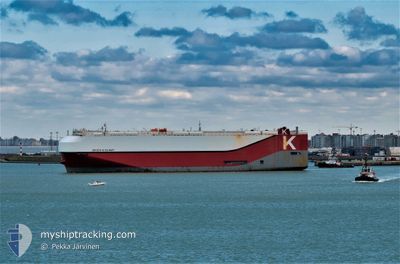
The vessel ORION HIGHWAY (IMO: 9728071, MMSI: 374678000) is a Cargo It's sailing under the flag of [PA] Panama.
In this page you can find informations about the vessels current position, last detected port calls, and current voyage information. If the vessels is not in coverage by AIS you will find the latest position.
The current position of ORION HIGHWAY is detected by our AIS receivers and we are not responsible for the reliability of the data. The last position was recorded while the vessel was in Coverage by the Ais receivers of our vessel tracking app.
The current draught of ORION HIGHWAY as reported by AIS is 7.6 meters
Weather
| Temperature | 16.4°C / 61.52°F |
|---|---|
| Wind Speed | 15 knots |
| Direction | 232° SW |
| Pressure | 1022.7 hPa |
| Humidity | 58.6 % |
| Cloud Coverage | 3 % |
Featured Company
Last Port Calls
| Port | Arrival | Departure | Time In Port |
|---|---|---|---|
| 2024-06-23 03:49 | 2024-06-26 19:16 | 3 d | |
| 2024-06-16 08:20 | 2024-06-17 03:26 | 19 h | |
| 2024-06-13 19:51 | 2024-06-14 18:24 | 22 h | |
| 2024-05-31 22:25 | 2024-06-01 08:55 | 10 h | |
| 2024-05-28 08:13 | 2024-05-29 14:30 | 1 d | |
| 2024-05-16 17:39 | 2024-05-17 06:56 | 13 h | |
| 2024-05-14 08:13 | 2024-05-16 11:48 | 2 d | |
| 2024-05-09 20:24 | 2024-05-10 05:32 | 9 h | |
| 2024-05-01 21:25 | 2024-05-02 06:34 | 9 h | |
| 2024-04-29 10:12 | 2024-04-29 20:17 | 10 h |
Most Visited Ports (Last year)
| Port | Arrivals | |
|---|---|---|
| 7 | ||
| 7 | ||
| 6 | ||
| 6 | ||
| 6 | ||
| 6 |
Last Trips
| Origin | Departure | Destination | Arrival | Distance | |
|---|---|---|---|---|---|
| 2024-06-17 03:26 | 2024-06-23 03:49 | 728.96 nm | |||
| 2024-06-14 18:24 | 2024-06-16 08:20 | 571.67 nm | |||
| 2024-06-01 08:55 | 2024-06-13 19:51 | 3882.28 nm | |||
| 2024-05-29 14:30 | 2024-05-31 22:25 | 818.81 nm | |||
| 2024-05-17 06:56 | 2024-05-28 08:13 | 4839.39 nm | |||
| 2024-05-16 11:48 | 2024-05-16 17:39 | 45.37 nm | |||
| 2024-05-10 05:32 | 2024-05-14 08:13 | 287.28 nm | |||
| 2024-05-02 06:34 | 2024-05-09 20:24 | 3340.51 nm | |||
| 2024-04-29 20:17 | 2024-05-01 21:25 | 817.81 nm | |||
| 2024-04-24 00:56 | 2024-04-29 10:12 | 2309.93 nm |
Events
| Tid | Event | Detaljer | Position / Dest | Information |
|---|---|---|---|---|
| 2024-06-26 19:17 | Status ändrad | Default Under way using engine |
-39.25626 / 146.64491
JPTHS
|
Fart: 17.5 kn Kurs: 77.2° |
| 2024-06-26 19:08 | UTANFÖR täckningsområde |
-39.26585 / 146.59240
Bass Strait
JPTHS
|
Fart: 17.5 kn Kurs: 77.2° |
|
| 2024-06-26 19:06 | Status ändrad | Under way using engine Default |
-39.26822 / 146.57904
JPTHS
|
Fart: 17.5 kn Kurs: 77° |
| 2024-06-26 19:01 | Status ändrad | Default Under way using engine |
-39.27322 / 146.54787
JPTHS
|
Fart: 17.4 kn Kurs: 90.7° |
| 2024-06-26 13:46 | Status ändrad | Under way using engine Default |
-38.60770 / 144.83226
JPTHS
|
Fart: 17.5 kn Kurs: 122° |
| 2024-06-26 13:41 | Status ändrad | Default Under way using engine |
-38.59414 / 144.80493
JPTHS
|
Fart: 17.5 kn Kurs: 123° |
| 2024-06-26 13:40 | Status ändrad | Under way using engine Default |
-38.59305 / 144.80274
JPTHS
|
Fart: 17.5 kn Kurs: 123° |
| 2024-06-26 13:37 | I täckningsområde |
-38.59305 / 144.80274
Bass Strait
JPTHS
|
Fart: 17.5 kn Kurs: 123° |
|
| 2024-06-26 11:01 | Status ändrad | Default Under way using engine |
-38.33245 / 144.90208
JPTHS
|
Fart: 18.7 kn Kurs: 177.7° |
| 2024-06-26 10:55 | UTANFÖR täckningsområde |
-38.30736 / 144.91315
Bass Strait
JPTHS
|
Fart: 18.7 kn Kurs: 177.7° |