

ON PEACE
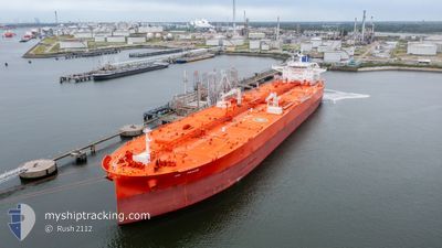
Tanker

Current Trip
| Time Travelled | 7 days |
|---|---|
| Remaining Time | 5 days |
| Distance Travelled | 2356.86 nm |
| Remaining Distance | 1470.87 nm |
| AVG Speed | 12.6 Knop |
| MAX Speed | 16.4 Knop |
| AVG Wind | 9.9 knots |
| MAX Wind | 27.3 knots |
| MIN Temp | 23.7°C / 74.66°F |
| MAX Temp | 31.4°C / 88.52°F |
| Djupgående | 8.5 m |
| Position mottagen | 2 d sen |
Current Position
| Longitud | --- |
|---|---|
| Latitude | --- |
| Status | Under way using engine |
| Fart | 13.6 Knop |
| Kurs | 268.5° |
| Område | Laccadive Sea |
| Station | T-AIS |
| Position mottagen | 2 d sen |
Information
The current position of ON PEACE is in Laccadive Sea with coordinates 5.81650° / 80.06857° as reported on 2025-03-11 11:09 by AIS to our vessel tracker app. The vessel's current speed is 13.6 Knop and is heading at the port of AL JUBAIL. The estimated time of arrival as calculated by MyShipTracking vessel tracking app is 2025-03-19 09:01 LT
The vessel ON PEACE (IMO: 9893204, MMSI: 370236000) is a Tanker It's sailing under the flag of [PA] Panama.
In this page you can find informations about the vessels current position, last detected port calls, and current voyage information. If the vessels is not in coverage by AIS you will find the latest position.
The current position of ON PEACE is detected by our AIS receivers and we are not responsible for the reliability of the data. The last position was recorded while the vessel was in Coverage by the Ais receivers of our vessel tracking app.
The current draught of ON PEACE as reported by AIS is 8.5 meters
Weather
| Temperature | 28.4°C / 83.12°F |
|---|---|
| Wind Speed | 5 knots |
| Direction | 32° NNE |
| Pressure | 1011.8 hPa |
| Humidity | 67.5 % |
| Cloud Coverage | 11 % |


Featured Company
Last Port Calls
| Port | Arrival | Departure | Time In Port |
|---|---|---|---|
| 2025-03-03 13:57 | 2025-03-07 00:29 | 3 d | |
| 2025-02-13 00:14 | 2025-02-15 04:15 | 2 d | |
| 2025-01-27 03:52 | 2025-01-29 01:39 | 1 d | |
| 2025-01-16 21:54 | 2025-01-17 14:46 | 16 h | |
| 2025-01-06 08:05 | 2025-01-07 10:36 | 1 d |
Most Visited Ports (Last year)
| Port | Arrivals | |
|---|---|---|
| 2 | ||
| 2 | ||
| 2 | ||
| 1 | ||
| 1 | ||
| 1 |
Last Trips
| Origin | Departure | Destination | Arrival | Distance | |
|---|---|---|---|---|---|
| 2025-02-15 04:15 | 2025-03-03 13:57 | 3763.14 nm | |||
| 2025-01-29 01:39 | 2025-02-13 00:14 | 657.98 nm | |||
| 2025-01-17 14:46 | 2025-01-27 03:52 | 2120.21 nm | |||
| 2025-01-07 10:36 | 2025-01-16 21:54 | 2660.16 nm | |||
| 2024-12-20 21:41 | 2025-01-06 08:05 | 2667.48 nm |
Events
| Tid | Event | Detaljer | Position / Dest | Information |
|---|---|---|---|---|
| 2025-03-11 11:10 | Status ändrad | Default Under way using engine |
5.81656 / 80.06318
JUBAIL
|
Fart: 13.6 kn Kurs: 268.5° |
| 2025-03-11 11:09 | UTANFÖR täckningsområde |
5.81650 / 80.06857
Laccadive Sea
JUBAIL
|
Fart: 13.6 kn Kurs: 268.5° |
|
| 2025-03-11 11:07 | Status ändrad | Under way using engine Default |
5.81647 / 80.07532
JUBAIL
|
Fart: 13.7 kn Kurs: 270° |
| 2025-03-11 10:57 | Status ändrad | Default Under way using engine |
5.81635 / 80.11266
JUBAIL
|
Fart: 13.9 kn Kurs: 268.7° |
| 2025-03-11 09:59 | Destination ändrad | JUBAIL FUJAIRAH |
5.81554 / 80.33616
JUBAIL
|
Fart: 13.9 kn Kurs: 277.7° |
| 2025-03-11 09:59 | ETA ändrat | 2025/03/19 11:00 2025/03/18 13:00 |
5.81554 / 80.33616
JUBAIL
|
Fart: 13.9 kn Kurs: 277.7° |
| 2025-03-11 09:52 | Byter havsområde | Sri Lankan part of the Laccadive Sea Malaysian part of the Malacca Strait |
5.81179 / 80.36309
Laccadive Sea
FUJAIRAH
|
Fart: 13.9 kn Kurs: 276.5° |
| 2025-03-11 09:52 | I täckningsområde |
5.81179 / 80.36309
Laccadive Sea
FUJAIRAH
|
Fart: 13.9 kn Kurs: 276.5° |
|
| 2025-03-11 09:51 | Status ändrad | Under way using engine Default |
5.81136 / 80.36695
FUJAIRAH
|
Fart: 13.9 kn Kurs: 272° |
| 2025-03-06 19:51 | UTANFÖR täckningsområde |
1.24793 / 103.39447
Malacca Strait
FUJAIRAH
|
Fart: 12.4 kn Kurs: 313.1° |