
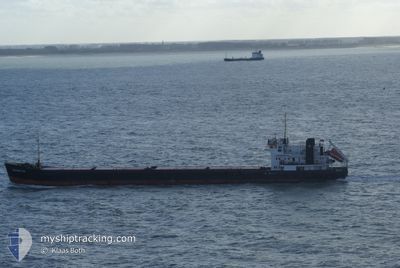
OMSKIY-134
General Cargo
Current Trip
| Time Travelled | 24 days |
|---|---|
| Remaining Time | --- |
| Distance Travelled | 2149.72 nm |
| Remaining Distance | --- |
| AVG Speed | 6.5 Knop |
| MAX Speed | 12 Knop |
| AVG Wind | 14.7 knots |
| MAX Wind | 32.8 knots |
| MIN Temp | 7.8°C / 46.04°F |
| MAX Temp | 29.6°C / 85.28°F |
| Djupgående | 3.4 m |
| Position mottagen | 23 h, 27 m sen |
Current Position
| Longitud | 34.50508° |
|---|---|
| Latitude | 36.53361° |
| Status | Under way using engine |
| Fart | 7.8 Knop |
| Kurs | 44.4° |
| Område | Mediterranean Sea - Eastern Basin |
| Station | T-AIS |
| Position mottagen | 23 h, 27 m sen |
Info
Information
The current position of OMSKIY-134 is in Mediterranean Sea - Eastern Basin with coordinates 36.53361° / 34.50508° as reported on 2024-04-25 05:41 by AIS to our vessel tracker app. The vessel's current speed is 7.8 Knop
The vessel OMSKIY-134 (IMO: 8881711, MMSI: 273317900) is a General Cargo that was built in 1988 ( 36 År gammal ). It's sailing under the flag of [RU] Russia.
In this page you can find informations about the vessels current position, last detected port calls, and current voyage information. If the vessels is not in coverage by AIS you will find the latest position.
The current position of OMSKIY-134 is detected by our AIS receivers and we are not responsible for the reliability of the data. The last position was recorded while the vessel was in Coverage by the Ais receivers of our vessel tracking app.
The current draught of OMSKIY-134 as reported by AIS is 3.4 meters
Weather
| Temperature | 25.3°C / 77.54°F |
|---|---|
| Wind Speed | 5 knots |
| Direction | 338° NNW |
| Pressure | 1006.3 hPa |
| Humidity | 45 % |
| Cloud Coverage | 98 % |
Featured Company
Most Visited Ports (Last year)
| Port | Arrivals | |
|---|---|---|
| 4 | ||
| 4 | ||
| 3 | ||
| 3 | ||
| 1 | ||
| 1 |
Last Trips
| Origin | Departure | Destination | Arrival | Distance |
|---|
Events
| Tid | Event | Detaljer | Position / Dest | Information |
|---|---|---|---|---|
| 2024-04-25 08:28 | STOPPAR förflyttning | 2.35 nm, South of MERSIN |
36.75779 / 34.64996
MERSIN
|
Fart: 0.2 kn Kurs: 85° |
| 2024-04-25 05:48 | Status ändrad | Default Under way using engine |
36.54526 / 34.51840
MERSIN
|
Fart: 7.8 kn Kurs: 44.4° |
| 2024-04-25 05:41 | UTANFÖR täckningsområde |
36.53361 / 34.50508
Mediterranean Sea - Eastern Basin
MERSIN
|
Fart: 7.8 kn Kurs: 44.4° |
|
| 2024-04-25 05:09 | Status ändrad | Under way using engine Default |
36.48607 / 34.44469
MERSIN
|
Fart: 7.7 kn Kurs: 48° |
| 2024-04-25 05:08 | Status ändrad | Default Under way using engine |
36.48426 / 34.44255
MERSIN
|
Fart: 6.6 kn Kurs: 50.2° |
| 2024-04-24 21:29 | I täckningsområde |
36.05767 / 33.52724
Mediterranean Sea - Eastern Basin
MERSIN
|
Fart: 8.2 kn Kurs: 78° |
|
| 2024-04-24 02:44 | Status ändrad | Default Under way using engine |
36.03789 / 30.53891
MERSIN
|
Fart: 7.6 kn Kurs: 91.9° |
| 2024-04-24 02:39 | UTANFÖR täckningsområde |
36.03821 / 30.52635
Mediterranean Sea - Eastern Basin
MERSIN
|
Fart: 7.6 kn Kurs: 91.9° |
|
| 2024-04-23 20:10 | Byter havsområde | Turkish part of the Mediterranean Sea - Eastern Basin Greek part of the Mediterranean Sea - Eastern Basin |
36.06720 / 29.63379
Mediterranean Sea - Eastern Basin
MERSIN
|
Fart: 6.9 kn Kurs: 91.5° |
| 2024-04-23 18:31 | Byter havsområde | Greek part of the Mediterranean Sea - Eastern Basin Turkish part of the Mediterranean Sea - Eastern Basin |
36.12450 / 29.41410
Mediterranean Sea - Eastern Basin
MERSIN
|
Fart: 6.7 kn Kurs: 109.2° |