
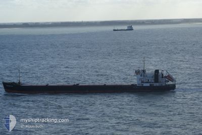
OMSKIY-134
General Cargo
Current Trip
| Time Travelled | 22 days |
|---|---|
| Remaining Time | 1 day |
| Distance Travelled | 1875.91 nm |
| Remaining Distance | 275.74 nm |
| AVG Speed | 6.6 Knots |
| MAX Speed | 12 Knots |
| AVG Wind | 15.5 knots |
| MAX Wind | 32.8 knots |
| MIN Temp | 7.8°C / 46.04°F |
| MAX Temp | 23.9°C / 75.02°F |
| Dybgang | 3.4 m |
| Position Modtaget | Nu |
Current Position
| Longitude | 29.49626° |
|---|---|
| Latitude | 36.10120° |
| Status | Under way using engine |
| Fart | 6.7 Knots |
| Kurs | 110.1° |
| Område | Mediterranean Sea - Eastern Basin |
| Station | T-AIS |
| Position Modtaget | Nu |
Info
Information
The current position of OMSKIY-134 is in Mediterranean Sea - Eastern Basin with coordinates 36.10120° / 29.49626° as reported on 2024-04-23 19:09 by AIS to our vessel tracker app. The vessel's current speed is 6.7 Knots and is heading at the port of MERSIN. The estimated time of arrival as calculated by MyShipTracking vessel tracking app is 2024-04-25 12:16 LT
The vessel OMSKIY-134 (IMO: 8881711, MMSI: 273317900) is a General Cargo that was built in 1988 ( 36 år gamle ). It's sailing under the flag of [RU] Russia.
In this page you can find informations about the vessels current position, last detected port calls, and current voyage information. If the vessels is not in coverage by AIS you will find the latest position.
The current position of OMSKIY-134 is detected by our AIS receivers and we are not responsible for the reliability of the data. The last position was recorded while the vessel was in Coverage by the Ais receivers of our vessel tracking app.
The current draught of OMSKIY-134 as reported by AIS is 3.4 meters
Weather
| Temperature | 19.7°C / 67.46°F |
|---|---|
| Wind Speed | 19 knots |
| Direction | 94° E |
| Pressure | 1014.9 hPa |
| Humidity | 75.2 % |
| Cloud Coverage | 100 % |
Featured Company
Most Visited Ports (Last year)
| Port | Arrivals | |
|---|---|---|
| 5 | ||
| 4 | ||
| 4 | ||
| 3 | ||
| 1 | ||
| 1 |
Last Trips
| Origin | Departure | Destination | Arrival | Distance |
|---|
Events
| Tid | Hændelsen | Detaljer | Position / Dest | Info |
|---|---|---|---|---|
| 2024-04-23 18:31 | Ændre havområde | Greek part of the Mediterranean Sea - Eastern Basin Turkish part of the Mediterranean Sea - Eastern Basin |
36.12450 / 29.41410
Mediterranean Sea - Eastern Basin
MERSIN
|
Fart: 6.7 kn Kurs: 109.2° |
| 2024-04-23 11:59 | Ændre havområde | Turkish part of the Mediterranean Sea - Eastern Basin Greek part of the Mediterranean Sea - Eastern Basin |
36.38341 / 28.58235
Mediterranean Sea - Eastern Basin
MERSIN
|
Fart: 5.4 kn Kurs: 110.9° |
| 2024-04-23 08:56 | Fundet i havområde | Greek part of the Mediterranean Sea - Eastern Basin |
36.48485 / 28.22625
Mediterranean Sea - Eastern Basin
MERSIN
|
Fart: 7.2 kn Kurs: 85.3° |
| 2024-04-23 07:47 | Ændre havområde | Greek part of the Aegean Sea Turkish part of the Aegean Sea |
36.48348 / 28.04113
Aegean Sea
MERSIN
|
Fart: 7.5 kn Kurs: 88° |
| 2024-04-23 07:47 | Status er ændret | Under way using engine Default |
36.48348 / 28.04113
MERSIN
|
Fart: 7.4 kn Kurs: 90° |
| 2024-04-23 07:37 | Status er ændret | Default Under way using engine |
36.48342 / 28.01564
MERSIN
|
Fart: 7.3 kn Kurs: 91.8° |
| 2024-04-23 07:32 | Status er ændret | Under way using engine Default |
36.48348 / 28.00294
MERSIN
|
Fart: 7.5 kn Kurs: 91° |
| 2024-04-23 07:25 | Status er ændret | Default Under way using engine |
36.48360 / 27.98477
MERSIN
|
Fart: 7.6 kn Kurs: 90.8° |
| 2024-04-23 07:14 | Ændre havområde | Turkish part of the Aegean Sea Greek part of the Aegean Sea |
36.48362 / 27.95708
Aegean Sea
MERSIN
|
Fart: 7.6 kn Kurs: 89.4° |
| 2024-04-22 19:21 | Status er ændret | Under way using engine Default |
36.98478 / 26.59758
MERSIN
|
Fart: 6.2 kn Kurs: 146° |