
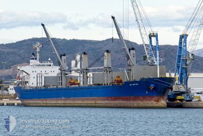
NYMPHI
Bulk Carrier
Current Trip
| Time Travelled | 8 days |
|---|---|
| Remaining Time | --- |
| Distance Travelled | 1122.81 nm |
| Remaining Distance | 104.28 nm |
| AVG Speed | 9.7 Knop |
| MAX Speed | 11.8 Knop |
| AVG Wind | 9.4 knots |
| MAX Wind | 20.9 knots |
| MIN Temp | 24.1°C / 75.38°F |
| MAX Temp | 34.2°C / 93.56°F |
| Djupgående | 4.9 m |
| Position mottagen | 5 d sen |
Current Position
| Longitud | 37.38989° |
|---|---|
| Latitude | 22.42327° |
| Status | Under way using engine |
| Fart | 10.5 Knop |
| Kurs | 333.5° |
| Område | Red Sea |
| Station | T-AIS |
| Position mottagen | 5 d sen |
Info
Information
The current position of NYMPHI is in Red Sea with coordinates 22.42327° / 37.38989° as reported on 2024-05-07 00:39 by AIS to our vessel tracker app. The vessel's current speed is 10.5 Knop and is heading at the port of AQABA. The estimated time of arrival as calculated by MyShipTracking vessel tracking app is 2024-05-11 18:00 LT
The vessel NYMPHI (IMO: 9615030, MMSI: 356832000) is a Bulk Carrier that was built in 2012 ( 12 År gammal ). It's sailing under the flag of [PA] Panama.
In this page you can find informations about the vessels current position, last detected port calls, and current voyage information. If the vessels is not in coverage by AIS you will find the latest position.
The current position of NYMPHI is detected by our AIS receivers and we are not responsible for the reliability of the data. The last position was recorded while the vessel was in Coverage by the Ais receivers of our vessel tracking app.
The current draught of NYMPHI as reported by AIS is 4.9 meters
Weather
| Temperature | 24.9°C / 76.82°F |
|---|---|
| Wind Speed | 8 knots |
| Direction | 12° NNE |
| Pressure | 1007.7 hPa |
| Humidity | 54.9 % |
| Cloud Coverage | --- |
Featured Company
Most Visited Ports (Last year)
| Port | Arrivals | |
|---|---|---|
| 2 | ||
| 2 | ||
| 1 | ||
| 1 | ||
| 1 | ||
| 1 |
Last Trips
| Origin | Departure | Destination | Arrival | Distance | |
|---|---|---|---|---|---|
| 2024-04-23 22:03 | 2024-04-29 15:37 | 267.16 nm | |||
| 2024-02-14 22:33 | 2024-03-01 14:21 | 228.24 nm |
Events
| Tid | Event | Detaljer | Position / Dest | Information |
|---|---|---|---|---|
| 2024-05-11 23:23 | STARTAR förflyttning |
27.72667 / 34.78833
AQABA
|
Fart: 4 kn Kurs: -1° |
|
| 2024-05-11 15:31 | STOPPAR förflyttning |
27.59166 / 34.76667
AQABA
|
Fart: Kurs: -1° |
|
| 2024-05-11 14:04 | STARTAR förflyttning |
27.66500 / 34.75333
AQABA
|
Fart: 4 kn Kurs: -1° |
|
| 2024-05-11 12:40 | STOPPAR förflyttning |
27.66333 / 34.73000
AQABA
|
Fart: Kurs: -1° |
|
| 2024-05-11 08:04 | STARTAR förflyttning |
27.51746 / 34.76198
AQABA
|
Fart: 3.8 kn Kurs: 7° |
|
| 2024-05-10 17:38 | STOPPAR förflyttning |
27.38500 / 34.81667
AQABA
|
Fart: Kurs: -1° |
|
| 2024-05-10 08:10 | STARTAR förflyttning |
26.96551 / 35.31487
AQABA
|
Fart: 3.3 kn Kurs: 174° |
|
| 2024-05-08 19:49 | STOPPAR förflyttning |
27.16500 / 34.88167
AQABA
|
Fart: Kurs: -1° |
|
| 2024-05-07 00:43 | Status ändrad | Default Under way using engine |
22.43167 / 37.38500
AQABA
|
Fart: 10.5 kn Kurs: 333.5° |
| 2024-05-07 00:39 | UTANFÖR täckningsområde |
22.42327 / 37.38989
Red Sea
AQABA
|
Fart: 10.5 kn Kurs: 333.5° |