
NORTH SEA
Fishing
Current Trip
FISHING GROUND
| Time Travelled | 3 days |
|---|---|
| Remaining Time | --- |
| Distance Travelled | 257.85 nm |
| Remaining Distance | --- |
| AVG Speed | 9.7 Knop |
| MAX Speed | 15 Knop |
| AVG Wind | 15.1 knots |
| MAX Wind | 24 knots |
| MIN Temp | 3°C / 37.4°F |
| MAX Temp | 7.8°C / 46.04°F |
| Djupgående | 5.4 m |
| Position mottagen | 1 m sen |
Current Position
| Longitud | --- |
|---|---|
| Latitude | --- |
| Status | Engaged in Fishing |
| Fart | 3.5 Knop |
| Kurs | 42° |
| Område | North Sea |
| Station | T-AIS |
| Position mottagen | 1 m sen |
Info
Information
The current position of NORTH SEA is in North Sea with coordinates 51.21191° / 1.79711° as reported on 2026-01-08 08:08 by AIS to our vessel tracker app. The vessel's current speed is 3.5 Knop
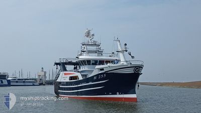
The vessel NORTH SEA (MMSI: 232061419) is a Fishing It's sailing under the flag of [GB] United Kingdom.
In this page you can find informations about the vessels current position, last detected port calls, and current voyage information. If the vessels is not in coverage by AIS you will find the latest position.
The current position of NORTH SEA is detected by our AIS receivers and we are not responsible for the reliability of the data. The last position was recorded while the vessel was in Coverage by the Ais receivers of our vessel tracking app.
The current draught of NORTH SEA as reported by AIS is 5.4 meters
Weather
| Temperature | 4.3°C / 39.74°F |
|---|---|
| Wind Speed | 4 knots |
| Direction | 174° S |
| Pressure | 1005.5 hPa |
| Humidity | 89.6 % |
| Cloud Coverage | 100 % |
Featured Company
Last Port Calls
| Port | Arrival | Departure | Time In Port |
|---|---|---|---|
| 2025-12-24 00:15 | 2026-01-05 03:32 | 12 d | |
| 2025-12-19 00:37 | 2025-12-22 03:35 | 3 d | |
| 2025-12-12 13:25 | 2025-12-15 04:31 | 2 d | |
| 2025-12-12 00:10 | 2025-12-12 12:15 | 12 h | |
| 2025-12-06 01:13 | 2025-12-08 03:34 | 2 d | |
| 2025-12-03 00:28 | 2025-12-03 02:26 | 1 h | |
| 2025-11-28 23:17 | 2025-12-01 03:15 | 2 d | |
| 2025-11-26 00:27 | 2025-11-26 02:03 | 1 h | |
| 2025-11-21 02:07 | 2025-11-24 03:24 | 3 d | |
| 2025-11-15 01:26 | 2025-11-17 03:37 | 2 d |
Most Visited Ports (Last year)
| Port | Arrivals | |
|---|---|---|
| 14 | ||
| 11 | ||
| 3 | ||
| 1 |
Last Trips
| Origin | Departure | Destination | Arrival | Distance | |
|---|---|---|---|---|---|
| 2025-12-22 03:35 | 2025-12-24 00:15 | 246.10 nm | |||
| 2025-12-15 04:31 | 2025-12-19 00:37 | 364.16 nm | |||
| 2025-12-12 12:15 | 2025-12-12 13:25 | 5.03 nm | |||
| 2025-12-08 03:34 | 2025-12-12 00:10 | 461.23 nm | |||
| 2025-12-03 02:26 | 2025-12-06 01:13 | 387.09 nm | |||
| 2025-12-01 03:15 | 2025-12-03 00:28 | 244.51 nm | |||
| 2025-11-26 02:03 | 2025-11-28 23:17 | 301.92 nm | |||
| 2025-11-24 03:24 | 2025-11-26 00:27 | 234.30 nm | |||
| 2025-11-17 03:37 | 2025-11-21 02:07 | 440.22 nm | |||
| 2025-11-13 01:48 | 2025-11-15 01:26 | 261.32 nm |
Events
| Tid | Event | Detaljer | Position / Dest | Information |
|---|---|---|---|---|
| 2026-01-08 06:01 | Byter havsområde | United Kingdom part of the North Sea French part of the North Sea |
51.08434 / 1.67745
North Sea
|
Fart: 6.6 kn Kurs: 25.3° |
| 2026-01-08 05:35 | Byter havsområde | French part of the North Sea French part of the English Channel |
51.02979 / 1.57635
North Sea
|
Fart: 12 kn Kurs: 45.4° |
| 2026-01-08 03:35 | Byter havsområde | French part of the English Channel United Kingdom part of the English Channel |
50.70744 / 1.19268
English Channel
|
Fart: 11.6 kn Kurs: 38.9° |
| 2026-01-08 01:26 | I täckningsområde |
50.53220 / .87620
English Channel
|
Fart: 4.1 kn Kurs: 68.8° |
|
| 2026-01-07 22:42 | UTANFÖR täckningsområde |
50.43631 / .45647
English Channel
|
Fart: 4.6 kn Kurs: 75° |
|
| 2026-01-07 22:42 | I täckningsområde |
50.43631 / .45647
English Channel
|
Fart: 4.6 kn Kurs: 75° |
|
| 2026-01-05 21:47 | UTANFÖR täckningsområde |
50.99809 / 1.42743
English Channel
|
Fart: 15 kn Kurs: 223.4° |
|
| 2026-01-05 21:29 | Byter havsområde | United Kingdom part of the English Channel United Kingdom part of the North Sea |
51.04743 / 1.51737
English Channel
|
Fart: 14.8 kn Kurs: 226° |
| 2026-01-05 18:44 | Byter havsområde | United Kingdom part of the North Sea French part of the North Sea |
51.39258 / 2.06496
North Sea
|
Fart: 3.9 kn Kurs: 215.2° |
| 2026-01-05 14:41 | Byter havsområde | French part of the North Sea United Kingdom part of the North Sea |
51.39612 / 2.07039
North Sea
|
Fart: 5.3 kn Kurs: 35° |