
NORTH SEA
Fishing
Current Trip
FISHING GROUND
| Time Travelled | 3 days |
|---|---|
| Remaining Time | --- |
| Distance Travelled | 355.32 nm |
| Remaining Distance | --- |
| AVG Speed | 6.7 Knots |
| MAX Speed | 11.4 Knots |
| AVG Wind | 20.5 knots |
| MAX Wind | 30 knots |
| MIN Temp | 10.4°C / 50.72°F |
| MAX Temp | 13.8°C / 56.84°F |
| Dybgang | 5.4 m |
| Position Modtaget | 1 m siden |
Current Position
| Longitude | --- |
|---|---|
| Latitude | --- |
| Status | Engaged in Fishing |
| Fart | 4.4 Knots |
| Kurs | 24° |
| Område | North Sea |
| Station | T-AIS |
| Position Modtaget | 1 m siden |
Info
Information
The current position of NORTH SEA is in North Sea with coordinates 51.23384° / 1.88077° as reported on 2025-12-11 04:56 by AIS to our vessel tracker app. The vessel's current speed is 4.4 Knots
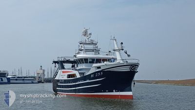
The vessel NORTH SEA (MMSI: 232061419) is a Fishing It's sailing under the flag of [GB] United Kingdom.
In this page you can find informations about the vessels current position, last detected port calls, and current voyage information. If the vessels is not in coverage by AIS you will find the latest position.
The current position of NORTH SEA is detected by our AIS receivers and we are not responsible for the reliability of the data. The last position was recorded while the vessel was in Coverage by the Ais receivers of our vessel tracking app.
The current draught of NORTH SEA as reported by AIS is 5.4 meters
Weather
| Temperature | 11.7°C / 53.06°F |
|---|---|
| Wind Speed | 17 knots |
| Direction | 215° SW |
| Pressure | 1021.4 hPa |
| Humidity | 86.8 % |
| Cloud Coverage | 3 % |
Featured Company
Last Port Calls
| Port | Arrival | Departure | Time In Port |
|---|---|---|---|
| 2025-12-06 01:13 | 2025-12-08 03:34 | 2 d | |
| 2025-12-03 00:28 | 2025-12-03 02:26 | 1 h | |
| 2025-11-28 23:17 | 2025-12-01 03:15 | 2 d | |
| 2025-11-26 00:27 | 2025-11-26 02:03 | 1 h | |
| 2025-11-21 02:07 | 2025-11-24 03:24 | 3 d | |
| 2025-11-15 01:26 | 2025-11-17 03:37 | 2 d | |
| 2025-11-13 00:15 | 2025-11-13 01:48 | 1 h | |
| 2025-11-07 02:37 | 2025-11-10 03:28 | 3 d | |
| 2025-10-31 20:11 | 2025-11-03 03:37 | 2 d | |
| 2025-10-24 16:46 | 2025-10-27 03:49 | 2 d |
Most Visited Ports (Last year)
| Port | Arrivals | |
|---|---|---|
| 11 | ||
| 10 | ||
| 3 | ||
| 1 |
Last Trips
| Origin | Departure | Destination | Arrival | Distance | |
|---|---|---|---|---|---|
| 2025-12-03 02:26 | 2025-12-06 01:13 | 387.09 nm | |||
| 2025-12-01 03:15 | 2025-12-03 00:28 | 244.51 nm | |||
| 2025-11-26 02:03 | 2025-11-28 23:17 | 301.92 nm | |||
| 2025-11-24 03:24 | 2025-11-26 00:27 | 234.30 nm | |||
| 2025-11-17 03:37 | 2025-11-21 02:07 | 440.22 nm | |||
| 2025-11-13 01:48 | 2025-11-15 01:26 | 261.32 nm | |||
| 2025-11-10 03:28 | 2025-11-13 00:15 | 335.31 nm | |||
| 2025-11-03 03:37 | 2025-11-07 02:37 | 478.29 nm | |||
| 2025-10-27 03:49 | 2025-10-31 20:11 | 372.43 nm | |||
| 2025-10-24 07:02 | 2025-10-24 16:46 | 84.92 nm |
Events
| Tid | Hændelsen | Detaljer | Position / Dest | Info |
|---|---|---|---|---|
| 2025-12-10 22:54 | START Sejllads | 10.21 nm, North West of CALAIS |
51.09892 / 1.67681
FISHING GROUND
|
Fart: 3.2 kn Kurs: 354° |
| 2025-12-10 21:55 | STOP Sejllads | 9.65 nm, North West of CALAIS |
51.08761 / 1.67850
FISHING GROUND
|
Fart: 0.2 kn Kurs: 41° |
| 2025-12-10 21:43 | Ændre havområde | United Kingdom part of the North Sea French part of the North Sea |
51.08318 / 1.67762
North Sea
|
Fart: 3.2 kn Kurs: 30° |
| 2025-12-10 21:38 | START Sejllads | 9.39 nm, North West of CALAIS |
51.07757 / 1.67224
FISHING GROUND
|
Fart: 4.7 kn Kurs: 344° |
| 2025-12-10 21:36 | STOP Sejllads | 9.33 nm, North West of CALAIS |
51.07800 / 1.67502
FISHING GROUND
|
Fart: 0.3 kn Kurs: 336° |
| 2025-12-10 21:23 | Ændre havområde | French part of the North Sea United Kingdom part of the North Sea |
51.08420 / 1.68091
North Sea
|
Fart: 4.9 kn Kurs: 214.1° |
| 2025-12-10 05:52 | START Sejllads | 20.58 nm, East of RAMSGATE |
51.34354 / 1.96733
FISHING GROUND
|
Fart: 6.4 kn Kurs: 200.9° |
| 2025-12-10 05:51 | STOP Sejllads | 20.63 nm, East of RAMSGATE |
51.34517 / 1.96856
FISHING GROUND
|
Fart: 0.1 kn Kurs: 214° |
| 2025-12-09 20:17 | Ændre havområde | United Kingdom part of the North Sea French part of the North Sea |
51.40380 / 2.06806
North Sea
|
Fart: 10.7 kn Kurs: 230.1° |
| 2025-12-09 20:05 | Ændre havområde | French part of the North Sea United Kingdom part of the North Sea |
51.42739 / 2.10681
North Sea
|
Fart: 5.3 kn Kurs: 198.2° |