
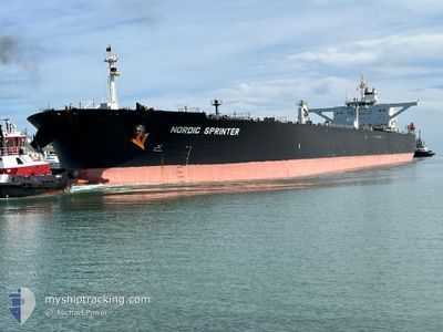
NORDIC SPRINTER
Crude Oil Tanker
Current Trip
| Time Travelled | 30 days |
|---|---|
| Remaining Time | 8 days |
| Distance Travelled | 5539.34 nm |
| Remaining Distance | 2218.12 nm |
| AVG Speed | 10.3 Knop |
| MAX Speed | 14 Knop |
| AVG Wind | 9.8 knots |
| MAX Wind | 25.4 knots |
| MIN Temp | 16.2°C / 61.16°F |
| MAX Temp | 29.4°C / 84.92°F |
| Djupgående | 15 m |
| Position mottagen | 4 d sen |
Current Position
| Longitud | --- |
|---|---|
| Latitude | --- |
| Status | Under way using engine |
| Fart | 12.1 Knop |
| Kurs | 179.3° |
| Område | Gulf of Oman |
| Station | T-AIS |
| Position mottagen | 4 d sen |
Info
Information
The current position of NORDIC SPRINTER is in Gulf of Oman with coordinates 25.22217° / 56.74835° as reported on 2025-03-03 10:13 by AIS to our vessel tracker app. The vessel's current speed is 12.1 Knop and is heading at the port of SINGAPORE. The estimated time of arrival as calculated by MyShipTracking vessel tracking app is 2025-03-15 17:48 LT
The vessel NORDIC SPRINTER (IMO: 9297503, MMSI: 319067500) is a Crude Oil Tanker that was built in 2005 ( 20 År gammal ). It's sailing under the flag of [KY] Cayman Is.
In this page you can find informations about the vessels current position, last detected port calls, and current voyage information. If the vessels is not in coverage by AIS you will find the latest position.
The current position of NORDIC SPRINTER is detected by our AIS receivers and we are not responsible for the reliability of the data. The last position was recorded while the vessel was in Coverage by the Ais receivers of our vessel tracking app.
The current draught of NORDIC SPRINTER as reported by AIS is 15 meters
Weather
| Temperature | 28.1°C / 82.58°F |
|---|---|
| Wind Speed | 5 knots |
| Direction | 346° NNW |
| Pressure | 1012 hPa |
| Humidity | 69 % |
| Cloud Coverage | 6 % |
Featured Company
Last Port Calls
| Port | Arrival | Departure | Time In Port |
|---|---|---|---|
| 2025-02-03 05:48 | 2025-02-05 06:36 | 2 d | |
| 2025-01-02 03:45 |
Most Visited Ports (Last year)
| Port | Arrivals | |
|---|---|---|
| 4 | ||
| 1 | ||
| 1 | ||
| 1 |
Last Trips
| Origin | Departure | Destination | Arrival | Distance | |
|---|---|---|---|---|---|
| 2025-01-02 11:45 | 2025-02-03 13:48 | 6843.97 nm |
Events
| Tid | Event | Detaljer | Position / Dest | Information |
|---|---|---|---|---|
| 2025-03-03 10:13 | Status ändrad | Default Under way using engine |
25.22154 / 56.74834
SGSIN
|
Fart: 12.1 kn Kurs: 179.3° |
| 2025-03-03 10:13 | UTANFÖR täckningsområde |
25.22217 / 56.74835
Gulf of Oman
SGSIN
|
Fart: 12.1 kn Kurs: 179.3° |
|
| 2025-03-03 07:58 | Byter havsområde | United Arab Emirates part of the Gulf of Oman Omani part of the Gulf of Oman |
25.66108 / 56.76299
Gulf of Oman
SGSIN
|
Fart: 11.7 kn Kurs: 182° |
| 2025-03-03 06:47 | Byter havsområde | Omani part of the Gulf of Oman Omani part of the Persian Gulf |
25.90212 / 56.76980
Gulf of Oman
SGSIN
|
Fart: 12.1 kn Kurs: 168.4° |
| 2025-03-03 06:45 | ETA ändrat | 2025/03/15 12:00 2025/03/15 08:00 |
25.90874 / 56.76823
SGSIN
|
Fart: 12 kn Kurs: 168.2° |
| 2025-03-03 06:44 | Status ändrad | Under way using engine Default |
25.91041 / 56.76791
SGSIN
|
Fart: 12 kn Kurs: 168° |
| 2025-03-03 06:30 | I täckningsområde |
25.90212 / 56.76980
Gulf of Oman
SGSIN
|
Fart: 12.1 kn Kurs: 168.4° |
|
| 2025-03-02 23:54 | Status ändrad | Default Under way using engine |
26.23255 / 55.89309
SGSIN
|
Fart: 9.9 kn Kurs: 77.2° |
| 2025-03-02 23:52 | UTANFÖR täckningsområde |
26.23148 / 55.88772
Persian Gulf
SGSIN
|
Fart: 9.9 kn Kurs: 77.2° |
|
| 2025-03-02 23:43 | Byter havsområde | Omani part of the Persian Gulf United Arab Emirates part of the Persian Gulf |
26.21533 / 55.86726
Persian Gulf
SGSIN
|
Fart: 10.5 kn Kurs: 23.8° |