
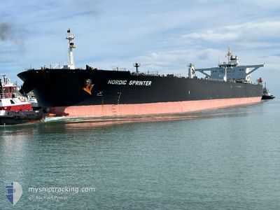
NORDIC SPRINTER
Crude Oil Tanker
Current Trip
| Time Travelled | 31 days |
|---|---|
| Remaining Time | 11 days |
| Distance Travelled | 3941.06 nm |
| Remaining Distance | 3395.37 nm |
| AVG Speed | 10.5 Knopen |
| MAX Speed | 15.4 Knopen |
| AVG Wind | 8.8 knots |
| MAX Wind | 24 knots |
| MIN Temp | 20.2°C / 68.36°F |
| MAX Temp | 30°C / 86°F |
| Diepgang | 14.9 M |
| Positie ontvangen | 3 h, 22 m geleden |
Current Position
| Lengtegraad | --- |
|---|---|
| Breedtegraat | --- |
| Status | Under way using engine |
| Snelheid | 12.4 Knopen |
| Koers | 52.9° |
| Gebied | Persian Gulf |
| Station | T-AIS |
| Positie ontvangen | 3 h, 22 m geleden |
Info
Information
The current position of NORDIC SPRINTER is in Persian Gulf with coordinates 26.07679° / 55.79001° as reported on 2024-12-18 11:49 by AIS to our vessel tracker app. The vessel's current speed is 12.4 Knopen and is heading at the port of SINGAPORE. The estimated time of arrival as calculated by MyShipTracking vessel tracking app is 2024-12-29 18:35 LT
The vessel NORDIC SPRINTER (IMO: 9297503, MMSI: 319067500) is a Crude Oil Tanker that was built in 2005 ( 19 Jaar oud ). It's sailing under the flag of [KY] Cayman Is.
In this page you can find informations about the vessels current position, last detected port calls, and current voyage information. If the vessels is not in coverage by AIS you will find the latest position.
The current position of NORDIC SPRINTER is detected by our AIS receivers and we are not responsible for the reliability of the data. The last position was recorded while the vessel was in Coverage by the Ais receivers of our vessel tracking app.
The current draught of NORDIC SPRINTER as reported by AIS is 14.9 meters
Weather
| Temperature | 21.4°C / 70.52°F |
|---|---|
| Wind Speed | 4 knots |
| Direction | 27° NNE |
| Pressure | 1015.8 hPa |
| Humidity | 50.2 % |
| Cloud Coverage | 1 % |
Featured Company
Last Port Calls
| Port | Arrival | Departure | Time In Port |
|---|---|---|---|
| 2024-11-14 00:53 | 2024-11-17 03:49 | 3 d |
Most Visited Ports (Last year)
| Port | Arrivals | |
|---|---|---|
| 2 | ||
| 1 | ||
| 1 | ||
| 1 | ||
| 1 |
Last Trips
| Origin | Departure | Destination | Arrival | Distance | |
|---|---|---|---|---|---|
| 2024-09-09 07:53 | 2024-11-14 08:53 | 6244.54 nm |
Events
| Tijd | Evenement | Details | Positie / Bestemming | Info |
|---|---|---|---|---|
| 2024-12-18 11:57 | Status Changed | Default Under way using engine |
26.09242 / 55.81224
SGSIN
|
Snelheid: 12.4 kn Koers: 52.9° |
| 2024-12-18 11:49 | Buitenbereik |
26.07679 / 55.79001
Persian Gulf
SGSIN
|
Snelheid: 12.4 kn Koers: 52.9° |
|
| 2024-12-18 11:43 | Draught Changed | 14.9 9.3 |
26.06287 / 55.77036
SGSIN
|
Snelheid: 12.4 kn Koers: 52.8° |
| 2024-12-18 11:43 | Destination Changed | SGSIN AEDAS |
26.06287 / 55.77036
SGSIN
|
Snelheid: 12.4 kn Koers: 52.8° |
| 2024-12-18 11:43 | ETA Changed | 2024/12/30 12:00 2024/12/16 20:01 |
26.06287 / 55.77036
SGSIN
|
Snelheid: 12.4 kn Koers: 52.8° |
| 2024-12-18 11:10 | Status Changed | Under way using engine Default |
25.99341 / 55.67314
AEDAS
|
Snelheid: 12 kn Koers: 51° |
| 2024-12-18 11:06 | Status Changed | Default Under way using engine |
25.98484 / 55.66180
AEDAS
|
Snelheid: 11.8 kn Koers: 50.7° |
| 2024-12-18 10:58 | Status Changed | Under way using engine Default |
25.96785 / 55.63920
AEDAS
|
Snelheid: 11.8 kn Koers: 51° |
| 2024-12-18 10:47 | Binnenbereik |
25.96785 / 55.63920
Persian Gulf
|
Snelheid: 11.8 kn Koers: 50° |
|
| 2024-12-17 20:43 | Start beweging | 3.69 nm, East of DAS ISLAND |
25.16456 / 52.93227
AEDAS
|
Snelheid: 3.8 kn Koers: 24° |