
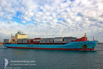
NORA MAERSK
Container Ship
Current Trip
| Time Travelled | 4 h, 47 mins |
|---|---|
| Remaining Time | 2 days |
| Distance Travelled | 71.87 nm |
| Remaining Distance | 787.47 nm |
| AVG Speed | 13.7 Knop |
| MAX Speed | 16.6 Knop |
| AVG Wind | 4.6 knots |
| MAX Wind | 6 knots |
| MIN Temp | 17.6°C / 63.68°F |
| MAX Temp | 19.2°C / 66.56°F |
| Djupgående | 10.4 m |
| Position mottagen | Nu |
Current Position
| Longitud | 7.54393° |
|---|---|
| Latitude | 43.34374° |
| Status | Under way using engine |
| Fart | 15.5 Knop |
| Kurs | 229.7° |
| Område | Mediterranean Sea - Western Basin |
| Station | T-AIS |
| Position mottagen | Nu |
Info
Information
The current position of NORA MAERSK is in Mediterranean Sea - Western Basin with coordinates 43.34374° / 7.54393° as reported on 2024-05-13 20:35 by AIS to our vessel tracker app. The vessel's current speed is 15.5 Knop and is heading at the port of ALGECIRAS. The estimated time of arrival as calculated by MyShipTracking vessel tracking app is 2024-05-15 21:18 LT
The vessel NORA MAERSK (IMO: 9192478, MMSI: 477642600) is a Container Ship that was built in 2000 ( 24 År gammal ). It's sailing under the flag of [HK] Hong Kong.
In this page you can find informations about the vessels current position, last detected port calls, and current voyage information. If the vessels is not in coverage by AIS you will find the latest position.
The current position of NORA MAERSK is detected by our AIS receivers and we are not responsible for the reliability of the data. The last position was recorded while the vessel was in Coverage by the Ais receivers of our vessel tracking app.
The current draught of NORA MAERSK as reported by AIS is 10.4 meters
Weather
| Temperature | 18.8°C / 65.84°F |
|---|---|
| Wind Speed | 6 knots |
| Direction | 53° NE |
| Pressure | 1012.3 hPa |
| Humidity | 74.9 % |
| Cloud Coverage | 8 % |
Featured Company
Last Port Calls
| Port | Arrival | Departure | Time In Port |
|---|---|---|---|
| 2024-05-12 16:16 | 2024-05-13 15:49 | 23 h | |
| 2024-05-09 21:37 | 2024-05-10 08:43 | 11 h | |
| 2024-05-03 21:47 | 2024-05-04 17:54 | 20 h | |
| 2024-05-02 03:52 | 2024-05-02 16:02 | 12 h | |
| 2024-04-30 23:10 | 2024-05-01 09:57 | 10 h | |
| 2024-04-27 14:34 | 2024-04-28 17:30 | 1 d | |
| 2024-04-25 20:52 | 2024-04-26 17:19 | 20 h | |
| 2024-04-20 09:10 | 2024-04-21 09:41 | 1 d | |
| 2024-04-18 16:38 | 2024-04-19 02:11 | 9 h | |
| 2024-04-17 11:00 | 2024-04-18 01:42 | 14 h |
Most Visited Ports (Last year)
| Port | Arrivals | |
|---|---|---|
| 33 | ||
| 22 | ||
| 20 | ||
| 19 | ||
| 15 | ||
| 6 |
Last Trips
| Origin | Departure | Destination | Arrival | Distance | |
|---|---|---|---|---|---|
| 2024-05-10 10:43 | 2024-05-12 18:16 | 366.31 nm | |||
| 2024-05-04 19:54 | 2024-05-09 23:37 | 326.20 nm | |||
| 2024-05-02 17:02 | 2024-05-03 23:47 | 414.90 nm | |||
| 2024-05-01 11:57 | 2024-05-02 04:52 | 33.98 nm | |||
| 2024-04-28 19:30 | 2024-05-01 01:10 | 851.27 nm | |||
| 2024-04-26 19:19 | 2024-04-27 16:34 | 345.56 nm | |||
| 2024-04-21 11:41 | 2024-04-25 22:52 | 317.81 nm | |||
| 2024-04-19 03:11 | 2024-04-20 11:10 | 414.27 nm | |||
| 2024-04-18 03:42 | 2024-04-18 17:38 | 29.79 nm | |||
| 2024-04-14 23:55 | 2024-04-17 13:00 | 852.37 nm |
Events
| Tid | Event | Detaljer | Position / Dest | Information |
|---|---|---|---|---|
| 2024-05-13 20:31 | Byter havsområde | French part of the Mediterranean Sea - Western Basin Mon�gasque part of the Mediterranean Sea - Western Basin |
43.35480 / 7.56216
Mediterranean Sea - Western Basin
ITVDL>ESALG
|
Fart: 15.6 kn Kurs: 230.4° |
| 2024-05-13 20:25 | Byter havsområde | Mon�gasque part of the Mediterranean Sea - Western Basin French part of the Mediterranean Sea - Western Basin |
43.37357 / 7.58681
Mediterranean Sea - Western Basin
ITVDL>ESALG
|
Fart: 15.4 kn Kurs: 216.5° |
| 2024-05-13 20:07 | Byter havsområde | French part of the Mediterranean Sea - Western Basin Italian part of the Mediterranean Sea - Western Basin |
43.42725 / 7.66470
Mediterranean Sea - Western Basin
ITVDL>ESALG
|
Fart: 15.7 kn Kurs: 230.1° |
| 2024-05-13 19:07 | Byter havsområde | Italian part of the Mediterranean Sea - Western Basin Italian part of the Ligurian Sea |
43.60349 / 7.94455
Mediterranean Sea - Western Basin
ITVDL>ESALG
|
Fart: 16.2 kn Kurs: 229.6° |
| 2024-05-13 15:49 | AVGÅTT HAMN |
|
44.27078 / 8.45397
ITVDL>ESALG
|
Fart: 5.2 kn Kurs: 72° |
| 2024-05-13 15:46 | STARTAR förflyttning |
44.26839 / 8.44936
[IT] VADO LIGURE
|
Fart: 4 kn Kurs: 54° |
|
| 2024-05-13 15:44 | Status ändrad | Under way using engine Moored |
44.26744 / 8.44781
[IT] VADO LIGURE
|
Fart: 0.3 kn Kurs: 46° |
| 2024-05-13 10:57 | Status ändrad | Moored Default |
44.26740 / 8.44707
[IT] VADO LIGURE
|
Fart: Kurs: 44° |
| 2024-05-13 10:54 | Status ändrad | Default Moored |
44.26740 / 8.44707
[IT] VADO LIGURE
|
Fart: Kurs: 44° |
| 2024-05-13 09:51 | Status ändrad | Moored Default |
44.26740 / 8.44707
[IT] VADO LIGURE
|
Fart: Kurs: 44° |