
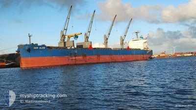
NKR ALICE
Cargo
Current Trip
| Time Travelled | 3 days |
|---|---|
| Remaining Time | --- |
| Distance Travelled | 522.79 nm |
| Remaining Distance | --- |
| AVG Speed | 10.8 Knop |
| MAX Speed | 12 Knop |
| AVG Wind | 7 knots |
| MAX Wind | 14.8 knots |
| MIN Temp | 25.9°C / 78.62°F |
| MAX Temp | 28.5°C / 83.3°F |
| Djupgående | 13.1 m |
| Position mottagen | 3 d sen |
Current Position
| Longitud | --- |
|---|---|
| Latitude | --- |
| Status | Under way using engine |
| Fart | 8.5 Knop |
| Kurs | 92.5° |
| Område | South Atlantic Ocean |
| Station | T-AIS |
| Position mottagen | 3 d sen |
Info
Information
The current position of NKR ALICE is in South Atlantic Ocean with coordinates -24.05782° / -46.33651° as reported on 2025-02-13 01:37 by AIS to our vessel tracker app. The vessel's current speed is 8.5 Knop and is heading at the port of UMM QASR. The estimated time of arrival as calculated by MyShipTracking vessel tracking app is 2025-03-15 12:00 LT
The vessel NKR ALICE (IMO: 9914515, MMSI: 636021279) is a Cargo It's sailing under the flag of [LR] Liberia.
In this page you can find informations about the vessels current position, last detected port calls, and current voyage information. If the vessels is not in coverage by AIS you will find the latest position.
The current position of NKR ALICE is detected by our AIS receivers and we are not responsible for the reliability of the data. The last position was recorded while the vessel was in Coverage by the Ais receivers of our vessel tracking app.
The current draught of NKR ALICE as reported by AIS is 13.1 meters
Weather
| Temperature | 26.6°C / 79.88°F |
|---|---|
| Wind Speed | 9 knots |
| Direction | 354° N |
| Pressure | 1016.9 hPa |
| Humidity | 78.2 % |
| Cloud Coverage | 77 % |
Featured Company
Last Port Calls
| Port | Arrival | Departure | Time In Port |
|---|---|---|---|
| 2025-02-07 18:03 | 2025-02-13 01:10 | 5 d | |
| 2024-12-30 06:10 | 2024-12-30 16:49 | 10 h | |
| 2024-12-01 08:45 | 2024-12-09 00:15 | 7 d |
Most Visited Ports (Last year)
| Port | Arrivals | |
|---|---|---|
| 3 | ||
| 2 | ||
| 2 | ||
| 2 | ||
| 2 | ||
| 1 |
Last Trips
| Origin | Departure | Destination | Arrival | Distance | |
|---|---|---|---|---|---|
| 2024-12-30 16:49 | 2025-02-07 15:03 | 4470.09 nm | |||
| 2024-12-09 01:15 | 2024-12-30 06:10 | 4035.10 nm | |||
| 2024-11-29 16:58 | 2024-12-01 09:45 | 475.83 nm |
Events
| Tid | Event | Detaljer | Position / Dest | Information |
|---|---|---|---|---|
| 2025-02-14 17:45 | STARTAR förflyttning | 14.06 nm, South East of SANTOS |
-24.13494 / -46.14407
IQ UQR
|
Fart: 4.7 kn Kurs: 130° |
| 2025-02-13 03:08 | STOPPAR förflyttning | 13.68 nm, South East of SANTOS |
-24.13152 / -46.15020
IQ UQR
|
Fart: Kurs: 120° |
| 2025-02-13 01:39 | Status ändrad | Default Under way using engine |
-24.05833 / -46.33218
IQ UQR
|
Fart: 8.5 kn Kurs: 92.5° |
| 2025-02-13 01:37 | Status ändrad | Under way using engine Default |
-24.05782 / -46.33651
IQ UQR
|
Fart: 7.9 kn Kurs: 95° |
| 2025-02-13 01:37 | UTANFÖR täckningsområde |
-24.05782 / -46.33651
South Atlantic Ocean
|
Fart: 8.5 kn Kurs: 92.5° |
|
| 2025-02-13 01:17 | Status ändrad | Default Under way using engine |
-24.02784 / -46.34629
IQ UQR
|
Fart: 8.5 kn Kurs: 200° |
| 2025-02-13 01:10 | Status ändrad | Under way using engine Default |
-24.01112 / -46.33932
IQ UQR
|
Fart: 8 kn Kurs: 214° |
| 2025-02-13 01:10 | AVGÅTT HAMN |
|
-24.01112 / -46.33932
IQ UQR
|
Fart: 8 kn Kurs: 214° |
| 2025-02-13 01:04 | Status ändrad | Default Under way using engine |
-23.99860 / -46.33214
[BR] SANTOS
|
Fart: 7.9 kn Kurs: 240° |
| 2025-02-13 00:58 | Status ändrad | Under way using engine Default |
-23.99229 / -46.32063
[BR] SANTOS
|
Fart: 7.2 kn Kurs: 274° |